National Register of Historic Places listings in Alexandria, Virginia facts for kids
This page lists amazing historic places in Alexandria, Virginia, that are part of the National Register of Historic Places. Think of it like a special list of important buildings, areas, and landmarks that are protected because they teach us so much about history!
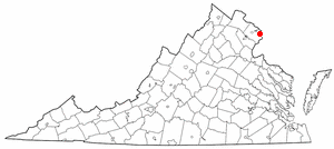
Alexandria is an independent city in Virginia, United States. There are 50 places and areas in Alexandria on this special list. Seven of these are even more important and are called National Historic Landmarks. You can even see where some of these places are on an online map if their exact location is listed.
Contents
Exploring Alexandria's Historic Gems
Alexandria is full of history! Many buildings and places here have been around for a long time and have amazing stories to tell. Let's explore some of these special spots.
Old Town Alexandria: A Historic Heartbeat
The Alexandria Historic District is like the heart of old Alexandria. It's a large area with many historic buildings. Walking through it feels like stepping back in time! This district became a National Historic Landmark in 1966.
Important Buildings in Old Town
- Alexandria City Hall: This is where the city's government works. It's a beautiful building located at 301 King Street. It was added to the Register in 1984.
- Bank of Alexandria: Found at 133 N. Fairfax Street, this old bank building has been around since 1792. It joined the Register in 1973.
- Carlyle House: Located at 121 N. Fairfax Street, this grand stone mansion was built in 1753. It's one of the oldest and most important houses in Alexandria. It became a historic place in 1969.
- Christ Church: This church, at the corner of Cameron and Columbus Streets, is very famous. George Washington and Robert E. Lee both attended services here! It's a National Historic Landmark since 1970.
- Gadsby's Tavern: At 128 N. Royal Street, this historic tavern and hotel was a popular spot for travelers and important people in the 1700s. George Washington even visited here! It's a National Historic Landmark since 1966.
- Old Dominion Bank Building: This building at 201 Prince Street was once a bank. It was added to the Register in 1980.
- Old Presbyterian Meeting House: Located at 321 S. Fairfax Street, this church has a long history, dating back to 1775. It joined the Register in 2001.
- Stabler-Leadbeater Apothecary Shop: This old pharmacy at 105-107 S. Fairfax Street operated for over 140 years! It's like a time capsule of old medicines and tools. It became a historic place in 1982.
- The Lyceum: Found at 201 S. Washington Street, The Lyceum was built in 1839 as a center for learning and lectures. It's now a museum. It joined the Register in 1969.
Places Connected to Important People
Alexandria has been home to many famous Americans.
- President Gerald R. Ford Jr. House: This house at 514 Crown View Drive was the home of President Gerald R. Ford Jr. It's a National Historic Landmark since 1985.
- Robert E. Lee Boyhood Home: Located at 607 Oronoco Street, this was the childhood home of Robert E. Lee, a famous general during the Civil War. It became a historic place in 1986.
- Lee-Fendall House: Another home connected to the Lee family, this house at 614 Oronoco Street was built in 1785. It joined the Register in 1979.
- George Washington National Masonic Memorial: This huge tower at 101 Callahan Street is a memorial to George Washington, who was a Mason. It's one of the largest private memorials to him and became a National Historic Landmark in 2015.
Sites of African American History
Alexandria has many important places that tell the story of African Americans.
- Alfred Street Baptist Church: This church at 313 S. Alfred Street has been a center of the African American community for a very long time. It was added to the Register in 2004.
- Beulah Baptist Church: Located at 320 S. Washington Street, this church also played a big role in the African American community. It joined the Register in 2004.
- Bruin's Slave Jail: At 1707 Duke Street, this building was once a jail where enslaved people were held. It's a very important, though sad, reminder of a difficult time in history. It became a historic place in 2000.
- Contrabands and Freedmen Cemetery: This cemetery at 1001 S. Washington Street is where many African Americans who escaped slavery during the Civil War were buried. It's a powerful memorial and joined the Register in 2012.
- Davis Chapel: Found at 606-A S. Washington Street, this chapel is another important site for African American history in Alexandria. It was added to the Register in 2004.
- Moses Hepburn Rowhouses: These homes at 206-212 N. Pitt Street belonged to Moses Hepburn, a prominent African American businessman. They joined the Register in 2004.
- Dr. Albert Johnson House: Located at 814 Duke Street, this was the home of Dr. Albert Johnson. It became a historic place in 2004.
- Odd Fellows Hall: At 411 S. Columbus Street, this hall was a meeting place for the Odd Fellows, a fraternal organization that included African American members. It joined the Register in 2004.
- George Lewis Seaton House: This house at 404 S. Royal Street belonged to George Lewis Seaton, an important African American builder and community leader. It was added to the Register in 2004.
- Uptown-Parker-Gray Historic District: This district covers an area north of Cameron Street and west to Buchanan and N. West Streets. It's important for showing the history of African American communities in Alexandria. It joined the Register in 2010.
Other Interesting Historic Places
- Alexandria Canal Tide Lock: This old lock at 1 Canal Center Plaza was part of a canal system used to transport goods. It's a reminder of how people moved things around long ago. It became a historic place in 1980.
- Alexandria National Cemetery: Located at 1450 Wilkes Street, this cemetery is where many soldiers are buried. It's a place of honor and remembrance. It joined the Register in 1995.
- Alexandria Union Station: This train station at 110 Callahan Drive is an important transportation hub. It was added to the Register in 2013.
- Bayne-Fowle House: This historic house at 811 Prince Street joined the Register in 1986.
- Fairfax-Moore House: Located at 207 Prince Street, this house became a historic place in 1991.
- Fort Ward: At 4301 W. Braddock Road, Fort Ward was a Union Army fort during the Civil War. It's now a park and museum. It joined the Register in 1982.
- Charles M. Goodman House: This house at 510 N. Quaker Lane is an example of modern architecture from the mid-20th century. It was added to the Register in 2013.
- Jones Point Lighthouse and District of Columbia South Cornerstone: Found in Jones Point Park, this lighthouse helped guide ships. The nearby cornerstone marks an original boundary of Washington D.C. It became a historic place in 1980.
- Lloyd House: This house at 220 N. Washington Street joined the Register in 1976.
- Mount Vernon Memorial Highway: This historic road, part of the George Washington Memorial Parkway, was built to connect Washington D.C. to George Washington's home at Mount Vernon. It became a historic place in 1981.
- Orange and Alexandria Railroad Hooff's Run Bridge: This old railroad bridge at Jamieson Avenue is a piece of early railroad history. It joined the Register in 2003.
- Parkfairfax Historic District: This large residential area is bounded by Quaker Lane, US 395, and other streets. It was built during World War II to house government workers. It became a historic district in 1999.
- Protestant Episcopal Theological Seminary: Located at 3737 Seminary Road, this seminary is a historic educational institution. It joined the Register in 1980.
- Rosemont Historic District: This neighborhood, roughly bounded by Commonwealth Avenue and other streets, is known for its historic homes. It became a historic district in 1992.
- St. Paul's Episcopal Church: This church at 228 S. Pitt Street joined the Register in 1985.
- Boundary Markers of the Original District of Columbia: Several stone markers (Southwest No. 1, No. 2, No. 3, No. 4, and No. 5) are located in Alexandria. These stones mark the original boundaries of the District of Columbia, surveyed in the 1790s. They are important historical markers and were added to the Register in 1991.
- Town of Potomac: This historic district, roughly bounded by Commonwealth Avenue and other streets, was once a separate town before becoming part of Alexandria. It joined the Register in 1992.
Images for kids


