National Register of Historic Places listings in Boise County, Idaho facts for kids
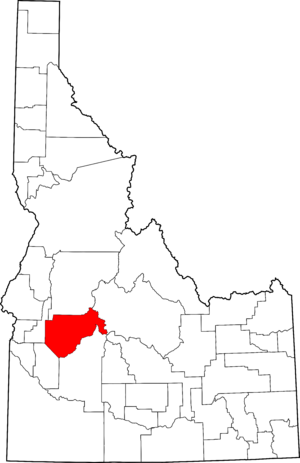
Boise County, Idaho, is a place full of history! Imagine stepping back in time to when gold miners roamed the land or when big dams were built to help people. This article will tell you about some special places in Boise County that are so important, they're listed on the National Register of Historic Places. This register is like a national hall of fame for buildings, sites, and objects that tell America's story.
There are currently four amazing spots in Boise County that have earned a place on this important list. More places can be added all the time, as new discoveries are made or old places are recognized for their value. Let's explore these historic treasures!
Contents
What is the National Register of Historic Places?
The National Register of Historic Places is the official list of the United States' historic places worth saving. It's managed by the National Park Service. When a place is added to this list, it means it's important to the history of a community, a state, or even the whole country.
Being on the Register helps protect these places. It also encourages people to learn about them and keep them safe for future generations. Think of it as a way to make sure our past isn't forgotten!
Amazing Historic Places in Boise County
Boise County has some truly unique sites that show different parts of its past. From massive engineering projects to old gold mining towns, these places tell fascinating stories.
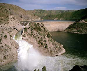
Arrowrock Dam: A Giant of Engineering
The Arrowrock Dam is a massive concrete dam located about 10 miles east of Boise. It was built a long time ago, in 1915, and was one of the largest dams in the world at that time! It was a huge achievement in engineering.
This dam was built to help control the Boise River and provide water for farming in the area. It helped turn dry land into fertile fields. The dam is still an important part of managing water resources in Idaho today. It shows how people worked together to solve big problems.
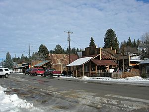
Idaho City: A Gold Rush Town
Idaho City is a historic town that was once the biggest city in Idaho! This was during the exciting days of the Idaho gold rush in the 1860s. Thousands of miners flocked here hoping to strike it rich.
The town was founded in 1862 and quickly grew. It had stores, saloons, and everything a bustling gold mining town needed. Even though the gold rush ended, Idaho City still keeps its historic charm. Many of its old buildings are still standing, making it feel like you've stepped back in time. It's a great place to imagine what life was like for those early pioneers.
Placerville: Another Gold Rush Gem
Placerville is another historic town in Boise County that played a big part in the gold rush. Like Idaho City, it was a busy mining camp in the 1860s. Miners found a lot of gold in the creeks and rivers around Placerville.
The town's historic district is roughly bounded by its city limits. It's recognized for its well-preserved buildings and layout from the gold rush era. These old buildings help us understand how these mining communities were set up and how people lived during that exciting, wild time. Placerville is a quiet reminder of Idaho's golden past.
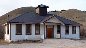
Upper Brownlee School: A Historic Classroom
The Upper Brownlee School is a historic schoolhouse located near the town of Sweet. It was built in 1910 and served as a place where children from the surrounding rural areas could get an education.
This school is a great example of a "one-room schoolhouse." This means all the students, from different grades, learned together in a single classroom with one teacher. It was a common way for kids to go to school in the past, especially in smaller communities. The Upper Brownlee School reminds us of how education has changed over the years and how important it has always been.


