National Register of Historic Places listings in Buckingham County, Virginia facts for kids
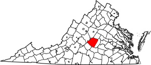
This article is about the cool and historic places in Buckingham County, Virginia, that are listed on the National Register of Historic Places. This special list helps protect important buildings, sites, and districts across the United States. When a place is on this list, it means it's recognized for its history, architecture, or how it connects to important events.
You can think of the National Register as a way to celebrate and save places that tell a story about our past. In Buckingham County, there are 12 such places. These include old homes, schools, and even entire historic areas. They help us learn about how people lived long ago and what was important to them.
Contents
Exploring Buckingham County's Historic Places
Buckingham County is full of interesting history, and many of its special places are recognized on the National Register of Historic Places. These sites help us remember important moments and people from the past. Let's take a look at some of these fascinating locations.
Historic Homes and Estates
Many of the places on the list are old homes, each with its own unique story.
Bryn Arvon and Gwyn Arvon
These two places, Bryn Arvon and Gwyn Arvon, are located near Arvonia, Virginia. They were added to the National Register on January 3, 1991. These sites are important examples of the architecture and history of the area.
Chellowe
Chellowe is another historic spot, found near Sprouses Corner, Virginia. It was listed on August 5, 1999. This property helps us understand the history of homes and land use in Buckingham County.
Guerrant House
Also in the Arvonia, Virginia area, the Guerrant House became a registered historic place on December 7, 2000. It's a significant example of the homes built in this part of Virginia.
Locust Grove (Peter Francisco House)
Near Dillwyn, Virginia, you'll find Locust Grove, also known as the Peter Francisco House. This house was added to the list on March 16, 1972. Peter Francisco was a hero during the American Revolutionary War, known for his incredible strength. This house helps tell his story.
Perry Hill
Perry Hill is a historic property near Saint Joy, Virginia. It was recognized on October 30, 1980. This site adds to the rich history of homes in the county.
Woodside
Located near the town of Buckingham, Virginia, Woodside was listed on November 16, 1993. It's another example of the historic homes that dot the landscape of Buckingham County.
Important Historic Districts
Sometimes, it's not just one building that's historic, but a whole group of buildings or an area. These are called historic districts.
Buckingham Courthouse Historic District
The heart of Buckingham, Virginia, is the Buckingham Courthouse Historic District. This area, which includes both sides of U.S. Route 60, was listed on November 12, 1969. It's important because it shows how the county seat developed over time, with its courthouse and other old buildings.
Buckingham Female Collegiate Institute Historic District
Near Gravel Hill, you'll find the Buckingham Female Collegiate Institute Historic District. This district was added to the National Register on October 4, 1984. It was once a school for young women, showing the history of education in the area.
Seven Islands Archeological and Historic District
This district, located near Arvonia, Virginia, is very special because it's both an archeological site and a historic district. It was listed on July 3, 1991, and even extends into Fluvanna County. Archeological sites are places where scientists study human history through digging up old objects and structures.
Other Significant Sites
Beyond homes and districts, other types of places are also important enough to be listed.
Buckingham Training School
The Buckingham Training School, located at 245 Camden Street in Dillwyn, Virginia, was added to the list on February 13, 2015. This school played an important role in the education of African American children in the community.
Stanton Family Cemetery
Near Diana Mills, Virginia, the Stanton Family Cemetery is a historic burial ground. It was listed on April 29, 1993. Cemeteries like this are important for understanding family histories and burial customs of the past.
Images for kids


