
National Register of Historic Places listings in Caledonia County, Vermont facts for kids

Caledonia County in Vermont is home to many special places that are listed on the National Register of Historic Places. This list includes buildings, areas, and structures that are important to the history of the United States. Think of it like a special hall of fame for old buildings and places!
These places are chosen because they tell us stories about the past. They might be very old, have a unique design, or be connected to important events or people. By listing them, we help make sure they are protected and remembered for future generations. In Caledonia County, there are 57 such places, including one very important one called a National Historic Landmark.
Contents
What are Historic Places?
A "historic place" is a building, a group of buildings, a site, or even a whole neighborhood that has special meaning because of its history, architecture, or what happened there. When a place is added to the National Register of Historic Places, it means the United States government recognizes its importance. This helps protect it and can even provide help for its upkeep.
Exploring Caledonia County's History
Caledonia County has a rich history, and its historic places show us what life was like long ago. From grand buildings to charming bridges and old schoolhouses, each site has a story to tell.
Famous Buildings and Landmarks
Some buildings in Caledonia County are especially well-known and important.
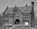
St. Johnsbury Athenaeum
The St. Johnsbury Athenaeum is a very special place, so important that it's a National Historic Landmark! Located at 30 Main Street in St. Johnsbury, it was built in 1896. This building is famous for its beautiful design and for being one of the first public libraries and art galleries in the country. It was funded by Horace Fairbanks, who was famous for making the world's first platform weighing scales. Imagine a place where you could read books and see amazing art, all in one building, over a hundred years ago!

Fairbanks Museum and Planetarium
Also in St. Johnsbury, the Fairbanks Museum and Planetarium at 1302 Main Street is another significant landmark. It was added to the Register in 2008. This museum is a wonderful place to learn about nature, science, and the stars. It's a great example of how old buildings can still be used for education and fun today.

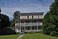
Franklin Fairbanks House
Close by, at 357 Western Avenue in St. Johnsbury, is the Franklin Fairbanks House. This house was built for Franklin Fairbanks, a member of the famous Fairbanks family who were important in the area's history. It was added to the Register in 1980. This grand home gives us a peek into the lives of important families from the past.

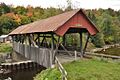
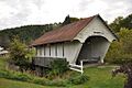
Charming Covered Bridges
Caledonia County is known for its beautiful covered bridges. These wooden bridges were built with roofs to protect the wooden parts from snow and rain, helping them last longer. They are like tunnels over rivers!
Bradley Covered Bridge
The Bradley Covered Bridge is north of Lyndon, crossing Miller Run. It was built a long time ago and added to the Register in 1977. Imagine horses and buggies crossing this bridge!

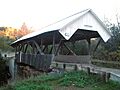
Burrington Covered Bridge
Northeast of Lyndon, the Burrington Covered Bridge crosses the East Branch of the Passumpsic River. It joined the Register in 1974. These bridges are not just old; they are also very pretty and a big part of Vermont's charm.

Centre Covered Bridge
The Centre Covered Bridge, also northeast of Lyndon, crosses the Passumpsic River. It was listed in 1974. Each covered bridge has its own unique design and story.

Greenbanks Hollow Covered Bridge
South of Danville, you can find the Greenbanks Hollow Covered Bridge over Joes Brook. This bridge was added to the Register in 1974. It's a great example of the craftsmanship from the past.

Historic Homes and Farms
Many old homes and farms in Caledonia County are also recognized for their historical value. They show us how people lived and worked in earlier times.
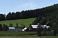
William and Agnes Gilkerson Farm
The William and Agnes Gilkerson Farm in Barnet is a historic farm that was listed in 1992. It's also known as Kitchel Hill Farm. Farms like this are important because they show us how agriculture shaped the region.

Josiah and Lydia Shedd Farmstead
In Peacham, the Josiah and Lydia Shedd Farmstead at 1721 Bayley-Hazen Road was added to the Register in 2005. This farmstead helps us understand the daily lives of families who farmed the land centuries ago.

Alice Lord Goodine House
The Alice Lord Goodine House in Groton, listed in 2004, is special because it now houses the local library! It's a great example of an old building being given a new life for the community.

Old Schools and Meetinghouses
Education and community gatherings were very important in early Vermont. Many old schoolhouses and meetinghouses are preserved as historic sites.
Cobb School
The Cobb School in Hardwick, listed in 1993, is an example of a traditional one-room schoolhouse. Imagine all the children from different grades learning together in one room!
Stannard Schoolhouse
The Stannard Schoolhouse in Stannard, added in 1977, is another old school building. It's now used as the town hall, showing how historic buildings can continue to serve the community.

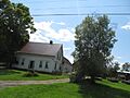
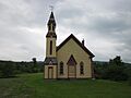
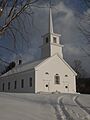
Christian Union Society Meetinghouse
In South Walden, the Christian Union Society Meetinghouse was listed in 1980. Meetinghouses were central to community life, used for religious services, town meetings, and social events.
Why These Places Matter
These historic places in Caledonia County are more than just old buildings. They are important because they:
- Teach us about the past: They show us how people lived, worked, and built things long ago.
- Preserve unique architecture: Many have special designs that are no longer common.
- Connect us to our roots: They help us understand where our communities came from.
- Boost local pride: They are special landmarks that make Caledonia County unique.
By learning about and respecting these sites, we help keep their stories alive for everyone.
Images for kids
-
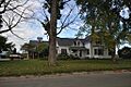
Barnet Center Historic District
-
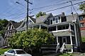
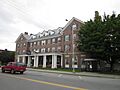
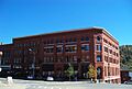
Benoit Apartment House-74 Pearl Street
-
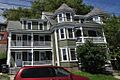
Benoit Apartment House-76 Pearl Street
-
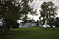
Burklyn Hall
-
Burrington Covered Bridge
-
Centre Covered Bridge
-
Chamberlin Mill Covered Bridge
-
Cote Apartment House
-
Darling Estate Historic District
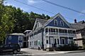
-
Darling Inn
-
J. R. Darling Store
-
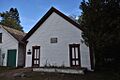
District 6 School House
-
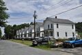
Downtown Hardwick Village Historic District
-
Elkins Tavern
-
Hardwick Street Historic District
-
Lee Farm
-
Lind Houses
-
Maple Street-Clarks Avenue Historic District
-
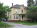
Caleb H. Marshall House
-
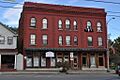
Mathewson Block
-
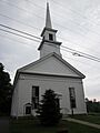
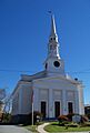
Methodist-Episcopal Church (Stannard, Vermont)
-
Morency Paint Shop and Apartment Building
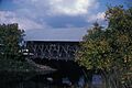
-
Old Schoolhouse Bridge
-
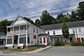
Peacham Corner Historic District
-
Railroad Street Historic District
-
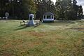
Ricker Pond State Park
-
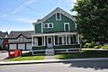
Riverside (Lyndonville, Vermont)
-
Shearer and Corser Double House
-
St. Johnsbury Federal Fish Culture Station
-
St. Johnsbury Historic District
-
St. Johnsbury Main Street Historic District
-
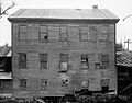
Thresher Mill
-
Phineas Thurston House
-
Toll House (Burke, Vermont)
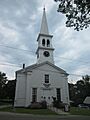
-
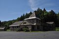
Union Meeting House (Burke, Vermont)
-
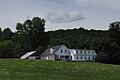
West View Farm
-
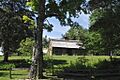
Wheelock Common Historic District
-
Whitehill House
-
Whittier House
.jpg)


