
National Register of Historic Places listings in Chautauqua County, New York facts for kids

Did you know that many special buildings, places, and even objects in the United States are officially recognized for their important history? This list is all about the amazing historic places in Chautauqua County, New York, that are part of the National Register of Historic Places.
The National Register of Historic Places is like a special club for buildings, sites, and objects that are important in American history, architecture, archaeology, engineering, or culture. When a place is added to this list, it means it's worth protecting and celebrating! In Chautauqua County, New York, there are 48 of these amazing places. Two of them are even more special, called National Historic Landmarks, which are places of national importance.
Contents
Discovering Chautauqua County's Historic Treasures
Chautauqua County is full of interesting history, and many of its old buildings and sites tell stories from the past. These places help us understand how people lived, worked, and built communities long ago.
What Makes a Place Historic?
A place can be added to the National Register for many reasons. Maybe it's a very old building with unique architecture, or perhaps an important event happened there. It could also be a place connected to famous people or a special way of life. Each spot on this list has a unique story to tell!
Why Are These Places Important?
Protecting these historic places helps us learn about our past. It also keeps our towns and cities looking unique and interesting. When a building is on the National Register, it can sometimes get special help for repairs and upkeep, making sure it lasts for many more years.
Special Landmarks in Chautauqua County
Among the many historic places in Chautauqua County, two are extra special because they are National Historic Landmarks. This means they are important to the history of the entire United States, not just New York!
- Chautauqua Institution Historic District: This is a whole area, not just one building! It's a famous place where people have gathered for over 150 years to learn, discuss ideas, and enjoy arts and culture. It's known for its beautiful old buildings and its focus on education and community.
- Lewis Miller Cottage, Chautauqua Institution: Located within the Chautauqua Institution, this cottage belonged to Lewis Miller, one of the founders of the Chautauqua movement. It's a great example of the simple, charming homes built there in the early days.
A Glimpse at Other Notable Sites
Many other places in Chautauqua County are also on the National Register, each with its own history. Here are just a few examples:
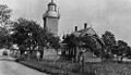
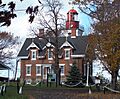
- Barcelona Lighthouse and Keeper's Cottage: This historic lighthouse helped guide ships on Lake Erie. It's a reminder of the important role lighthouses played in safe travel.
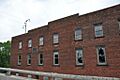
- Busti Mill: This old mill shows us how people used to process grains and other goods. Mills were vital centers for communities in the past.
- Dunkirk Light: Another important lighthouse on Lake Erie, helping ships navigate the waters near Dunkirk.
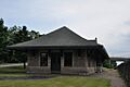
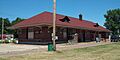
- Erie Railroad Station (Jamestown): Train stations were once bustling hubs of activity, connecting towns and cities. This station in Jamestown tells the story of early travel and transportation.
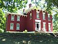
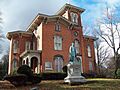
- Gov. Reuben Fenton Mansion: This grand house was once home to Reuben Fenton, who was the Governor of New York. It gives us a peek into the lives of important figures from the past.
- Midway Park: This historic amusement park has been a place of fun and entertainment for generations. It's one of the oldest continuously operating amusement parks in the United States!
- Welch Factory Building No. 1: This building is connected to the famous Welch's grape juice company, which started right here in Chautauqua County. It's a piece of local industrial history.
Images for kids
-
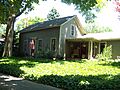
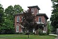
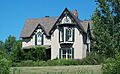
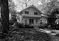
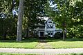
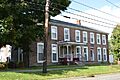
Atwater-Stone House
-
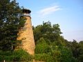
Barcelona Lighthouse
-

L. Bliss House
-
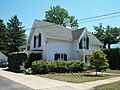
Smith Bly House
-
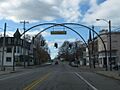
Brocton Arch
-
Busti Mill
-
Harriet Campbell-Taylor House
-
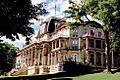
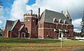
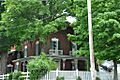
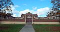
Athenaeum Hotel in the Chautauqua Institution Historic District
-
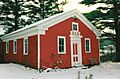
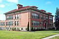
Clymer District School No. 5
-
Dunkirk Light
-
East Main Street Historic District
-
Erie Railroad Station
-
Euclid Avenue School
-
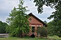
Fay-Usborne Mill
-
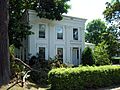
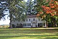
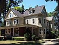
Gov. Reuben Fenton Mansion
-
Fredonia Commons Historic District
-
French Portage Road Historic District
-
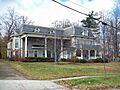
Frank A. Hall House
-
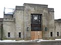
Jamestown Armory
-
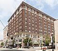
Hotel Jamestown in the Jamestown Downtown Historic District
-
Lake Shore & Michigan Southern Freight Depot
-
Lake Shore and Michigan Southern Railway Station
-
Dr. John Lord House
-
Gerald Mack House
-
McMahan Homestead
-
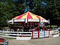
Carousel at Midway Park
-
Lewis Miller Cottage
-
Nixon Homestead
-
Partridge-Sheldon House
-
Pennsylvania Railroad Station
-
House in the Point Chautauqua Historic District
-
Point Gratiot Lighthouse Complex
-
Rorig Bridge
-
School No. 7
-
Henry Dwight Thompson House
-
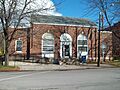
US Post Office-Dunkirk
-
US Post Office-Fredonia
-
Ward House
-
Welch Factory Building No. 1
-
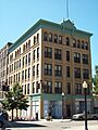
The Wellman Building
-
Reuben Gridley Wright Farm Complex
-
Reuben Wright House
-
York-Skinner House


.jpg)


