National Register of Historic Places listings in Clay County, Nebraska facts for kids
This article is about special places in Clay County, Nebraska, that are listed on the National Register of Historic Places. These are important buildings and sites that tell us about the past.
The National Register of Historic Places is like a special list kept by the United States government. It includes buildings, structures, objects, sites, and districts that are important in American history, architecture, archaeology, engineering, or culture. When a place is on this list, it means it's recognized as a valuable part of our country's heritage. It also helps protect these places for future generations to enjoy and learn from.
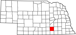
There are 9 amazing places in Clay County that are on this important list. Let's explore some of them!
Historic Places in Clay County
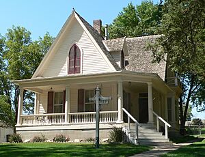
Isaac Newton Clark House
- Location: 407 West Cedar Street, Sutton, Nebraska
- Listed: December 15, 1983
What Makes it Special?
This house was built around 1877. It belonged to Isaac Newton Clark, who was one of the people who helped start the town of Sutton. He worked hard to bring railroads and businesses to the area. The house is built in a style called Gothic Revival. This style is quite rare to see in Nebraska, making the house even more unique!
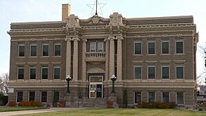
Clay County Courthouse
- Location: Fairfield Street, between Alexander and Brown Avenues, Clay Center, Nebraska
- Listed: January 10, 1990
What Makes it Special?
This beautiful brick building is where the county government does its work. It was designed by an architect named William F. Gernandt and built between 1917 and 1919. The courthouse is built in the Beaux-Arts style, which is known for being grand and fancy. It also has special clay decorations called terracotta trim.
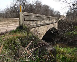
Deering Bridge
- Location: County road over School Creek, 2 miles north and 2 miles east of Sutton
- Listed: June 29, 1992
What Makes it Special?
The Deering Bridge is a great example of an old concrete arch bridge. It was built in 1916 and is about 50 feet (15 meters) long. This bridge is special because of its strong and well-designed concrete arch. Part of this bridge actually reaches into a neighboring county called Fillmore County!
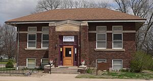
Fairfield Carnegie Library
- Location: 412 North D Street, Fairfield, Nebraska
- Listed: November 29, 2001
What Makes it Special?
This library was built in 1913. It's a Carnegie library, which means it was built with money donated by Andrew Carnegie, a very rich businessman who helped build many libraries across the United States. What makes this library stand out is how well its outside and inside have been kept over the years. It still looks very much like it did when it was first built!
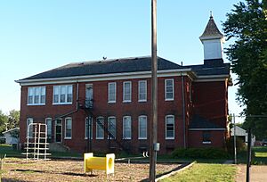
Glenville School
- Location: 401 South 5th Street, Glenvil, Nebraska
- Listed: December 31, 1998
What Makes it Special?
The Glenville School was first built in 1903. Later, in 1924, it was made bigger. For many years, this school taught students from kindergarten all the way through high school. It's an important part of the history of education in the Glenvil community.
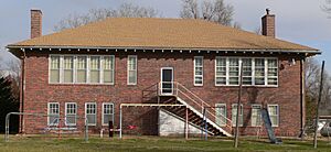
Inland School
- Location: Junction of NWC East Avenue and Edison Street, Inland, Nebraska
- Listed: March 28, 2002
What Makes it Special?
The Inland School was built in 1924. Just like the Glenville School, it was a public school that served students from kindergarten up to high school. It played a big role in the lives of many children in the Inland area for decades.
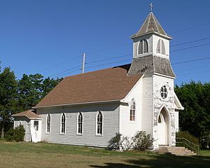
Saint Martin's Catholic Church
- Location: Northwest of Deweese, Nebraska
- Listed: September 26, 1985
What Makes it Special?
This beautiful church was built in 1907. It was designed by James H. Craddock for a group of Czech immigrants who had moved to the area. The church is also built in the Gothic Revival style, similar to the Isaac Newton Clark House. It shows the history and culture of the early settlers in Clay County.


