Glenvil, Nebraska facts for kids
Quick facts for kids
Glenvil, Nebraska
|
|
|---|---|
|
Village
|
|

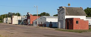
Downtown Glenvil: Winters Avenue
|
|

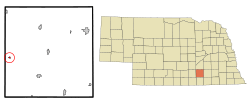
Location of Glenvil, Nebraska
|
|
| Country | United States |
| State | Nebraska |
| County | Clay |
| Area | |
| • Total | 0.17 sq mi (0.45 km2) |
| • Land | 0.17 sq mi (0.45 km2) |
| • Water | 0.00 sq mi (0.00 km2) |
| Elevation | 1,844 ft (562 m) |
| Population
(2020)
|
|
| • Total | 267 |
| • Estimate
(2021)
|
266 |
| • Density | 1,570/sq mi (593/km2) |
| Time zone | UTC-6 (Central (CST)) |
| • Summer (DST) | UTC-5 (CDT) |
| ZIP code |
68941
|
| Area code(s) | 402 |
| FIPS code | 31-19070 |
| GNIS feature ID | 2398978 |
Glenvil is a small village located in Clay County, Nebraska, in the United States. It was once known as Glenville. In 2020, about 267 people lived there. Glenvil is part of the larger Hastings, Nebraska area.
Contents
History of Glenvil
Glenvil was started in 1873. This happened when the St. Joseph & Denver City Railroad built its tracks to this spot.
Early Days and Name Change
The first post office in Glenvil opened in 1873. At first, its name was spelled "Glenville." This spelling was used until 1914. After that, it became "Glenvil."
Population Changes Over Time
Glenvil's population was highest in the 1920s, with about 300 people. By 1998, the number of residents had dropped to about half of that.
Glenvil's Schools
The first school in Glenvil was set up around 1871 or 1872. It was a simple wooden building. A tornado destroyed it, but it was rebuilt in 1882. The Glenville School was a more important school building. It was used from 1903 to 1995. This historic school is now listed on the National Register of Historic Places. This means it is a special place worth protecting.
Building a New Playground
In 1997, Glenvil gained national attention. Residents wanted to build a new playground for kids. They wrote letters to famous people asking for money. They sent letters to billionaire Warren Buffett, comedian Robin Williams, and talk show hosts Jay Leno, David Letterman, and Oprah Winfrey. They also wrote to Bill Gates, who started Microsoft.
Bill Gates was the only one who wrote back. He sent a check for $5,000 to help with the playground. Less than a month later, Merle Hinrichs also sent money. He was the chairman of Asian Sources Media in Hong Kong. He sent a check for $20,000 because the organizers needed more money. Merle Hinrichs had actually gone to school in Glenvil when he was younger!
Geography of Glenvil
Glenvil is a very small village. According to official records, its total area is about 0.17 square miles (0.45 square kilometers). All of this area is land, with no water.
Population Information
| Historical population | |||
|---|---|---|---|
| Census | Pop. | %± | |
| 1900 | 246 | — | |
| 1910 | 304 | 23.6% | |
| 1920 | 400 | 31.6% | |
| 1930 | 376 | −6.0% | |
| 1940 | 285 | −24.2% | |
| 1950 | 281 | −1.4% | |
| 1960 | 323 | 14.9% | |
| 1970 | 332 | 2.8% | |
| 1980 | 363 | 9.3% | |
| 1990 | 304 | −16.3% | |
| 2000 | 332 | 9.2% | |
| 2010 | 310 | −6.6% | |
| 2020 | 260 | −16.1% | |
| 2021 (est.) | 266 | −14.2% | |
| U.S. Decennial Census | |||
Population in 2010
In 2010, there were 310 people living in Glenvil. These people lived in 125 different homes, and 83 of these were families. The village had about 1823 people per square mile.
Most of the people living in Glenvil were White (92.9%). A small number were African American (1.6%), Native American (0.6%), or from other backgrounds. About 4.5% of the population identified as Hispanic or Latino.
Households and Families
Out of the 125 homes, about 35% had children under 18 living there. Nearly half (49.6%) were married couples living together. Some homes had a single parent, either a mother (11.2%) or a father (5.6%). About 28% of homes had just one person living alone. The average home had about 2.48 people, and the average family had about 3.06 people.
Age Groups in Glenvil
The average age of people in Glenvil was 38 years old.
- About 28% of residents were under 18 years old.
- About 7% were between 18 and 24 years old.
- About 24% were between 25 and 44 years old.
- About 26% were between 45 and 64 years old.
- About 15.5% were 65 years old or older.
The village had a nearly even number of males (49.7%) and females (50.3%).
See also
In Spanish: Glenvil (Nebraska) para niños
 | Claudette Colvin |
 | Myrlie Evers-Williams |
 | Alberta Odell Jones |

