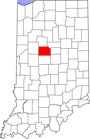
National Register of Historic Places listings in Clinton County, Indiana facts for kids
Have you ever wondered about old buildings and places that are really important to history? In Clinton County, Indiana, there are many special spots that are listed on the National Register of Historic Places. This is like a special list kept by the United States government. It helps protect places that tell us about the past.
When a building or area is on this list, it means it's worth saving. It might be very old, have a unique design, or be connected to important events or people. Clinton County has 13 of these amazing places. They are found in towns like Frankfort and Colfax, and even in some quieter country areas. Let's explore some of these historic treasures!
Exploring Clinton County's Historic Places
Many of Clinton County's historic sites are found in its towns. Some are entire neighborhoods, while others are single buildings. These places help us understand what life was like long ago.
Frankfort's Historic Gems
Frankfort, the county seat, is home to several important historic sites. These include old buildings and even whole neighborhoods.
|- class="vcard" ! style="background: #E6E6FA" | 1 | Christian Ridge Historic District
|
|
(#03000540)
| class="adr" | Roughly bounded by Prairie Creek, Young and E. Washington Sts., and Harvard Terr.
40°16′43″N 86°30′21″W / 40.278611°N 86.505833°W
| class="note" | This historic neighborhood shows off many different styles of homes. It's a great place to see how people lived and built houses in the past.
|- class="vcard" ! style="background:#A8EDEF" | 2 | Clinton County Courthouse
|
|
(#78000027)
| class="adr" | Public Square
40°16′52″N 86°30′40″W / 40.281111°N 86.511111°W
| class="note" | The courthouse is a grand building in the center of Frankfort. It's where important county decisions are made and has been a key part of the community for many years.
|- class="vcard" ! style="background:#A8EDEF" | 4 | Charles H. and Emma Condon House
|
|
(#96001545)
| class="adr" | 603 S. Jackson St.
40°16′33″N 86°30′36″W / 40.275833°N 86.51°W
| class="note" | This beautiful house once belonged to Charles H. and Emma Condon. It's a great example of homes built in its time.
|- class="vcard" ! style="background: #E6E6FA" | 5 | Frankfort Commercial Historic District
|
|
(#98001055)
| class="adr" | Roughly bounded by Walnut, Columbia, and Morrison Sts. and Prairie Creek
40°16′54″N 86°30′42″W / 40.281667°N 86.511667°W
| class="note" | This district includes many old shops and businesses in downtown Frankfort. It shows how the town grew and developed over time.
|- class="vcard" ! style="background:#A8EDEF" | 7 | Old Frankfort Stone High School
|
|
(#79000012)
| class="adr" | 301 E. Clinton
40°16′48″N 86°30′32″W / 40.28°N 86.508889°W
| class="note" | This old stone building was once a high school. Imagine all the students who learned and grew up within its walls!
|- class="vcard" ! style="background: #E6E6FA" | 10 | South Frankfort Historic District
|
|
(#09000422)
| class="adr" | Roughly between Walnut St., Prairie Creek, and Meredith and Columbia Sts.
40°16′35″N 86°30′40″W / 40.276308°N 86.511225°W
| class="note" | Another historic neighborhood in Frankfort, this area has many interesting old homes and buildings that tell stories of the past.
Historic Libraries and Buildings in Other Towns
Beyond Frankfort, other towns in Clinton County also have important historic buildings. These include old libraries and unique structures.
|- class="vcard" ! style="background:#A8EDEF" | 3 | Colfax Carnegie Library
|
|
(#94000230)
| class="adr" | 207 S. Clark St.
40°11′36″N 86°39′59″W / 40.193333°N 86.666389°W
| class="note" | This library in Colfax was built with money from Andrew Carnegie, a famous businessman. Many towns received funds from him to build libraries.
|- class="vcard" ! style="background:#A8EDEF" | 6 | Kirklin Public Library
|
|
(#95000206)
| class="adr" | 115 N. Main St.
40°11′36″N 86°21′37″W / 40.193333°N 86.360278°W
| class="note" | Like the Colfax library, this one in Kirklin also received funding from Andrew Carnegie. These libraries were important centers for learning.
|- class="vcard" ! style="background:#A8EDEF" | 8 | Rosenberger Building
|
|
(#84001004)
| class="adr" | 83 Old Main St.
40°11′25″N 86°39′49″W / 40.190278°N 86.663611°W
| class="note" | The Rosenberger Building in Colfax is another example of the historic architecture found in Clinton County's towns.
Bridges and Rural Landmarks
Not all historic places are in towns. Some are out in the countryside, like old bridges or farmhouses.
|- class="vcard" ! style="background:#A8EDEF" | 9 | Scotland Bridge
|
|
(#94000228)
| class="adr" | Lost Rd. (County Road 400E) over Sugar Creek, northeast of Mechanicsburg
40°10′36″N 86°25′54″W / 40.176667°N 86.431667°W
| class="note" | This old bridge crosses Sugar Creek. It's a great example of how bridges were built a long time ago. Part of it is also in Boone County.
|- class="vcard" ! style="background:#A8EDEF" | 11 | John Young House
|
|
(#94001348)
| class="adr" | 9665 N. County Road 250E, northeast of Geetingsville
40°25′36″N 86°27′31″W / 40.426667°N 86.458611°W
| class="note" | The John Young House is a historic home located in a rural part of Clinton County. It gives us a peek into farm life from the past. |}
| Frankfort | Frankfort | Frankfort | Frankfort | Frankfort | Frankfort | Colfax | Kirklin | Colfax | Jackson and Harrison Townships | Warren Township |


