National Register of Historic Places listings in Covington County, Alabama facts for kids
The National Register of Historic Places is like a special list of important buildings, places, and areas in the United States. These places are chosen because they have a lot of history, special architecture, or are important to our culture. When a place is on this list, it means it's recognized as valuable and efforts are made to protect it for future generations.
Covington County, Alabama, has several amazing places on this list. These sites help us learn about the past and understand how people lived and worked long ago in this part of Alabama. Let's explore some of these cool historic spots!
Contents
Discovering Historic Places in Covington County
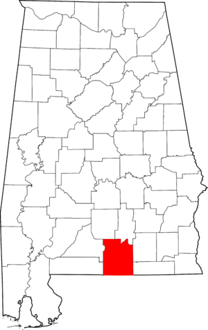
Covington County is home to 10 places that are officially listed on the National Register of Historic Places. These include individual buildings and larger areas called "historic districts." A historic district is a group of buildings or an area that shares a common history or architectural style.
Andalusia's Historic Gems
The city of Andalusia has many of Covington County's historic places. It's like a treasure chest of old buildings!
Andalusia Commercial Historic District
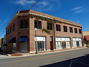
Imagine walking through a part of town where many old shops and buildings still stand. That's the Andalusia Commercial Historic District. It includes streets like Coffee Street and South Three Notch Street. This area shows what the main business part of Andalusia looked like many years ago. It was added to the list in 1989.
Avant House: A Glimpse into the Past
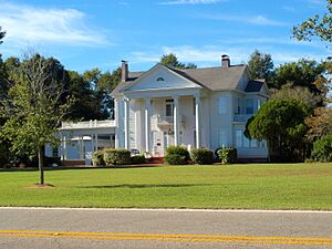
The Avant House is a beautiful old home located at 909 Sanford Road. It was built a long time ago and gives us an idea of how people lived in Andalusia in the past. This house was added to the National Register in 1996.
Old Banks and Their Stories
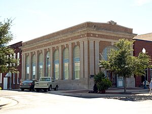
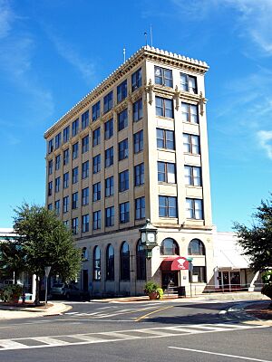
Andalusia has two former bank buildings on the list. The Bank of Andalusia at 28 South Court Square and the First National Bank Building at 101 South Cotton Street. These buildings are important because they show the grand architecture used for banks in the past. They also tell us about the economic history of the town. The Bank of Andalusia was listed in 1989, and the First National Bank Building in 1982.
Three Notch Museum: A Train Station's New Life
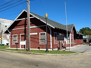
The Three Notch Museum is actually the old Central of Georgia Depot. A "depot" is another word for a train station. This building, located at 125 Central Street, was once a busy place where trains arrived and departed. Now, it's a museum where you can learn about the history of the area. It became a historic place in 1984.
Covington County Courthouse and Jail
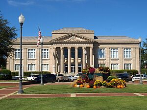
The Covington County Courthouse and Jail is another important building in Andalusia. Located at 101 North Court Square, this building has been the center of local government for many years. Courthouses are often grand buildings that represent justice and community. It was added to the list in 1989.
J.W. Shreve Addition Historic District
The J.W. Shreve Addition Historic District is another neighborhood in Andalusia with historic homes. It includes parts of 6th Avenue, College Street, and East Three Notch Street. This district shows how residential areas developed in the early 1900s. It was recognized in 2009.
Historic Places in Florala and Opp
Andalusia isn't the only city in Covington County with historic sites. Florala and Opp also have important places.
Florala Historic District
The Florala Historic District is a large area in Florala that includes many historic buildings. It covers parts of Fifth Avenue, North Fifth Street, South Fifth Street, and Wall Street. This district helps preserve the unique look and feel of Florala's past. It was added to the National Register in 2010.
Opp Commercial Historic District
Just like Andalusia, the city of Opp has its own Opp Commercial Historic District. This area includes streets like Covington Avenue, Hart Street, Main Street, Whaley Street, and College Street. It shows the historic heart of Opp's business community. This district was listed in 2001.
William T. Shepard House
The William T. Shepard House was an important historic home near Opp, on Poley Road. It was listed on the National Register in 1973. Sadly, this house was destroyed by a fire in 1976. Even though it's no longer standing, its historical importance is still recognized.
Why These Places Matter
These historic places in Covington County are more than just old buildings. They are like pieces of a puzzle that help us understand the story of the county and its people. By preserving them, we keep history alive for everyone to learn from and enjoy. They remind us of the past and inspire us to build for the future.


