
National Register of Historic Places listings in Henry County, Missouri facts for kids

Do you know that some buildings and places are so special they get listed on a national list? This list is called the National Register of Historic Places. It helps protect important places in the United States.
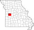
This article is about the cool historic places found in Henry County, Missouri. There are 8 special places in Henry County that are on this important list. These places are like treasures from the past!
What is the National Register of Historic Places?
The National Register of Historic Places is the official list of the nation's historic places. It is part of a program by the United States government. This program helps to identify, evaluate, and protect historic and archaeological resources.
When a building or area is added to the Register, it means it's important to the history of America. It could be important because of its architecture, its connection to famous people, or events that happened there. Being on the list can also help protect these places. It can even make them eligible for special grants or tax benefits to help keep them in good shape.
Discovering Henry County's Historic Treasures
Henry County in Missouri has several buildings and areas that are very old and important. These places tell stories about how people lived long ago. They show us what buildings looked like in the past. Let's explore some of these amazing sites!
Historic Buildings in Clinton
Many of Henry County's historic places are in the city of Clinton. This city has a rich history.
- Anheuser-Busch Brewing Association Building: This building is located at 203 West Franklin Street. It was added to the National Register on August 9, 1991. It's a reminder of old businesses in the area.
- Clinton Square Historic District: This isn't just one building, but a whole area! It includes parts of North and South Main, South Washington, West Franklin, and West Jefferson streets. This district was listed on February 7, 2007. It shows what a town square looked like a long time ago.
- William F. and Julia Crome House: You can find this house at 305 South Second Street. It became a historic site on March 25, 1999. It's a great example of homes from its time.
- Judge Jerubial Gideon Dorman House: This house is at 302 West Franklin Street. It was added to the list on February 10, 1983. Imagine a judge living here many years ago!
- Gustave C. Haysler House: Located at 301 South Second Street, this house joined the Register on July 21, 1995. It's another beautiful old home in Clinton.
- C.C. Williams House: This house is at 303 West Franklin Street. It was listed on October 21, 1982. It stands near other historic homes.
Historic Places in Montrose
The town of Montrose also has its own special historic sites.
- C.M. and Vina Clark House: This house is at 704 California Avenue in Montrose. It was added to the National Register on January 16, 1997.
- St. Ludger Catholic Church: This beautiful church is at the corner of Route K and High Street. It was listed on April 13, 1998. Churches often have amazing architecture and history.
These places help us learn about the past and keep history alive for future generations.
Images for kids
-
Location of Henry County in Missouri
