National Register of Historic Places listings in Holmes County, Mississippi facts for kids
Did you know that many special places in the United States are protected because of their history? These places are listed on something called the National Register of Historic Places. It's like a special list kept by the U.S. government to make sure important buildings, sites, and objects are preserved for future generations.
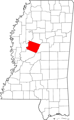
This article is about the amazing historic places you can find in Holmes County, Mississippi. There are 17 different spots in the county that are on this important list! Some are single buildings, and others are whole areas called "historic districts" that have many old and interesting buildings together.
What is the National Register of Historic Places?
The National Register of Historic Places is the official list of the nation's historic places worth saving. It's part of a program to help people understand and protect America's history. When a place is added to the Register, it means it's recognized as important to local, state, or national history. This can help protect it from being changed or torn down, and sometimes it even helps with getting money to fix it up.
Historic Places in Holmes County
Holmes County has a rich history, and many of its special places are recognized on the National Register. Let's explore some of them!
Acona Church, Cemetery, and School
This historic site is located near Lexington on Mississippi Highway 17. It includes an old church, a cemetery, and a school building. These places tell us about how communities lived, learned, and worshipped many years ago. It was added to the Register in 2002.
Mollie Clark House
The Mollie Clark House is a historic home located in Pickens at 2221 Yazoo Street. It was recognized for its historical importance in 1980.
Clifton Plantation House
Found off Mississippi Highway 12 near Howard, the Clifton Plantation House is another significant historic building in Holmes County. It was added to the National Register in 1985.
Durant Illinois Central Railroad Depot
Located at 436 East Mulberry Street in Durant, this old train station is a reminder of when railroads were super important for travel and moving goods. The Durant Illinois Central Railroad Depot was listed in 2016.
Eureka Masonic College
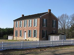
You can find the Eureka Masonic College on Mississippi Highway 17 near Richland. This site, listed in 1970, includes a building often called "The Little Red Schoolhouse." It was once a college run by the Freemasons, a fraternal organization.
Holmes County Courthouse Complex
In the heart of Lexington, the Holmes County Courthouse Complex is a very important historic district. It includes the courthouse and other buildings around Court Square. This complex was added to the Register in 1994 and is a key part of the county's government and history.
Holmes County State Park
This beautiful state park, located between Interstate 55 and U.S. Highway 51 south of Durant, is also on the National Register! It was listed in 1997. State parks often have historic elements, like old structures or areas important for their natural or cultural history.
Lexington Historic District
The town of Lexington has a large historic district that covers many streets around Courthouse Square, including Yazoo, Vine, Tchula, Boulevard, Springs, Race Streets, and Old Tchula Road. This district was recognized in 2001 because it has so many historic buildings that show what the town was like long ago.
Gov. Edmund F. Noel House
Located at 315 North Street in Lexington, this house was once the home of Governor Edmund F. Noel. He was a governor of Mississippi in the early 1900s. His home was added to the National Register in 1999.
Tye House
The Tye House is another historic home, found at 2440 North 1st Street in Pickens. It was listed on the National Register in 1979.
West Historic District
The town of West also has its own historic district. It's roughly bordered by Emory Street, Anderson Avenue, Cross Street, and the Illinois Central Railroad tracks. This area was recognized in 1993 for its historic buildings and layout.
Other Important Sites
Some historic sites on the National Register have their exact locations kept private to protect them. These often include archaeological sites, which are places where scientists study the remains of past human life. Holmes County has several of these "address restricted" sites, including:
- Joe Cowsert Place Site (22HO507) near Goodman
- French Site (22HO565) near Cruger (this site also extends into Carroll County)
- Frances Lee Mound Group (22HO654) near Tchula
- Old Hoover Place Site (22HO502) near Pickens
- Oswego Site (22HO658) near Tchula
- Providence Mound (22HO609) near Lexington
These sites are important because they can teach us a lot about the people who lived in Holmes County thousands of years ago!
Images for kids


