National Register of Historic Places listings in Iron County, Missouri facts for kids
Have you ever wondered about really old and important places in your state? In the United States, there's a special list called the National Register of Historic Places. It's like a hall of fame for buildings, sites, and objects that are super important to American history, architecture, archaeology, engineering, or culture. When a place is on this list, it means it's recognized for its special value and efforts are made to protect it.
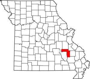
Iron County, Missouri has six amazing places that are on this important list. These sites help us learn about the past and understand how people lived and what happened in this area long ago. Let's explore some of these cool historic spots!
Historic Places in Iron County
Fort Davidson
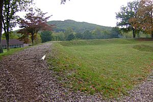
Fort Davidson is a historic site located in Pilot Knob, Missouri. It was added to the National Register of Historic Places on February 26, 1970. This fort played a big role during the American Civil War. It was built by Union soldiers to protect the area.
A famous battle, the Battle of Pilot Knob, happened here in 1864. Even though the Union soldiers were outnumbered, they fought bravely against Confederate forces. Today, you can visit the site and learn about this important part of history. It's a great place to imagine what life was like during the Civil War.
Immanuel Evangelical Lutheran Church
The Immanuel Evangelical Lutheran Church is another historic building in Pilot Knob, Missouri. It was listed on the National Register on January 22, 1979. This church is located at E Pine and N Zeigler Street.
Churches like this one are often important parts of a community's history. They show us how people worshipped and gathered together many years ago. The architecture of old churches can also tell us about the styles and building methods used in the past.
Iron County Courthouse Buildings
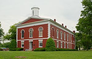
The Iron County Courthouse Buildings are found in Ironton, Missouri. These buildings were added to the National Register of Historic Places on June 27, 1979. They are located on Courthouse Square and at 220 S. Shepherd Street.
Courthouses are usually the center of a county's government and legal activities. They are where important decisions are made and records are kept. The buildings themselves often have interesting designs and stories about the people who worked there.
Ironton Lodge Hall
The Ironton Lodge Hall is another historic spot in Ironton, Missouri. It was listed on the National Register on April 23, 2013. You can find it at 133 N. Main Street.
Lodge halls were often meeting places for community groups or organizations. These groups might have been for social gatherings, charity work, or even secret societies. Such buildings are important because they show how people organized themselves and spent their free time in earlier days.
St. Paul's Episcopal Church
St. Paul's Episcopal Church is also located in Ironton, Missouri. It was added to the National Register of Historic Places on May 21, 1969. This church is on the northwestern corner of Knob and Reynolds Streets.
Like the Immanuel Evangelical Lutheran Church, St. Paul's Episcopal Church represents the religious and community life of Ironton. Old churches often have beautiful stained glass windows, unique architectural features, and long histories of serving their congregations.
Ursuline Academy-Arcadia College Historic District
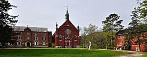
The Ursuline Academy-Arcadia College Historic District is in Arcadia, Missouri. This entire district was listed on the National Register on July 1, 1998. It is located at the junction of Maine and Maple Streets.
A "historic district" means that a whole area, not just one building, is important. This district includes buildings that were once part of Ursuline Academy and Arcadia College. These were schools that played a big role in educating young people in the area. Learning about these places helps us understand the history of education and community development in Iron County.


