National Register of Historic Places listings in Kenosha County, Wisconsin facts for kids
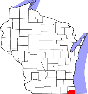
Welcome to Kenosha County, Wisconsin! Did you know that many special places here are protected because of their history? These places are listed on the National Register of Historic Places. It's like a special club for buildings, sites, and even shipwrecks that are important to the history of the United States.
This list shows you all the cool historic spots in Kenosha County. There are 29 places currently on the list, and a couple more were once listed but aren't anymore. Let's explore some of these amazing historical treasures!
Contents
Cool Historic Places in Kenosha County
These are some of the most interesting places in Kenosha County that are on the National Register of Historic Places. They include old buildings, parks, and even a shipwreck!
Historic Buildings and Homes
Many old buildings in Kenosha County have amazing stories.
Boys and Girls Library
The Boys and Girls Library, located at 5810 8th Avenue in Kenosha, was added to the list on October 24, 1980. It's a special place where many kids have learned and explored through books over the years.
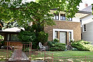
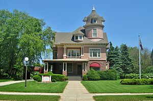
Anthony and Caroline Isermann House
This beautiful house at 6416 Seventh Avenue in Kenosha joined the Register on February 25, 2004. It's a great example of the homes built a long time ago.
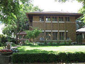
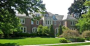
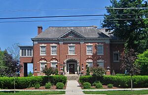
Frank and Jane Isermann House
Right nearby, at 6500 Seventh Avenue, is the Frank and Jane Isermann House. It was also added on February 25, 2004. These two houses show how people lived in Kenosha in the past.
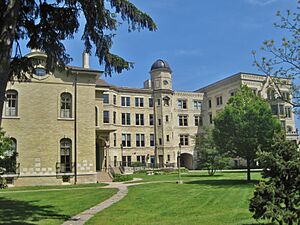
Kemper Hall
Kemper Hall, found at 6501 3rd Avenue in Kenosha, has been on the Register since June 7, 1976. It's a grand old building with a lot of history.
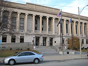
Kenosha County Courthouse and Jail
The Kenosha County Courthouse and Jail, located at 912 56th Street, became a historic site on March 9, 1982. This building is where important decisions for the county are made.
Manor House
The Manor House, at 6536 3rd Avenue in Kenosha, was listed on October 29, 1980. It's another example of the beautiful old homes in the area.
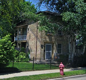
John McCaffary House
You can find the John McCaffary House at 5732 13th Court in Kenosha. It was added to the Register on January 31, 1978, preserving its unique style.
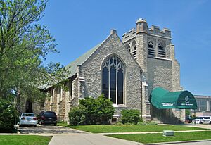
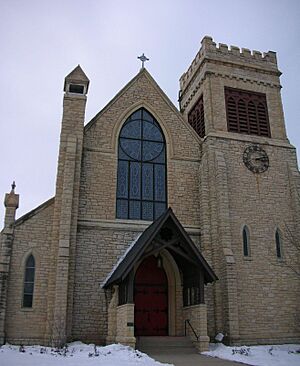
St. Matthew's Episcopal Church
St. Matthew's Episcopal Church, located at 5900 7th Avenue in Kenosha, has been a historic site since June 6, 1979. Churches like this are often important parts of a community's history.
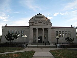
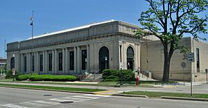
Gilbert M. Simmons Memorial Library
The Gilbert M. Simmons Memorial Library, at 711 59th Place in Kenosha, was listed on December 17, 1974. This library is a central part of the community and has served many generations.
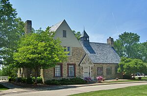
Washington Park Clubhouse
The Washington Park Clubhouse, at 2205 Washington Road in Kenosha, joined the Register on January 23, 2003. It's a historic spot within a popular park.
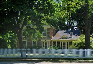
Justin Weed House
The Justin Weed House, located at 3509 Washington Road in Kenosha, was added on December 3, 1974. It's another example of the historic homes that make Kenosha special.
Historic Districts and Parks
Sometimes, a whole area or group of buildings is considered historic.
Civic Center Historic District
The Civic Center Historic District in Kenosha, roughly between 55th and 58th Streets and 8th and 10th Avenues, was listed on July 26, 1989. This area contains many important public buildings.
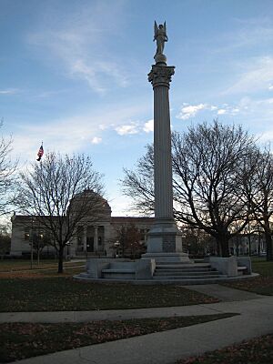
Library Park
Library Park, at 711 59th Place in Kenosha, became a historic site on June 22, 2000. It's a lovely park that adds to the historic feel of the area.
Library Park Historic District
The Library Park Historic District, surrounding Library Park, was listed on November 29, 1988. This district includes many historic homes and buildings near the park.
Third Avenue Historic District
The Third Avenue Historic District, along Third Avenue between 61st and 66th Streets in Kenosha, was added on November 1, 1988. This district shows off the historic architecture of the neighborhood.
Historic Lighthouses and Beach Houses
Kenosha is on Lake Michigan, so it has some important historic sites related to the water.
Kenosha Light Station
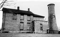
The Kenosha Light Station, at 5117 Fourth Avenue in Kenosha, joined the Register on June 28, 1990. Lighthouses are super important for guiding ships safely.
Kenosha North Pierhead Light
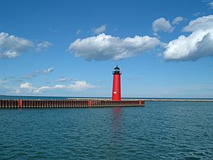
This lighthouse, located on the north pier at Kenosha harbor entry, was added on June 24, 2008. It helps guide boats into the harbor.
Simmons Island Beach House
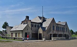
The Simmons Island Beach House, at 5001 Simmons Island in Kenosha, was listed on February 20, 2003. It's a historic spot where people have enjoyed the beach for many years.
Southport Beach House
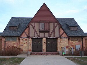
The Southport Beach House, at 7825 First Avenue in Kenosha, became a historic site on January 8, 2003. It's another important building for beachgoers in Kenosha's past.
Archaeological Sites and Shipwrecks
Some historic places are much older, like ancient sites or even sunken ships!
Barnes Creek Site
The Barnes Creek Site in Kenosha is an archaeological site that was added to the Register on July 20, 1977. These sites help us learn about people who lived here long, long ago.
Chesrow Site
The Chesrow Site, located on the western side of Highway 32 north of the Illinois line, was listed on November 30, 1978. It's another important archaeological spot.
Lucas Site
The Lucas Site in Pleasant Prairie is another archaeological site that joined the Register on February 24, 1995.
Rosinco (Shipwreck)
The shipwreck of the Rosinco, located about 12 miles east of Kenosha in Lake Michigan, was listed on July 18, 2001. Shipwrecks are like underwater time capsules!
Wehmhoff Mound (47KN15)
The Wehmhoff Mound, near Wheatland, is an ancient mound that was added to the Register on November 21, 1985. Mounds like this were often built by early Native American groups.
WISCONSIN shipwreck (iron steamer)
The shipwreck of the WISCONSIN, an iron steamer about 6.5 miles south-southeast of Kenosha, was listed on October 7, 2009. This shipwreck tells a story of maritime history.
Places No Longer Listed
Sometimes, a place might be removed from the National Register of Historic Places. This can happen if it's destroyed or if its historical importance changes.
Alford Park Warehouse
The Alford Park Warehouse in Kenosha was listed on December 31, 2002, but was removed on April 21, 2014. Sadly, it was destroyed in a fire in 2011.
Kenosha High School
Kenosha High School, at 913 57th Street, was listed on June 6, 1979, but was later delisted. However, it's still considered an important part of the Civic Center Historic District.


