
Kenosha County, Wisconsin facts for kids
Quick facts for kids
Kenosha County
|
|
|---|---|

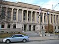
Kenosha County Courthouse and Jail
|
|

Location within the U.S. state of Wisconsin
|
|
 Wisconsin's location within the U.S. |
|
| Country | |
| State | |
| Founded | January 30, 1850 |
| Seat | Kenosha |
| Largest city | Kenosha |
| Area | |
| • Total | 754 sq mi (1,950 km2) |
| • Land | 272 sq mi (700 km2) |
| • Water | 482 sq mi (1,250 km2) 64%% |
| Population
(2020)
|
|
| • Total | 169,151 |
| • Estimate
(2023)
|
167,488 |
| • Density | 224.3/sq mi (86.6/km2) |
| Time zone | UTC−6 (Central) |
| • Summer (DST) | UTC−5 (CDT) |
| Congressional district | 1st |
Kenosha County is a county in the southeastern part of Wisconsin, a state in the United States. It's located right on the edge of Lake Michigan.
In 2020, about 169,151 people lived here. This makes it the eighth-most populated county in Wisconsin. The county is named after its biggest city, Kenosha, which is also the county seat. Kenosha is the fourth-largest city in Wisconsin.
Kenosha County is part of the larger Chicago metropolitan area. This means it's connected to the big city of Chicago. You can even travel to Chicago by train using Metra's Union Pacific / North Line. Tourism is also important here. In 2022, visitors spent over $424 million in Kenosha County!
Contents
History of Kenosha County
For many centuries, the Potowatomi people lived in the area that is now Kenosha County. In 1833, the land became part of the United States.
The city of Kenosha was started in 1835. Later, on January 30, 1850, Kenosha County was officially formed. It was created from a part of Racine County. Because of its location near Lake Michigan, many factories were built here in the 1800s. Making things in factories, called manufacturing, was a big part of the local economy for a long time.
Geography and Natural Features
Kenosha County covers a total area of about 754 square miles (1,953 square kilometers). A large part of this area, about 482 square miles (1,248 square kilometers), is water. This is because the county includes a section of Lake Michigan.
The land area of the county is about 272 square miles (704 square kilometers). Even with its size, Kenosha County is the fourth-smallest county in Wisconsin when you only count its land area.
Main Roads and Highways
Many important roads pass through Kenosha County. These roads help people travel easily to other parts of Wisconsin and nearby states.
 Interstate 41
 Interstate 94
 U.S. Highway 41 (Skokie Highway)
 U.S. Highway 45
 Highway 31 (Wisconsin)
 Highway 32 (Wisconsin)
 Highway 50 (Wisconsin)
 Highway 75 (Wisconsin)
 Highway 83 (Wisconsin)
 Highway 142 (Wisconsin)
 Highway 158 (Wisconsin)
 Highway 165 (Wisconsin)
Railroads and Trains
Several train lines operate in Kenosha County. They are used for moving goods and for passenger travel.
- Canadian National
- Canadian Pacific
- Metra
- Union Pacific
- Kenosha station
- Kenosha Streetcar
Bus Services
- Kenosha Area Transit provides bus services for people traveling around the county.
Airport for Travelers
- Kenosha Regional Airport (KENW) is the local airport. It serves Kenosha County and nearby towns.
Neighboring Counties
Kenosha County shares borders with several other counties.
- Racine County (to the north)
- Allegan County, Michigan (to the east, across Lake Michigan)
- Lake County, Illinois (to the south)
- McHenry County, Illinois (to the southwest)
- Walworth County (to the west)
Population and People
| Historical population | |||
|---|---|---|---|
| Census | Pop. | %± | |
| 1850 | 10,734 | — | |
| 1860 | 13,900 | 29.5% | |
| 1870 | 13,147 | −5.4% | |
| 1880 | 13,550 | 3.1% | |
| 1890 | 15,581 | 15.0% | |
| 1900 | 21,707 | 39.3% | |
| 1910 | 32,929 | 51.7% | |
| 1920 | 51,284 | 55.7% | |
| 1930 | 63,277 | 23.4% | |
| 1940 | 63,505 | 0.4% | |
| 1950 | 75,238 | 18.5% | |
| 1960 | 100,615 | 33.7% | |
| 1970 | 117,917 | 17.2% | |
| 1980 | 123,137 | 4.4% | |
| 1990 | 128,181 | 4.1% | |
| 2000 | 149,577 | 16.7% | |
| 2010 | 166,426 | 11.3% | |
| 2020 | 169,151 | 1.6% | |
| 2023 (est.) | 167,488 | 0.6% | |
| U.S. Decennial Census 1790–1960 1900–1990 1990–2000 2010–2020 2020 census |
|||

In 2000, there were about 149,577 people living in Kenosha County. There were 56,057 households, which are groups of people living together in one home. About 38,455 of these were families.
The population density was about 548 people per square mile. This means that, on average, 548 people lived in every square mile of land.
Many different groups of people live in Kenosha County. In 2000, about 28.8% of people had German roots. Other large groups included those with Italian, Irish, Polish, and English ancestry.
About 34.8% of households had children under 18 living with them. The average household had 2.6 people. The average family had 3.13 people.
The population in Kenosha County is made up of people of all ages. In 2000, about 27.1% of the people were under 18 years old. About 11.5% were 65 years or older. The average age of people in the county was 35 years old.
Education and Libraries
Libraries for Learning
The Kenosha County Library System (KCLS) provides library services for everyone. It includes the Kenosha Public Library (KPL), which serves the city of Kenosha and Pleasant Prairie. There is also the Community Library, which helps people in Randall, Paddock Lake, Salem Lakes, and Twin Lakes.
Communities in Kenosha County
Kenosha County has several different types of communities.
Cities
- Kenosha (This is the county seat, where the main government offices are.)
Villages
- Bristol
- Genoa City (Most of this village is in Walworth County.)
- Paddock Lake
- Pleasant Prairie
- Salem Lakes
- Somers
- Twin Lakes
Towns
Census-Designated Places
These are areas that are like towns but are not officially incorporated as cities or villages.
- Lily Lake
- New Munster
- Powers Lake
Unincorporated Communities
These are smaller communities that are not officially part of a city, village, or town.
- Bassett
- Benet Lake
- Brighton
- Camp Lake
- Chapin
- Cross Lake
- Fox River
- Klondike
- Lake Shangrila
- Liberty Corners
- Paris
- Salem
- Salem Oaks
- Slades Corners
- Trevor
- Truesdell
- Voltz Lake
- Wilmot
Ghost Towns or Old Neighborhoods
Images for kids
-
Kenosha County Courthouse and Jail
See also
 In Spanish: Condado de Kenosha para niños
