
National Register of Historic Places listings in Lewis and Clark County, Montana facts for kids

Have you ever wondered about really old and important buildings or places in your town? In Lewis and Clark County, Montana, there's a special list of these historic spots. It's called the National Register of Historic Places. This list helps protect places that are super important to American history, architecture, or even archaeology.
Contents
What is the National Register of Historic Places?
The National Register of Historic Places is like a hall of fame for historic sites across the United States. It's managed by the National Park Service. When a place is added to this list, it means it's recognized as special. It could be a building, a neighborhood, an old bridge, or even a historic battlefield.
Being on the list helps save these places. It encourages people to take care of them. It also means they might get special funding for repairs. This way, future generations can learn from and enjoy these important parts of our past.
Historic Places in Lewis and Clark County
Lewis and Clark County in Montana has many amazing historic places. There are 78 different properties and areas listed on the National Register here! These sites tell us stories about how people lived, worked, and built communities long ago. Let's explore some of them.
Famous Buildings and Homes
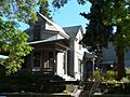
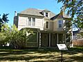
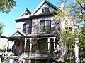
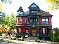
Many grand old buildings and houses in Helena, Montana, are on the list. These include beautiful churches and homes where important people once lived.
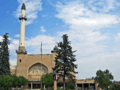
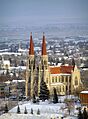
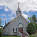
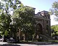
The Cathedral of Saint Helena is a huge, stunning church. It was built a long time ago. Its tall spires and beautiful stained glass windows make it a landmark. It's a great example of old-style architecture.
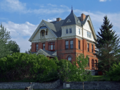
The Former Montana Executive Mansion was once where Montana's governors lived. Imagine living in such a historic house! It's a big part of the state's political history.
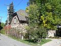
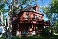
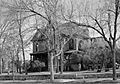
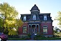
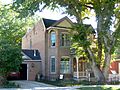
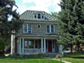
Some other interesting homes include the Algeria Shrine Temple, a unique building used for community events. The Joshua and Martha Armitage House and the Charles A. Broadwater House are examples of beautiful old family homes. They show us how houses were designed in the past.
Important Historic Districts
Sometimes, it's not just one building that's historic. It's a whole area! These are called historic districts.
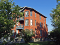
The Helena Historic District covers a large part of downtown Helena. It includes many old shops, offices, and homes. Walking through it feels like stepping back in time. You can see how the city grew and changed.
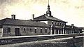
The Helena Railroad Depot Historic District is all about the old train station area. Train travel was very important for towns like Helena. This district reminds us of the days when trains brought people and goods.
The Mann Gulch Wildfire Historic District is a different kind of historic place. It's a natural area where a famous and tragic wildfire happened. It's important for understanding fire safety and forest management.
Other Cool Historic Sites
Lewis and Clark County also has many other unique historic spots.
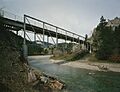
The Dearborn River High Bridge is an old bridge that crosses the Dearborn River. Bridges are important for travel and trade. This one shows us how engineers built strong structures long ago.
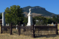
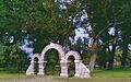
The Benton Avenue Cemetery and Forestvale Cemetery are historic burial grounds. They are important for understanding the history of the community. They also show us old art and traditions related to memorials.
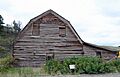
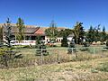
The Joe and Carrie Hilger Ranch is a historic ranch. Ranches were key to Montana's economy and way of life. This site helps us remember the state's farming and ranching past.
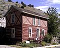
The Silver Creek School is an old schoolhouse. It reminds us of how children learned in the past. It shows how communities valued education.
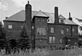
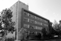
The Lewis and Clark County Hospital Historic District (also known as the Old Cooney Home) was once a hospital. It tells us about the history of healthcare in the area.
Why are These Places Important?
These historic places are more than just old buildings. They are like pieces of a puzzle that tell the story of Lewis and Clark County and Montana. They show us:
- How people lived: From grand mansions to simple schoolhouses.
- How towns grew: From busy railroad depots to bustling main streets.
- Important events: Like the Mann Gulch wildfire.
- Different styles of building: Showing how architecture changed over time.
By protecting these sites, we make sure their stories can be told for many years to come. They help us understand where we came from and appreciate the hard work of those who came before us.
Images for kids
-
Algeria Shrine Temple
-
Alice Creek Historic District
-
Benton Avenue Cemetery
-
Cathedral of Saint Helena
-
Childs Carriage House
-
William C. Crum House
-

D.H. Cuthbert House
-
Dearborn River High Bridge
-
Robert and Elizabeth Fisk House
-
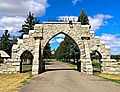
Forestvale Cemetery
-
Former Montana Executive Mansion
-
Hauser Mansion
-
Helena Historic District
-
Helena Railroad Depot Historic District
-
Helena South-Central Historic District
-
Joe and Carrie Hilger Ranch
-
Home of Peace Cemetery
-
House of the Good Shepherd Historic District
-
John H. Huseby House
-
T.H. Kleinschmidt House
-
Kluge House
-
Lewis and Clark County Hospital Historic District
-
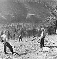
Mann Gulch Wildfire Historic District
-
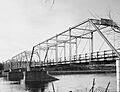
Missouri River Bridge
-

Montana State Arsenal, Armory and Drill Hall
-
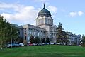
Montana State Capitol Building
-

Montana State Capitol Campus Historic District
-

Montana Veterans and Pioneers Memorial Building
-
Olsen House
-
Francis and Hannah Pope House
-
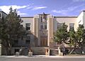
Porter Flats Apartments
-
Morris Silverman House
-
Stearns Hall
-
Temple Emanu-El
-
Unemployment Compensation Commission Building
-
Wassweiler Hotel and Bath Houses
-
Western Life Insurance Company Helena Branch Office
-
Young Women's Christian Association (Independent)
_-_Lewis_and_Clark_County,_Montana.png)

_-_Lewis_and_Clark_County,_Montana.png)


_-_Lewis_and_Clark_County.png)

_-_Lewis_and_Clark_County,_Montana.png)


.jpg)
_-_Lewis_and_Clark_County,_Montana.png)


_-_Lewis_and_Clark_County,_Montana.png)
_-_Lewis_and_Clark_County,_Montana.png)

_-_Lewis_and_Clark_County,_Montana.png)


_-_Lewis_and_Clark_County,_MT.png)


_(2012)_-_Lewis_and_Clark_County,_Montana.png)
