National Register of Historic Places listings in Loudon County, Tennessee facts for kids
Welcome to Loudon County, Tennessee! This page is a special list of places that are super important to history. They are all part of something called the National Register of Historic Places. Think of it like a hall of fame for buildings, islands, and other spots that tell amazing stories about the past in Loudon County, Tennessee, United States.
These places are chosen because they are very old, have special architecture, or played a big part in history. There are 24 places in Loudon County on this list right now. Two other places used to be on the list but are not anymore. Let's explore some of these cool historic spots!
Historic Places You Can Visit
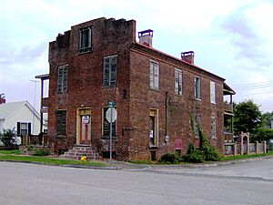
Blair's Ferry Storehouse
This old storehouse is located in Loudon. It was added to the historic list on July 14, 1977. Imagine all the goods and supplies that passed through its doors long ago when ferries were a main way to cross rivers!
Bowman House
The Bowman House is another historic spot near Loudon. It became a registered historic place on July 8, 1970. This house has stood for many years, watching history unfold around it.
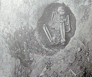
Bussell Island Site
Bussell Island is a very important place near Lenoir City. It's located in the Little Tennessee River. This island is special because it holds secrets from ancient times. It was added to the list on March 29, 1978, showing how important it is for understanding early human history in the area.
Cannon-Calloway House
West of Loudon, you'll find the Cannon-Calloway House. It joined the National Register on July 8, 1970. This house is a piece of history, showing us how people lived many years ago.
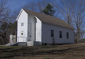
Craigs Chapel AME Zion Church
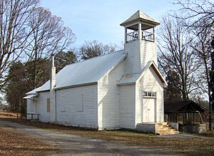
This church is in Greenback and was added to the list on March 12, 2001. It's a significant place because it was part of a special project by MTSU. They looked at many old African-American churches in rural Tennessee to make sure their history is remembered and protected.
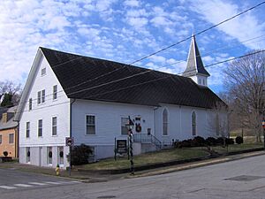
Cumberland Presbyterian Church of Loudon
The Cumberland Presbyterian Church in Loudon became a historic site on April 15, 1982. Churches like this often have beautiful architecture and have been important gathering places for communities for a very long time.
Dunbar Public School
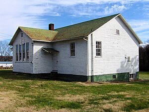
Located in Loudon, the Dunbar Public School was added to the list on November 15, 2007. This building used to be a school where many students learned and grew. Today, it serves the community as a community center, continuing to be a place for people to come together.
Greenback Depot
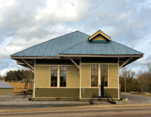
The Greenback Depot in Greenback was recognized as historic on December 18, 2013. It was built by the L&N railroad company in 1914. Train depots were once very busy places, connecting towns and helping people and goods travel across the country.
William H. Griffitts House
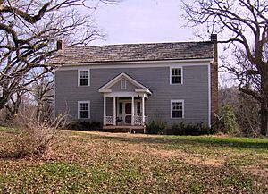
This house, located near Greenback, joined the list on March 2, 1989. It's another example of the historic homes that tell the story of early settlers and families in Loudon County.
Hackney Chapel AME Zion Church
Near Lenoir City, the Hackney Chapel AME Zion Church was added to the National Register on July 10, 2000. Like Craigs Chapel, it was part of the important survey by MTSU to document rural African-American churches in Tennessee.
Lenoir City Company
The Lenoir City Company building in Lenoir City became a historic site on March 19, 1982. This building was originally the main office for a company around 1890. Even though the company didn't last, the building now serves as a museum, helping to preserve the history of Lenoir City.
Lenoir Cotton Mill Warehouse
This warehouse in Lenoir City was added to the list on July 6, 2006. It was once used by the Lenoir Cotton Mill. Today, it has been changed into a home, showing how old buildings can find new life while keeping their historic charm.
Albert Lenoir House
West of Loudon, the Albert Lenoir House was recognized as historic on April 11, 1973. It's located where River Road crosses Sweetwater Creek. This house is a reminder of the early families who settled in the area.
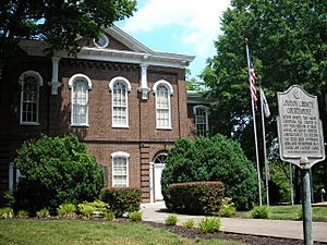
Loudon County Courthouse
The Loudon County Courthouse in Loudon became a historic landmark on May 28, 1975. Courthouses are often central to a county's history, where important decisions were made and justice was served.
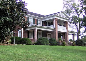
Mason Place
Mason Place in Loudon was added to the National Register on November 27, 1989. This building is another example of the beautiful and historic architecture found in the county.
McCollum Farm
Southwest of Greenback, the McCollum Farm was listed as historic on April 15, 1978. Farms like this played a huge role in the development of the region, providing food and livelihoods for many families.
National Campground
The National Campground near Greenback became a historic site on January 7, 1972. Campgrounds often have long histories as places for community gatherings, religious meetings, or simply enjoying nature.
Robinson Mill
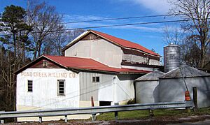
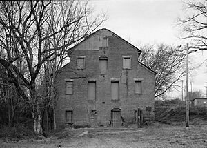
Robinson Mill, located near Loudon, was added to the list on April 5, 1984. Mills were essential for grinding grain and processing other goods, playing a vital role in the local economy many years ago.
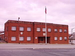
War Memorial Building
The War Memorial Building in Lenoir City was recognized as historic on December 29, 2011. It was built in 1951 to honor local veterans who served their country. It stands as a tribute to their bravery and sacrifice.
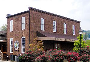
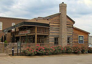
Orme Wilson and Company Storehouse
This storehouse in Loudon was added to the National Register on February 12, 1980. It's now home to a coffeehouse, showing how historic buildings can be used for new purposes while keeping their original charm.
John Winton House
The John Winton House near Lenoir City became a historic place on July 17, 2003. This house is another example of the rich history found in the homes of Loudon County.
Places That Were Once Listed
Sometimes, places are removed from the National Register of Historic Places. This can happen for different reasons, like if a building is moved or destroyed.
Carmichael Inn
The Carmichael Inn in Loudon was once on the historic list, added on July 8, 1970. However, it was removed on November 25, 1987, because it was moved to a different location within Loudon.
Lenoir Cotton Mill
The Lenoir Cotton Mill in Lenoir City was listed on June 18, 1975. Sadly, it was destroyed by a fire in 1991 and was removed from the list on July 30, 2002.


