
National Register of Historic Places listings in Maricopa County, Arizona facts for kids

Maricopa County is a large and interesting area in Arizona, known for its sunny weather and desert landscapes. It's also home to many places that are important to history! The National Register of Historic Places is a special list in the United States. It helps protect buildings, sites, and objects that are important because of their history, unique design, or the events that happened there.
This article explores some of these amazing historic places in Maricopa County, but it doesn't include those found in the city of Phoenix. Phoenix has so many historic spots that it has its own separate list! Maricopa County has 419 places on this special list. This includes 3 places that are also National Historic Landmarks, which are even more important. Outside of Phoenix, there are 197 historic places and 2 National Historic Landmarks that we'll learn about here.
Historic Places Around Maricopa County
Maricopa County is full of cool historic spots, from old bridges to unique houses and important archaeological sites. Let's explore some of them!
Tempe's Timeless Treasures
Tempe is a vibrant city with a rich past. Many of its historic buildings are connected to Arizona State University or the city's early development.
Bridges and Buildings in Tempe
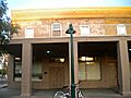
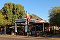
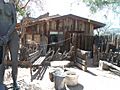
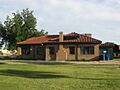
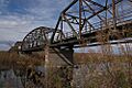
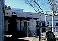
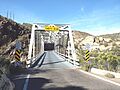
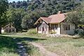
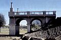
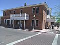
- The 1931 Tempe Bridge (Mill Ave.) was the first of the two Mill Avenue Bridges. It was built in 1931 and is a key part of the city's history.
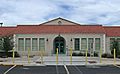
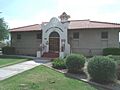
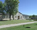
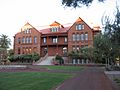
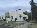
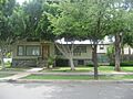
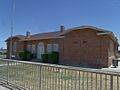
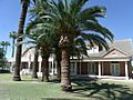
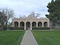
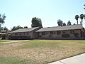
- The Administration/Science Building (Arizona State University campus) was listed in 1985. It's one of the older buildings at the university.
- The Andre Building (401-403 S. Mill Ave.) is a classic building. It was rebuilt in 1893 after the original one burned down.
- The B. B. Moeur Activity Building (Arizona State University campus) was built in 1939. It was part of a program to create jobs during tough economic times. Today, it's home to the Mars Space Flight Facility!
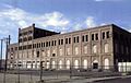
- The Borden Milk Co. Creamery and Ice Factory (1300-1360 E. 8th St.) has a cool history. Originally built in 1892, its current look comes from 1927. It shows off the Mission Revival style of architecture.
- The Industrial Arts Building (Arizona State University campus) is another historic building on the ASU campus, added to the list in 1985.
- Old Main (Arizona State University campus) is a very important building at ASU. It was listed in 1985 and is a central part of the university's history.
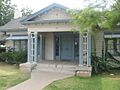
- The President's House (Arizona State University campus) is another historic building on the ASU campus, listed in 1985.
- The Tempe Hardware Building (520 S. Mill Ave.) was added to the list in 1980. It's a reminder of Tempe's early businesses.
- The Tempe Woman's Club (1290 S. Mill Ave.) was listed in 2000. Women's clubs played a big role in community development.
- The Vienna Bakery (415 S. Mill Ave.) was listed in 1980. It represents the early businesses that served the community.
Historic Homes in Tempe
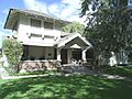
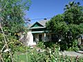
- The Rose Eisendrath House (1400 N. College Ave.) is a 1930 house built in the Pueblo Revival style. It was designed by a famous Arizona architect, Robert T. Evans.
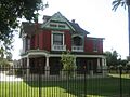
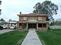
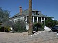
- The C.T. Hayden House (3 W. 1st St.) was the home of Charles T. Hayden, who helped found Tempe. It was built in 1871.
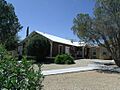
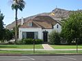
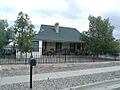
- The Niels Petersen House (Southern Ave. and Priest St.) was listed in 1978. It's an example of early homes in the area.
- The Gov. Benjamin B. Moeur House (34 E. 7th St.) was the home of Benjamin B. Moeur, who served as Governor of Arizona. It was listed in 2012.
- The Sampson-Tupper House (601 W. 3rd St.) was built in 1888 and is part of the Roosevelt Addition Historic District.
Tempe's Historic Districts
- The Borden Homes Historic District (1000-1100 blocks of S. Una & S. Butte Aves., & 1600-1700 blocks of E. 12th St.) is one of the earliest neighborhoods built in Tempe after World War II.
- The Date Palm Manor Historic District (2024-2106 S. Mill Ave, 5-1377 W. Palmcroft, 32-121 W. Palmdale, 2019-2025 S. Dateland & 2015-2030 Dromedary Drs.) was listed in 2015.
- The University Park Historic District (Bounded by 13th St., Forest Ave, alley between Apache Boulevard and 14th St., McAllister Ave., Union Pacific railroad line, and Mill Ave.) was listed in 2008. It's a neighborhood with many historic homes.
Glendale's Gems
Glendale also has many historic places, especially its charming downtown area.
Historic Buildings in Glendale
- The Beet Sugar Factory (5243 W. Glendale Ave.) was built in 1910. It reminds us of Glendale's agricultural past.
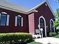
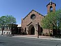
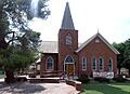
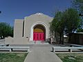
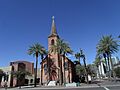
- The First Methodist Episcopal Church of Glendale Sanctuary (7102 N. 58th Dr.) was built in 1926.
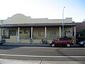
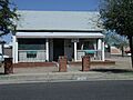
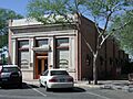
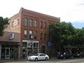
- The First National Bank of Glendale Building (6838 N. 58th Dr.) was built in 1906. It shows the early growth of businesses in Glendale.
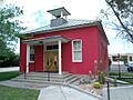
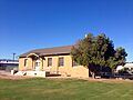
- The Glendale Grammar School One-room Class Building (7301 N. 58th Dr.) was built in 1920. It's a great example of early school buildings.
- The Glendale High School Auditorium (6216 W. Myrtle Ave.) was built in 1939.
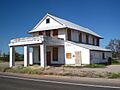
- The Glendale Woman's Club Clubhouse (7032 N. 56th Ave.) was built in 1912. Women's clubs were very active in improving communities.
- The Jonas McNair House (5919 W. Myrtle Ave.) was built in 1897.
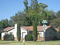
- The Manistee Ranch (5127 W. Northern Ave.) includes a main mansion built in 1897. It's a beautiful example of a historic ranch.
- The C.H. Tinker House (6838 N. 59th Dr.) was built in 1913.
Glendale's Historic Neighborhoods
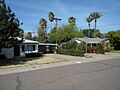
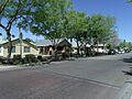
- The 59th Avenue Residential Historic District (Western side of 59th Ave. between Orangewood Ave. and Frier Dr.) shows early rural development. Homes here were built on large lots.
- The Floralcroft Historic District (Roughly bounded by State St., 59th Ave., Myrtle St., Grand Ave., and 61st Ave.) includes the 1895 Santa Fe Depot.
- The Glendale Townsite-Catlin Court Historic District (Roughly bounded by Gardenia, 58th, Myrtle, 57th, Palmaire, and 59th Aves. and 58th Dr.) is one of Glendale's oldest and most historic neighborhoods.
- The Glendale Tract Historic District (51st Ave. and Northern Ave.) includes the Glendale Tract Community Center, built in 1937.
- The Myrtle Avenue Residential Historic District (6305-6423 W. Myrtle Ave.) includes the historic Morcomb's Service Station from 1930.
- The Northfield Historic District (Bounded by W. State Ave (S), N. 59th Ave (E), W. Orangewood Ave (N), and N. 59th Lane (W)) includes the Jack Shawver House, built in 1952.
- The Sahuaro Ranch (N. 59th Ave.) has a main mansion built in 1886. It's a large historic ranch.
Mesa's Marvels
Mesa, one of Arizona's largest cities, also has many places that tell its story.
Mesa's Notable Buildings
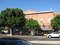
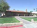
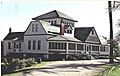
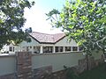
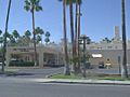
- The Alhambra Hotel (43 S. Macdonald) was Mesa’s longest operating hotel. It's even a stop on local ghost tours!
- The Alma Ward Meeting House (809 W. Main St.) includes three buildings important to Mesa's religious and educational history.
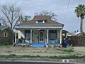
- The Dr. Lucius Charles Alston House (453 N. Pima St.) was the home of the first African American doctor in Mesa.
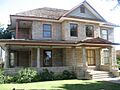
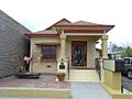
- The Angulo-Hostetter House (150 North Wilbur) is a Colonial Revival home from 1902, with some Victorian features.
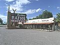
- The Buckhorn Baths Motel (5900 E. Main St.) is a group of fourteen buildings, including a bathhouse, from 1939.
- The Irving School (155 N. Center St.) was listed in 2000.
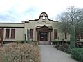
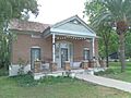
- The Lehi School (2345 N. Horne) was built in 1913. Today, it's home to the Mesa Historical Museum.
- The Mesa Journal-Tribune FHA Demonstration Home (238 W. 2nd St.) was moved in 2002 from its original spot.
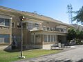
- The Mesa Woman's Club (200 N. Macdonald) was listed in 1991.
- The Sirrine House (160 N. Center St.) was listed in 1995.
- The Spangler-Wilbur House (128 N. MacDonald St.) was listed in 1993.
- The Straugh House (148 N. Macdonald) was listed in 1991.
Mesa's Historic Districts and Sites
- The Evergreen Historic District (Roughly between Country Club and Macdonald, north of University Dr. to 8th St.) is a historic neighborhood in Mesa.
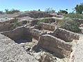
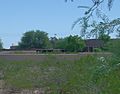
- The Mesa Grande (Junction of Date and 10th Sts.) is an important archaeological site.
- The Park of the Canals (1710 N Horne Ave.) is a fascinating site. It features an ancient canal built by the Hohokam people, which was later cleaned and used by Mormon pioneers in 1875.
- The Robson Historic District (Roughly bounded by Country Club Dr., Robson, and 2nd Sts.) is another historic neighborhood in Mesa.
- The Temple Historic District (Roughly between Mesa Dr., Broadway Rd., Hobson, and Main Sts.) includes the neighborhoods around the Mesa Arizona Temple.
- The West Second Street Historic District (Roughly between Robson St. and Center St., from 1st St. to 3rd St.) is a historic area in Mesa.
Wickenburg's Western Heritage
Wickenburg, known for its Western charm, has several historic buildings that tell the story of its past.
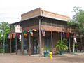
- The Cactus Inn (158 Yavapai) was listed in 1986.
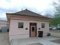
- The City Hall and Jail (117 Yavapai) was listed in 1986. It's a cool old building that served important town functions.
- The Garcia School (Yavapai St. and U.S. Route 89) was listed in 1982.
- The Masonic Hall (108 Tegner) was listed in 1986.
- The Municipal Light Plant (245 N. Washington) was listed in 1986.
- The Old Barber Shop (68 Frontier) was listed in 1986.
- The Old Brick Post Office (144 N. Frontier) was listed in 1986.
- The Safeway Pay 'n Takit (42 N. Tegner) was listed in 1986.
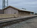
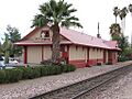
- The Santa Fe Railroad Depot (215 N. Frontier) was listed in 1986. It's a reminder of the importance of railroads in developing the West.
- The Vernetta Hotel (1 Apache St.) was listed in 1986.
- The Wickenburg High School and Annex (250 S. Tegner) includes the original 1925 school and a 1935 annex.
- The Wickenburg High School Gymnasium (252 S. Tegner) was built in 1934 as a concrete structure.
- The Henry Wickenburg Pioneer Cemetery (Adams St.) is where Henry Wickenburg, the town's founder, is buried.
Other Important Places in Maricopa County
- The Alchesay Canyon Bridge (State Route 88) near Roosevelt was listed in 1988.
- The Boulder Creek Bridge (State Route 88) near Tortilla Flat was listed in 1989.
- The Buckeye Union High School A-Wing (902 E. Eason Ave.) was listed in 2009.
- The Gila Bend Overpass (Business Route 8 over the Southern Pacific railroad line) was built in 1933 and listed in 1988.
- The Gillespie Dam Highway Bridge (Northwest of Gila Bend) was listed in 1981.
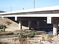
- The Hassayampa River Bridge (Old U.S. Route 80) near Buckeye was built in 1929. It was repaired in 1993.
- The Initial Point of the Gila and Salt River Base Line and Meridian (Summit of Monument Hill at 115th Ave. and Baseline Rd.) in Avondale is a very important surveying marker. It helped map out much of Arizona!
- The Laveen School Auditorium (5001 W. Dobbins Rd.) in Laveen was listed in 1996.
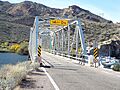
- The Mormon Flat Bridge (State Route 88) near Tortilla Flat was built in 1924 and listed in 1988.
- The Morristown Store (U.S. Route 89) was listed in 1991.
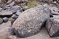
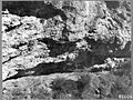
- The Painted Rock Petroglyph Site (Along Rocky Point Road west of Theba) has ancient rock carvings. It was listed in 1977.
- The Palo Verde Ruin (Palo Verde Open Space Park) in Peoria is an archaeological site listed in 2011.
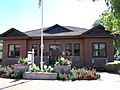
- The Peoria Central School (10304 N. 83rd Ave.) was a two-room school built in 1906. Today, it's the Peoria Arizona Historical Society Museum.
- The First Presbyterian Church of Peoria (10236 N. 83rd Ave.) was listed in 2012.
- The Rittenhouse Elementary School (Ellsworth Rd.) in Queen Creek is a 1925 schoolhouse built in the Spanish Colonial Revival style. It now houses The San Tan Museum.
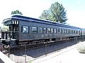
- The Roald Amundsen Pullman Private Railroad Car (7301 Indian Bend Rd.) in Scottsdale was built in 1928. This special train car reportedly carried several U.S. Presidents!
- The San Marcos Hotel (1 San Marcos Pl.) in Chandler was listed in 1982.
- The Scottsdale Grammar School (7333 E. Scottsdale Mall) was built in 1909. It's also known as "The Little Red Schoolhouse."
- The Sun City DEVCO Model No.1 (10801 W. Oakmont Dr.) in Sun City was built in 1959. It's now the Del Webb Sun Cities Museum.
- The Sunflower Ranger Station (State Route 87) near Punkin Center was listed in 1993.
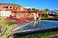
- Taliesin West (North of the junction of Shea Boulevard and 108th St.) in Scottsdale is a famous building designed by architect Frank Lloyd Wright. It was listed as a National Historic Landmark in 1974.
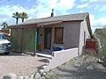
- The Tubercular Cabin (6140 Skyline Dr.) in Cave Creek was listed in 2001. It's a reminder of how people dealt with illnesses in the past.
- The Valley Field Riding and Polo Club (2530 N. 64th St.) in Scottsdale was listed in 2009.
Archaeological Sites (Address Restricted)
Some historic sites are kept secret to protect them. These are often ancient archaeological sites.
- Archeological Site No. AZ U:10:20(ASU) (Mesa)
- Archeological Site No. AZ U:10:25(ASU) (Mesa)
- Azatlan Archeological Site (Rio Verde Estates)
- Brazaletes Pueblo Site (Carefree) is a large ancient village north of Phoenix.
- Cashion Archeological Site (Avondale)
- Fortaleza (Gila Bend)
- Gatlin Site (Gila Bend) is a National Historic Landmark.
- Midvale Archeological Site (Chandler)
- Petroglyph Site AZ U 1:165 (Scottsdale) has ancient rock carvings.
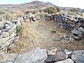
- Sears-Kay Ruin (Tonto National Forest, Carefree)
- Skeleton Cave Massacre Site (Apache Junction) is a site with a sad history related to the Yavapai people.
Images for kids
-
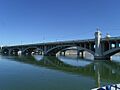
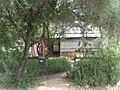
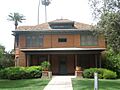
The 1931 Tempe Bridge
-
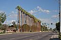
59th Avenue Residential Historic District
-
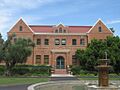
Administration/Science Building
-
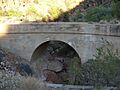
Alchesay Canyon Bridge
-
Alhambra Hotel
-
Alma Ward Meeting House
-
Dr. Lucius Charles Alston House
-
Ammo Bunker (S-1007)
-
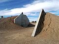
Ammo Bunker (S-1008)
-
Andre Building
-
Angulo-Hostetter House
-
B. B. Moeur Activity Building
-
Beet Sugar Factory
-
Borden Homes Historic District
-
Borden Milk Co. Creamery and Ice Factory
-
Boulder Creek Bridge
-
Buckeye Union High School A-Wing
-
Buckhorn Baths Motel
-
E.C. Bunch House
-
Cactus Inn
-
Cave Creek Service Station
-
Central School
-
Chandler Commercial Historic District
-
Chandler High School
-
City Hall and Jail
-
Civil Engineering Maintenance Shop
-
Date Palm Manor Historic District
-
Demountable Hangar
-
George O. Dowdy Rental Cottage
-
Rose Eisendrath House
-
Elias-Rodriguez House
-
Elliott House
-
George Ellis House
-
Farmer-Goodwin House
-
First Methodist Episcopal Church of Glendale Sanctuary
-
First National Bank of Glendale Building
-
First Presbyterian Church of Peoria
-
Flagpole
-
Floralcroft Historic District
-
Frankenberg House (Josephine Frankenberg House)
-
Frankenberg House (D. J. Frankenberg House)
-
Garcia School
-
Gatlin Site
-
Gila Bend Overpass
-

Gilbert Elementary School
-
Gillespie Dam Highway Bridge
-
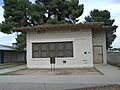
Glendale Grammar School One-room Class Building
-
Glendale High School Auditorium
-
Glendale Townsite-Catlin Court Historic District
-
Glendale Tract Historic District
-
Glendale Woman's Club Clubhouse
-
Gonzales-Martinez House
-
Goodwin Building
-
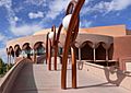
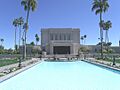
Grady Gammage Memorial Auditorium
-
Roy Hackett House
-
Harrington-Birchett House
-
Hassayampa River Bridge
-
C.T. Hayden House
-
Hiatt House
-
House at 160 Apache
-
House at 170 Center
-
House at 186 Washington
-
Housing Storage Supply Warehouse
-
Industrial Arts Building
-
Initial Point of the Gila and Salt River Base Line and Meridian
-
Irving School
-
Jacobs House
-
Edward L. Jones House
-
Louise Lincoln Kerr House and Studio
-
Laird-Hugh House
-
Laveen School Auditorium
-
Lehi School
-
Samuel C. Long House
-
MacLennan House
-
Main Building, Tempe Normal School
-
Manistee Ranch
-
Matthews Hall
-
McCullough-Price House
-
Jonas McNair House
-
Mesa Grande
-
Mesa Journal-Tribune FHA Demonstration Home
-
Mesa Woman's Club
-
Gov. Benjamin B. Moeur House
-
Moeur Park
-
W. A. Moeur House
-
Mormon Flat Bridge
-
Morristown Store
-
Morrow-Hudson House
-
C.P. Mullen House
-
Myrtle Avenue Residential Historic District
-
Northfield Historic District
-
Old Barber Shop
-
Old Brick Post Office
-
Painted Rocks
-
Palo Verde Ruin
-
Park of the Canals
-
Niels Petersen House
-
President's House
-
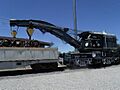
Railroad Steam Wrecking Crane and Tool Car
-
Byron Redden House
-
Lowell Redden House
-
Rittenhouse Elementary School
-
Roald Amundsen Pullman Private Railroad Car
-
Roosevelt Addition Historic District
-
Safeway Pay 'n Takit
-
Sahuaro Ranch
-
St. Mary's Church-Our Lady of Mount Carmel Catholic Church
-
San Marcos Hotel
-
Santa Fe Railroad Depot
-
Robert Scott House
-
Scottsdale Grammar School
-
B.H. Scudder Rental House
-
Sears-Kay Ruin
-
Selleh House
-
Shride House
-
Silk Stocking Neighborhood Historic District
-
Sirrine House
-
Skeleton Cave Massacre Site
-
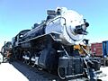
Southern Pacific Railroad Locomotive No. SP 2562 and Tender No. 8365
-
Spangler-Wilbur House
-
Storms House
-
Straugh House
-
Suhwaro Hotel
-
Sun City DEVCO Model No.1
-
Sun-Up Ranch
-
Sunflower Ranger Station
-
Taliesin West
-
Tempe Beach Stadium
-
Tempe Butte
-
Tempe Concrete Arch Highway Bridge
-
Tempe Double Butte Cemetery, Pioneer Section
-
Tempe Hardware Building
-
Tempe Woman's Club
-
Temple Historic District
-
Thunderbird Estates and The McDonald Addition Historic District
-
C.H. Tinker House
-
Frank Titus House
-
Tubercular Cabin
-
University Park Historic District
-
George B. Upton House
-
Valley Field Riding and Polo Club
-
Vernetta Hotel
-
Vienna Bakery
-
Harry Walker House
-
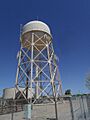
Water Pump Station and Water Tower
-
E.M. White Dairy Barn
-
Wickenburg-Boetto House
-
Wickenburg High School and Annex
-
Wickenburg High School Gymnasium
-
Henry Wickenburg Pioneer Cemetery
-
Wisdom House


-1.JPG)
-2.JPG)
.jpg)

.jpg)


.jpg)
.jpg)

.jpg)


.jpg)
.jpg)


.jpg)

.jpg)
.jpg)


.jpg)


.jpg)


.jpg)


.jpg)


.jpg)


.jpg)
.jpg)


.jpg)
.jpg)

.jpg)


.jpg)


.jpg)
.jpg)


.jpg)


.jpg)


.jpg)


