
National Register of Historic Places listings in Miami facts for kids

Welcome to Miami, Florida! This amazing city is full of history, and many of its special buildings and places are protected. They are listed on something called the National Register of Historic Places. Think of it like a special hall of fame for important historical sites across the United States.
When a place is on this list, it means it's recognized for its unique history, architecture, or culture. It helps make sure these places are kept safe for future generations to enjoy and learn from. Miami has many such treasures, from old homes to famous landmarks. Some are even more special, called National Historic Landmarks, which means they are important to the history of the entire country!
In Miami-Dade County, there are 189 places on the National Register. Miami itself is home to 77 of these, including 5 National Historic Landmarks. One cool spot, the Venetian Causeway, is even split between Miami and Miami Beach! Let's explore some of these fascinating historic places in Miami.
Contents
Exploring Miami's Historic Gems
Miami is a city with a rich past, and many of its buildings tell stories of earlier times. These historic places help us understand how the city grew and changed.
Famous Landmarks and Buildings
Miami has several well-known buildings that are on the National Register. They stand out because of their unique design or the important events that happened there.
Freedom Tower
The Freedom Tower is one of Miami's most famous buildings. Located at 600 Biscayne Boulevard, it was built in 1925. This tower looks a lot like the Giralda bell tower in Seville, Spain. For many years, it was the headquarters for the Miami News newspaper. Later, in the 1960s, it became a processing center for Cuban refugees arriving in the United States. It's a powerful symbol of hope and new beginnings for many.
Vizcaya Museum and Gardens

Imagine a grand Italian villa right in Miami! That's Vizcaya, located at 3251 South Miami Avenue. It was built between 1914 and 1922 as the winter home of James Deering, a wealthy businessman. This amazing estate has beautiful gardens, stunning architecture, and incredible art. It's like stepping back in time to a European palace. Vizcaya is so important that it's also a National Historic Landmark.
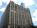
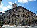
Dade County Courthouse
The Dade County Courthouse at 73 West Flagler Street is a very important building in Miami. It was finished in 1928 and was one of the tallest buildings in Florida for many years. This courthouse is a great example of the architecture from that time, with its grand design and tall structure. It has seen many important legal decisions and events in Miami's history.
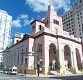
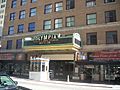
Olympia Theater
The Olympia Theater and Office Building at 174 East Flagler Street is a historic movie palace. Opened in 1926, it was designed to look like a Spanish village with twinkling stars on the ceiling. It was a popular spot for people to watch movies and live shows. Today, it's still a vibrant performing arts venue, bringing entertainment to Miami.
Homes of Important People
Some historic places are special because famous or important people lived there. These homes give us a glimpse into their lives.
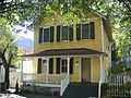
Marjory Stoneman Douglas House

The Marjory Stoneman Douglas House at 3744 Stewart Avenue was the home of Marjory Stoneman Douglas. She was a famous environmentalist and writer who worked hard to protect the Florida Everglades. Her book, The Everglades: River of Grass, helped many people understand how important this unique ecosystem is. Her home is now a National Historic Landmark, honoring her incredible work.
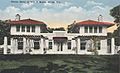
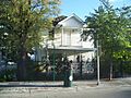
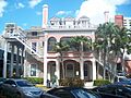
William Jennings Bryan House
The William Jennings Bryan House at 3115 Brickell Avenue was the winter home of William Jennings Bryan. He was a very important politician in the early 1900s, known for his powerful speeches and running for president multiple times. His house shows us how important figures lived in Miami during that era.
Ralph M. Munroe House (The Barnacle)

The Ralph M. Munroe House, also known as "The Barnacle," is located at 3485 Main Highway. Ralph Munroe was one of Coconut Grove's earliest settlers and a pioneer in yacht design. His home, built in 1891, is the oldest house in Miami-Dade County still on its original foundation. It's a beautiful example of early Florida architecture and offers a look at life in the late 1800s.
Historic Districts and Neighborhoods
Sometimes, it's not just one building, but a whole area that is historic. These "historic districts" show how neighborhoods looked and felt in the past.
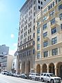
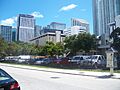
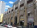
Downtown Miami Historic District
The Downtown Miami Historic District includes many important buildings in the heart of the city. This area, roughly bounded by Miami Court, 3rd Street, 3rd Avenue, and 2nd Street, shows the growth of Miami's business and civic center. Walking through this district is like taking a trip through time, seeing the different styles of buildings from Miami's early days.
Lummus Park Historic District
The Lummus Park Historic District is another special area in Miami. It's roughly located near Northwest Second Street and Northwest North River Drive. This district is important because it contains some of Miami's oldest buildings, including homes and public spaces. It gives us a sense of what early Miami neighborhoods were like.
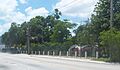
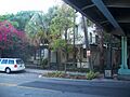
Bay Shore Historic District
The Bay Shore Historic District is a beautiful area roughly bounded by Northeast 55th Street, Biscayne Boulevard, Northeast 60th Street, and Biscayne Bay. This district features many homes built in the 1920s and 1930s, showcasing different architectural styles popular at the time. It's a lovely example of how Miami's residential areas developed along the bay.
Other Unique Historic Sites
Miami's historic places aren't just buildings. They include unique sites that tell different parts of the city's story.
Miami Circle

The Miami Circle (also known as the Brickell Point Site) at 401 Brickell Avenue is an incredible archaeological discovery. It's a perfect circle of 24 holes cut into the bedrock, believed to have been made by the Tequesta Native American tribe over 2,000 years ago! This site is a National Historic Landmark and gives us a rare look into the ancient history of South Florida.
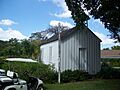
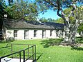
First Coconut Grove School
The First Coconut Grove School at 3429 Devon Road is a simple but very important building. It was the first schoolhouse in Coconut Grove, built in 1887. This small wooden building reminds us of the early days of education in Miami and how communities came together to teach their children.
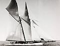
Half Moon (shipwreck)
Not all historic places are on land! The HALF MOON is a shipwreck located outside Bear Cut off Key Biscayne. This yacht, originally named Germania, sank in 1908. It's now an underwater archaeological preserve, offering a glimpse into maritime history and a unique dive site.
These are just a few of the many fascinating places on the National Register of Historic Places in Miami. Each one has a story to tell, helping us understand the rich and diverse history of this vibrant city.
Images for kids
-
Algonquin Apartments
-
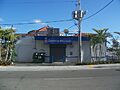
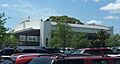
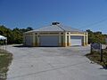
Atlantic Gas Station
-

Barracks and Mess Building-US Coast Guard Air Station at Dinner Key
-
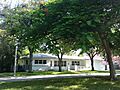
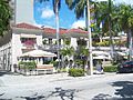
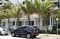
A house in the Bay Shore Historic District
-
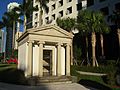
Brickell Mausoleum
-
William Jennings Bryan House
-

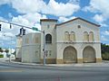
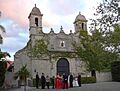
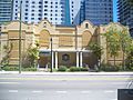
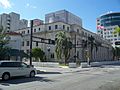
Central Baptist Church
-
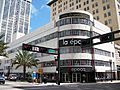
City National Bank Building
-
City of Miami Cemetery
-
The Congress Building
-
D. A. Dorsey House
-
Downtown Miami Historic District
-
Alfred I. DuPont Building
-
El Jardin
-
Fire Station No. 2
-
Fire Station No. 4
-
First Coconut Grove School
-
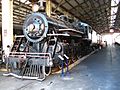
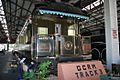
Florida East Coast Railway Locomotive No. 153
-
Gesu Church
-

Greater Bethel AME Church
-
I. and E. Greenwald Steam Engine No. 1058
-
Hahn Building
-
The HALF MOON shipwreck
-
Halissee Hall
-
Huntington Building
-
Ingraham Building
-
J & S Building
-
Dr. James M. Jackson Office
-
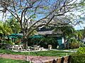
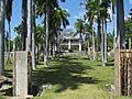
The Kampong
-
Kentucky Home
-
Lummus Park Historic District
-
Lyric Theater
-
Martina Apartments
-
Meyer-Kiser Building
-
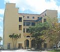
Miami City Hospital, Building No. 1
-
Miami Edison Senior High School
-
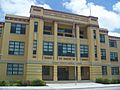
Miami Senior High School
-
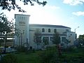
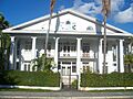
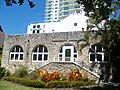
Miami Women's Club
-
Mount Zion Baptist Church
-
Old US Post Office and Courthouse
-
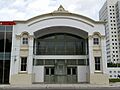
Olympia Theater and Office Building
-
Palm Cottage
-
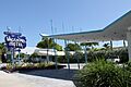
Pan American Seaplane Base and Terminal Building
-
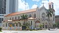
Plymouth Congregational Church
-
Ransom School "Pagoda"
-
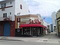
S & S Sandwich Shop
-
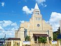
St. John's Baptist Church
-
Sears, Roebuck and Company Department Store
-
Security Building
-
Shoreland Arcade
-
South River Drive Historic District
-
Southside School
-
Trapp Homestead
-
Trinity Episcopal Cathedral
-
U.S. Car No. 1 (Ferdinand Magellan Railcar)
-
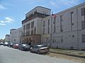
US Coast Guard Air Station Hangar at Dinner Key
-
US Post Office and Courthouse
-
Vagabond Motel
-
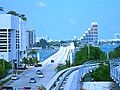
Venetian Causeway
-
Virginia Key Beach Park
-
Walgreen Drug Store
-
J. W. Warner House
-
Women's Club of Coconut Grove


See also
 In Spanish: Anexo:Registro Nacional de Lugares Históricos en Miami para niños
