
National Register of Historic Places listings in Muhlenberg County, Kentucky facts for kids

Welcome to Muhlenberg County, Kentucky! This area is home to some really special places that are part of the National Register of Historic Places. Think of it like a national list of important buildings, sites, and areas that tell us about America's past. These places are protected so future generations can learn from them.
In Muhlenberg County, there are 12 different places on this list. One of them is even part of an even more important list called a National Historic Landmark. That means it's super important to the whole country's history! Let's explore some of these cool historical spots.
Contents
What is the National Register of Historic Places?
The National Register of Historic Places is America's official list of buildings, districts, sites, structures, and objects that are important in American history, architecture, archaeology, engineering, and culture. When a place is added to this list, it means it's recognized for its special value. It helps protect these places and often makes them eligible for special grants or tax benefits to help keep them in good shape.
Historic Places in Muhlenberg County
Muhlenberg County has several fascinating places that have earned a spot on the National Register. Many of them are in the city of Greenville, which is the county seat.
Greenville's Historic Buildings
Greenville is home to many historic buildings that show us what life was like long ago.
Greenville City Hall

The old Greenville City Hall building, located on Court Street, was added to the National Register in 1985. This building once served as the main office for the city's government. It's a great example of the kind of architecture popular when it was built.
Muhlenberg County Courthouse

The Muhlenberg County Courthouse stands proudly on Courthouse Square. This building is where important legal decisions and county business have happened for many years. It was listed on the National Register in 1978, showing its long history and importance to the community.
Rice Tobacco Factory

The Rice Tobacco Factory, found on North Cherry Street, was an important part of the local economy. Tobacco was a major crop in Kentucky, and factories like this one processed it. It was added to the National Register in 1985, reminding us of the county's agricultural past.
George Short House

The George Short House, located at 121 North Main Street, is a historic home that was listed in 1980. This house gives us a peek into the lives of people who lived in Greenville many years ago. It shows the architectural styles popular at the time it was built.
Historic Districts in Greenville
Sometimes, it's not just one building that's important, but a whole group of buildings that tell a story together. These are called historic districts. Greenville has a few of these!
Greenville Commercial Historic District

This district includes the 100 blocks of North Main and East Main Cross Streets. It was listed in 1985. This area was once the bustling heart of Greenville's business world. Walking through it, you can imagine what it was like when horse-drawn carriages filled the streets and shops were full of customers.
North Main Street Historic District

The 100 and 200 blocks of North Main Street make up another historic district, listed in 1985. This area features many older homes and buildings that show the history and growth of Greenville. It's a great place to see different styles of architecture from the past.
South Cherry Street Historic District

This district is roughly bounded by South Cherry, Hopkinsville, West Main Cross, and North Cherry Streets. It was also listed in 1985. This area likely contains a mix of residential and commercial buildings that together paint a picture of Greenville's development over time.
Other Notable Sites
Beyond Greenville, Muhlenberg County has other important historical locations.
Baker Site (15MU12)
The Baker Site is a very old archaeological site located on the left bank of the Green River. This site is special because it's part of the Green River Shell Middens Archeological District. This larger district is a National Historic Landmark, which means it's one of the most important historical places in the entire country! The Baker Site helps us learn about ancient people who lived along the Green River thousands of years ago. They left behind huge piles of mussel shells, which are like clues about their lives.
Robert Thomas House

The Robert Thomas House is located in Central City, at 516 Broad Street. This historic home was added to the National Register in 1990. It represents the history and development of Central City, another important town in Muhlenberg County.
Images for kids
-
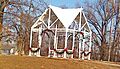
The gazebo on the site where the Martin House once stood.
-
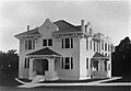
The Old Muhlenberg County Jail and Jailer's Residence, which was demolished around 2000.


