
Green River Shell Middens Archeological District facts for kids
|
Green River Shell Middens Archeological District
|
|
| Lua error in Module:Location_map at line 420: attempt to index field 'wikibase' (a nil value). | |
| Location | Along the Green River |
|---|---|
| NRHP reference No. | 85003182 |
Quick facts for kids Significant dates |
|
| Added to NRHP | May 5, 1994 |
| Designated NHLD | May 5, 1994 |
The Green River Shell Middens Archeological District is a special collection of archaeological sites in Kentucky, a state in the United States. These sites are found along the Green River. They are called shell middens because they are basically ancient trash piles made mostly of shells.
These shell piles were left behind by Native Americans who lived here a very long time ago. This was during a period known as the Archaic period. Studying these sites has taught us a lot about how people lived in the eastern U.S. thousands of years ago.
Contents
Discovering Ancient History: Green River Shell Middens
The Green River in Kentucky flows through a wide, flat area. This area was once covered by a huge body of water called Lake Green during the Pleistocene Ice Age. When the lake drained, it left behind a lot of silt, which is like fine mud.
The ancient shell middens are usually found along the paths of waterways that formed after Lake Green disappeared. Native Americans from the Archaic period were drawn to these rivers. They found lots of mussels there, which were an important food source for them.
What are Shell Middens?
Imagine you're having a big seafood feast, and you throw all the empty shells into a pile. That's pretty much what a shell midden is! These ancient piles are made up of shells from mussels and other seafood. They also contain tools, pottery, and other items that people used daily.
Archaeologists study these middens like detectives. They dig carefully through the layers to find clues about the past. By looking at the shells, bones, and tools, they can learn what people ate, how they hunted, and what their lives were like.
Life Along the Green River Long Ago
The Archaic period in North America lasted for thousands of years. During this time, people were hunter-gatherers. This means they hunted animals, fished, and collected plants for food. They didn't farm or live in permanent towns.
The Green River was a perfect place for them to live. It provided plenty of water, fish, and especially mussels. The shell middens show us that these ancient people spent a lot of time by the river. They gathered mussels, ate them, and left behind huge piles of their discarded shells.
Protecting These Special Places
The Green River Shell Middens Archeological District was officially recognized as a National Historic Landmark on May 5, 1994. This means it's a very important historical place in the United States.
The district includes twenty-three different archaeological sites. Each of these sites was already listed on the National Register of Historic Places before the district was created. These sites are spread across five counties in Kentucky: Butler County, Henderson County, McLean County, Muhlenberg County, and Ohio County. Protecting these sites helps us preserve and learn from the history of the earliest people in Kentucky.
Images for kids
-
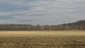
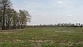
The Rayburn Johnson Shell Mound site.
-
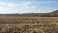
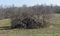
The Woodbury Shell Midden site.
-

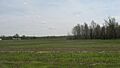
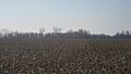
The Bluff City Shell Mound site.
-
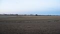
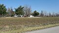
Archaeological Site 15HE580.
-
The James Giles Shell Midden site.
-
Archaeological Site 15HE635.
-
The Butterfield Site at Livermore.
-
The Austin Site.
-
Archaeological Site 15McL16.
-
The Crowe Shell Midden site.


