
Henderson County, Kentucky facts for kids
Quick facts for kids
Henderson County
|
|
|---|---|
.jpg)
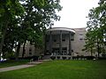
Henderson County courthouse in Henderson, Kentucky
|
|

Location within the U.S. state of Kentucky
|
|
 Kentucky's location within the U.S. |
|
| Country | |
| State | |
| Founded | 1798 |
| Named for | Richard Henderson |
| Seat | Henderson |
| Largest city | Henderson |
| Area | |
| • Total | 466 sq mi (1,210 km2) |
| • Land | 437 sq mi (1,130 km2) |
| • Water | 30 sq mi (80 km2) 6.4%% |
| Population
(2020)
|
|
| • Total | 44,793 |
| • Estimate
(2023)
|
44,119 |
| • Density | 96.12/sq mi (37.11/km2) |
| Time zone | UTC−6 (Central) |
| • Summer (DST) | UTC−5 (CDT) |
| Congressional district | 1st |
Henderson County is a county in the state of Kentucky, USA. It is located in western Kentucky, right on the Ohio River. Across the river is Evansville, Indiana.
In 2020, about 44,793 people lived here. The main city and county seat is Henderson.
The county was started in 1798. It was named after Richard Henderson. He bought a huge amount of land, about 17 million acres, from the Cherokee people. Part of that land later became Henderson County.
Henderson County is also known for its coal. It is part of the West Kentucky Coal Field area. It's also part of the larger Evansville, Indiana-Kentucky city area.
History of Henderson County
Henderson County was officially formed in 1798. It was created from a part of Christian County.
There's a special area called "Green River Island." It's on the Indiana side of the Ohio River, but it's actually part of Kentucky! This was decided in a big court case in 1820. The Ellis Park Race Course, a horse racing track, is located there.
Long ago, parts of the Cherokee Nation lived here. In 1893, the Southern Cherokee were welcomed to Kentucky. The governor at the time, John Young Brown, recognized them as an Indian tribe. Some Southern Cherokee people still live in Henderson County today.
Geography and Neighbors
The U.S. Census Bureau says that Henderson County covers about 466 square miles. Most of this is land, about 437 square miles. The rest, about 30 square miles, is water.
The northern edge of the county is the Ohio River. This river forms the border with Indiana.
Counties Nearby
Henderson County shares borders with these other counties:
- Posey County, Indiana (to the northwest)
- Vanderburgh County, Indiana (to the north)
- Warrick County, Indiana (to the northeast)
- Daviess County (to the east)
- McLean County (to the southeast)
- Webster County (to the south)
- Union County (to the west)
Population Over Time
| Historical population | |||
|---|---|---|---|
| Census | Pop. | %± | |
| 1800 | 1,468 | — | |
| 1810 | 4,703 | 220.4% | |
| 1820 | 5,714 | 21.5% | |
| 1830 | 6,659 | 16.5% | |
| 1840 | 9,548 | 43.4% | |
| 1850 | 12,171 | 27.5% | |
| 1860 | 14,262 | 17.2% | |
| 1870 | 18,457 | 29.4% | |
| 1880 | 24,515 | 32.8% | |
| 1890 | 29,536 | 20.5% | |
| 1900 | 32,907 | 11.4% | |
| 1910 | 29,352 | −10.8% | |
| 1920 | 27,609 | −5.9% | |
| 1930 | 26,295 | −4.8% | |
| 1940 | 27,020 | 2.8% | |
| 1950 | 30,715 | 13.7% | |
| 1960 | 33,519 | 9.1% | |
| 1970 | 36,031 | 7.5% | |
| 1980 | 40,849 | 13.4% | |
| 1990 | 43,044 | 5.4% | |
| 2000 | 44,829 | 4.1% | |
| 2010 | 46,250 | 3.2% | |
| 2020 | 44,793 | −3.2% | |
| 2023 (est.) | 44,119 | −4.6% | |
| U.S. Decennial Census 1790–1960 1900–1990 1990–2000 2010–2020 |
|||
In 2000, there were 44,829 people living in Henderson County. The county had about 18,095 households. Most people were White (91.16%), and about 7.10% were Black or African American.
The average household had about 2.43 people. The average family had about 2.93 people.
Towns and Places
Henderson County has several towns and communities.
Cities
- Corydon
- Henderson (This is the county seat, meaning it's where the county government is located.)
- Robards
Census-Designated Places
These are areas that are like towns but are not officially incorporated as cities.
- Anthoston
- Poole (partially in Webster County)
- Spottsville
Other Small Communities
These are smaller, unincorporated places:
- Alzey
- Baskett
- Bluff City
- Cairo
- Dixie
- Finley Addition
- Geneva
- Graham Hill
- Niagara
- Reed
- Scuffletown
- Smith Mills
- Weaverton
- Zion
Famous People from Henderson County
Many interesting people have connections to Henderson County:
- John James Audubon: A famous bird expert, painter, and naturalist. He lived in Henderson from 1810 to 1819.
- LaVerne Butler: A Kentucky clergyman and university president. He was born in Henderson County in 1926.
- Happy Chandler: He was the governor of Kentucky twice! He was born in Corydon, Kentucky, in 1898.
- Ewing Galloway: A journalist and lawyer. He was born in Little Dixie, Kentucky in 1880.
- W. C. Handy: A musician and composer known as the "father of the blues." He lived in Henderson in the 1890s.
- Grandpa Jones: A country music entertainer. He was born in Niagara, Kentucky, in 1913.
- Gary L. Littrell: A Command Sergeant Major in the military. He was born in Henderson in 1944.
- Luther Skaggs Jr.: A Marine corporal. He was born in Henderson, Kentucky, in 1923.
Images for kids
-
Henderson County courthouse in Henderson, Kentucky
See also
 In Spanish: Condado de Henderson (Kentucky) para niños
