National Register of Historic Places listings in Okeechobee County, Florida
Have you ever wondered about old buildings and places that are super important to history? In Okeechobee County, Florida, there are special spots that are listed on something called the National Register of Historic Places. This list helps protect places that tell us about the past.
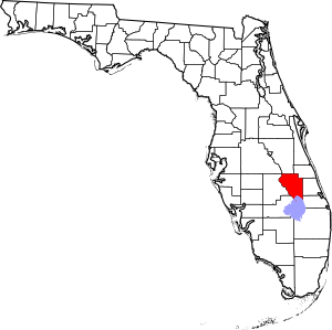
This article will tell you about all the amazing places in Okeechobee County that are on this important list. There are 3 of these special places. One of them is even more important and is called a National Historic Landmark! You can see where these places are on a map if you look up their coordinates.
Okeechobee's Historic Treasures
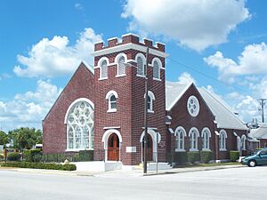
First Methodist Episcopal Church, South
This beautiful church is located at 200 N.W. 2nd Street in Okeechobee, Florida. It was added to the National Register of Historic Places on August 10, 2015.
Churches like this one are often important parts of a community's history. They are not just places of worship but also gathering spots where people have celebrated, mourned, and supported each other for many years. This church building shows us what architecture was like in the past and reminds us of the people who built and used it.
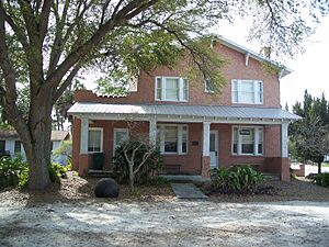
Freedman-Raulerson House
You can find the Freedman-Raulerson House at 600 South Parrott Avenue in Okeechobee, Florida. It became a historic place on April 11, 1985.
This house is a great example of homes built a long time ago. It tells us about how families lived and what their houses looked like in the past. Preserving old homes like the Freedman-Raulerson House helps us understand the daily lives and history of people who lived in Okeechobee County many years ago. It's like a time capsule you can visit!
Okeechobee Battlefield
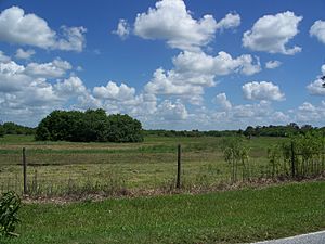
The Okeechobee Battlefield is about 4 miles southeast of Okeechobee, Florida, right on U.S. Route 441. This site is very special because it was listed as a National Historic Landmark on October 15, 1966. Being a National Historic Landmark means it's one of the most important historic places in the entire United States!
This battlefield is where a very important battle happened during the Second Seminole War. This war was fought between the United States Army and the Seminole people in Florida. The Battle of Okeechobee took place on December 25, 1837. It was one of the biggest and bloodiest battles of the war.
Today, the battlefield helps us remember this important event in history. It teaches us about the conflicts that shaped Florida and the bravery of the people involved. It's a place where you can learn about a significant part of American history.


