National Register of Historic Places listings in Osage County, Missouri facts for kids
Have you ever wondered about old buildings or places that have a special story? In Osage County, Missouri, there are several important spots that are officially recognized for their history. These places are listed on something called the National Register of Historic Places. It's like a special list kept by the United States government to help protect and celebrate places that are important to our country's past.
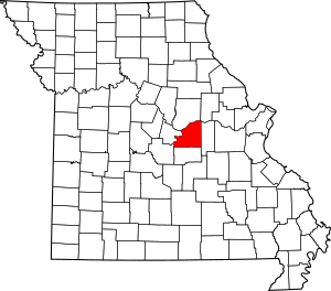
When a place is added to this list, it means it has a unique history, special architecture, or played a big part in local or national events. It helps people learn about the past and makes sure these places are preserved for future generations, like you! In Osage County, there are 9 different places on this list, including old schools, churches, homes, and even entire historic areas.
What is the National Register of Historic Places?
The National Register of Historic Places is the official list of the nation's historic places worthy of preservation. It's part of a national program to coordinate and support public and private efforts to identify, evaluate, and protect America's historic and archaeological resources. Think of it as a way to honor and keep safe the buildings, structures, objects, sites, and districts that tell the story of our country.
Why are these places important?
These historic places are like time capsules. They show us how people lived, worked, and built things many years ago. By protecting them, we can learn about the past and understand how our communities grew. It also helps us appreciate the craftsmanship and design of older buildings.
Historic Places in Osage County
Osage County is home to several fascinating places on the National Register. Each one has its own unique story.
Bonnots Mill Historic District
The Bonnots Mill Historic District is a special area in the town of Bonnots Mill. It was added to the list in 1993. This district includes many old buildings and streets that show what the town looked like long ago. Walking through it is like taking a step back in time!
Chamois Public School
The Chamois Public School building, located at 402 South Main Street in Chamois, became a historic site in 2003. This old school building served many students over the years and holds memories for generations of people in Chamois. It's a great example of early 20th-century school architecture.
Dauphine Hotel
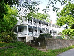
The Dauphine Hotel is another important building in Bonnots Mill. It was listed in 1980. This hotel once welcomed travelers and visitors, playing a key role in the town's social life and economy. It stands as a reminder of the early days of travel and hospitality in the area.
Huber's Ferry Farmstead Historic District
Near Jefferson City, you'll find the Huber's Ferry Farmstead Historic District. This farm area was recognized in 1999. Farmsteads like this one show us how farming families lived and worked in Missouri many years ago. They often include old farmhouses, barns, and other buildings that were part of daily farm life.
Osage County Poorhouse
The Osage County Poorhouse, located south of Linn, was added to the Register in 1998. This building once provided shelter and care for people who needed help in the community. It represents an important part of social welfare history in the county.
Sacred Heart Catholic Church and Parsonage
In Rich Fountain, the Sacred Heart Catholic Church and Parsonage became a historic listing in 1982. Churches often serve as central gathering places for communities and are important for their architecture and their role in local history and faith.
St. Joseph Church
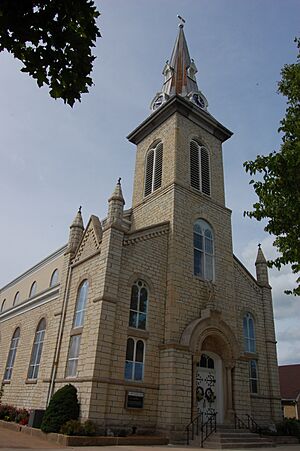
The St. Joseph Church in Westphalia was listed way back in 1972, making it one of the earlier listings in the county. This church is a beautiful example of historic religious architecture and has been a cornerstone of the Westphalia community for a very long time.
Alvah Washington Townley Farmstead Historic District
Another farmstead district, the Alvah Washington Townley Farmstead Historic District, is in Chamois. It was added to the list in 1999. Like Huber's Ferry, this district helps us understand the history of farming and rural life in Osage County.
Dr. Enoch T. and Amy Zewicki House
Finally, the Dr. Enoch T. and Amy Zewicki House in Linn was recognized in 2002. Historic homes like this one give us a glimpse into the lives of prominent families and the architectural styles popular in the past.
These places are more than just old buildings; they are pieces of history that help us understand where we come from and how our communities have changed over time.


