Chamois, Missouri facts for kids
Quick facts for kids
Chamois, Missouri
|
|
|---|---|
| City of Chamois | |
| Nickname(s):
Chammy Town
|
|

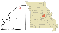
Location of Chamois, Missouri
|
|
| Country | United States |
| State | Missouri |
| County | Osage |
| Founded | 1856 |
| Area | |
| • Total | 0.40 sq mi (1.02 km2) |
| • Land | 0.37 sq mi (0.96 km2) |
| • Water | 0.03 sq mi (0.06 km2) |
| Elevation | 535 ft (163 m) |
| Population
(2020)
|
|
| • Total | 377 |
| • Density | 1,018.92/sq mi (392.93/km2) |
| Time zone | UTC-6 (Central (CST)) |
| • Summer (DST) | UTC-5 (CDT) |
| ZIP code |
65024
|
| Area code(s) | 573 |
| FIPS code | 29-13060 |
| GNIS feature ID | 2393795 |
Chamois is a small city in Osage County, Missouri, United States. It is located near the Missouri River. In 2020, about 377 people lived there. Chamois is part of the larger Jefferson City area.
Contents
History of Chamois
Chamois was officially started in 1856. Its name comes from the chamois, a European animal that looks a bit like a goat. A post office opened in Chamois the same year. The town also had a train station for the Missouri Pacific Railroad. This was important for travel and trade back then.
Two important places in Chamois are listed on the National Register of Historic Places. These are the Chamois Public School and the Alvah Washington Townley Farmstead Historic District. This means they are special historical sites.
Geography of Chamois
Chamois is located on the south side of the Missouri River valley. A stream called Dooling Creek flows near the west and north parts of the city. Missouri Route 89 passes through the town. It meets Missouri Route 100 in the northern part of Chamois.
According to the United States Census Bureau, the city covers a total area of about 0.40 square miles (1.02 square kilometers). Most of this area, about 0.37 square miles (0.96 square kilometers), is land. The rest, about 0.03 square miles (0.06 square kilometers), is water.
Population of Chamois
| Historical population | |||
|---|---|---|---|
| Census | Pop. | %± | |
| 1880 | 562 | — | |
| 1890 | 769 | 36.8% | |
| 1900 | 726 | −5.6% | |
| 1910 | 649 | −10.6% | |
| 1920 | 700 | 7.9% | |
| 1930 | 675 | −3.6% | |
| 1940 | 771 | 14.2% | |
| 1950 | 621 | −19.5% | |
| 1960 | 658 | 6.0% | |
| 1970 | 615 | −6.5% | |
| 1980 | 546 | −11.2% | |
| 1990 | 449 | −17.8% | |
| 2000 | 456 | 1.6% | |
| 2010 | 396 | −13.2% | |
| 2020 | 377 | −4.8% | |
| U.S. Decennial Census | |||
Chamois Population in 2010
Based on the census from 2010, there were 396 people living in Chamois. These people lived in 168 different homes, and 97 of these were families. The city had about 1070 people per square mile. There were 230 housing units in total.
Most of the people in Chamois (99.2%) were White. A small number were Native American (0.3%) or from other races (0.3%). About 1.0% of the population was Hispanic or Latino.
In 32.1% of the homes, there were children under 18 years old. About 38.7% of homes had married couples. Some homes had a female head of household (10.7%) or a male head of household (8.3%) without a spouse. About 42.3% of homes were not families.
Many homes (38.1%) had only one person living there. About 20.9% of homes had someone living alone who was 65 years old or older. On average, there were 2.36 people in each home and 3.04 people in each family.
The average age of people in Chamois was 35.7 years. About 27.5% of residents were under 18. About 7.4% were between 18 and 24. People aged 25 to 44 made up 26.3% of the population. Those aged 45 to 64 were 22.5%, and 16.4% were 65 or older. The city had slightly more females (52.0%) than males (48.0%).
See also
 In Spanish: Chamois (Misuri) para niños
 | Emma Amos |
 | Edward Mitchell Bannister |
 | Larry D. Alexander |
 | Ernie Barnes |

