National Register of Historic Places listings in Pontotoc County, Oklahoma facts for kids
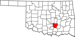
This page is about the National Register of Historic Places listings in Pontotoc County, Oklahoma. It's a list of special places and buildings in Pontotoc County, Oklahoma, United States, that are important to history.
The National Register of Historic Places is like a special club for old buildings, sites, and objects that are worth saving. These places tell us a lot about the past. When a place is on this list, it means it's recognized for its historical, architectural, or archaeological importance.
In Pontotoc County, there are 9 different places that have been added to this important list. You can find them in the city of Ada, Oklahoma and other parts of the county.
Contents
Historic Places in Pontotoc County
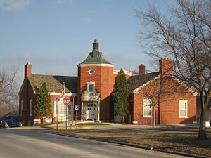
Ada Public Library
The Ada Public Library is located at 400 S. Rennie in Ada, Oklahoma. It was added to the National Register of Historic Places on November 13, 1989. This building is an important part of Ada's history and serves the community.
Bebee Field Round House
The Bebee Field Round House can be found near Oklahoma State Highway 13 in Ada, Oklahoma. It became a historic place on August 5, 1985. A round house is a special building used for turning trains around.
Science Hall at East Central University
Science Hall is on the campus of East Central University in Ada, Oklahoma. It was added to the list on December 23, 1986. This building is part of a university that has been educating students for many years.
F.W. Meaders House
The F.W. Meaders House is a historic home at 521 South Broadway in Ada, Oklahoma. It was recognized as a historic place on April 4, 2007. This house shows us what homes looked like in the past.
Mijo Camp Industrial District
The Mijo Camp Industrial District is on the northern side of Pontotoc County Road 148, near Ada, Oklahoma. This area was added to the National Register on September 26, 1985. It's a district, meaning it's a group of historic buildings or sites related to industry.
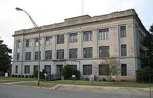
Pontotoc County Courthouse
The Pontotoc County Courthouse is located at 12th and Broadway in Ada, Oklahoma. This important building was added to the list on August 24, 1984. Courthouses are where local government and legal matters happen.
Roff Armory
The Roff Armory is at the junction of Burns and N. 9th Streets in Roff, Oklahoma. It became a historic site on September 18, 1997. An armory is a place where military equipment is stored or where soldiers train.
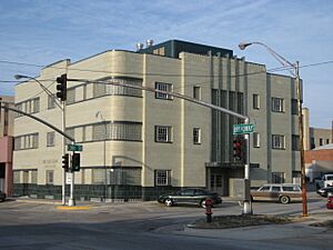
Sugg Clinic
The Sugg Clinic is located at 100 E. 13th St. in Ada, Oklahoma. It was added to the National Register on November 30, 1999. This building likely played a role in healthcare for the community.
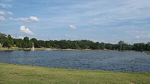
Wintersmith Park Historic District
The Wintersmith Park Historic District is found at E. 18th St. and Scenic Dr. in Ada, Oklahoma. This park area was recognized as historic on June 2, 2000. Parks often have historical importance as places where communities gathered and enjoyed nature.


