National Register of Historic Places listings in Powhatan County, Virginia facts for kids
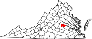
This page lists special places in Powhatan County, Virginia that are part of the National Register of Historic Places. This register is like a national list of important buildings, sites, and objects that are worth saving. These places tell us a lot about the history of the United States.
In Powhatan County, Virginia, there are 20 different places listed on this register. They include old homes, churches, and even whole areas that have a lot of history. You can see where some of these places are on an online map if their exact location is shared.
Contents
What is the National Register of Historic Places?
The National Register of Historic Places is the official list of the nation's historic places. It is part of a program to help people understand and protect important historical sites. When a place is added to this list, it means it is special. It could be important for its history, its architecture, or what it means to a community.
Why are these places important?
These historic places are like time capsules. They help us learn about the past. They show us how people lived, worked, and built things long ago. Protecting them means we can keep these stories alive for future generations. It also helps us understand how our communities grew and changed over time.
How do places get listed?
To get on the National Register, a place must meet certain rules. It needs to be at least 50 years old. It also has to be important in some way. This could be because of a famous person who lived there. Or maybe an important event happened there. Sometimes, a building is listed because it shows a special style of architecture. Once a place is listed, it can get help to be preserved.
Exploring Powhatan's Historic Sites
Powhatan County has many interesting historic places. These sites show different parts of its past. They include old houses, churches, and even entire historic neighborhoods. Each one has its own unique story to tell.
Types of Historic Places
You will find different kinds of places on the list. Some are large estates or plantations. These often have beautiful old houses and gardens. Others are smaller, like a historic church or a tavern. A "historic district" means a whole area with many old buildings. These districts show how a town or community looked in the past.
- Beaumont: This historic spot is located near Michaux. It was added to the list in 1987.
- Belmead: Found northwest of Powhatan, Belmead became a listed site in 1969.
- Belnemus: This historic place is west of Powhatan. It joined the register in 1979.
- Blenheim: Located in Ballsville, Blenheim was added to the list in 1986.
- Elmington: This site in Powhatan was recognized in 2005.
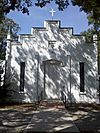
- Emmanuel Episcopal Church: This church in Powhatan was listed in 1990.
- Fighting Creek Plantation: This plantation in Powhatan was added in 2013.
- Fine Creek Mills Historic District: This whole historic area in Fine Creek Mills was listed in 2004.
- French's Tavern: Located in Ballsville, this old tavern was added in 1989.
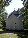
- Huguenot Memorial Chapel and Monument: This important site in Manakin was listed in 1988.
- Keswick: Northeast of Powhatan, Keswick joined the register in 1974.
- Mosby Tavern: This tavern in Powhatan was added to the list in 2003.
- Norwood: Northeast of Powhatan, Norwood was recognized in 1980.
- Paxton: This site in Powhatan was listed in 1990.
- Powhatan Courthouse Historic District: This important historic area in Powhatan was added in 1970.
- Provost: Located in Powhatan, Provost was listed in 1999.
- Red Lane Tavern: This tavern in Powhatan was added to the register in 2002.
- Rosemont: This site in Powhatan was recognized in 2008.
- St. Luke's Episcopal Church: This church in Fine Creek Mills was listed in 1989.
- Somerset: Located in Powhatan, Somerset was added to the list in 2006.
| Name on the Register | Image | Date listed | Location | City or town | Description | |
|---|---|---|---|---|---|---|
| 1 | Beaumont |
(#87000571) |
VA 313 37°40′05″N 77°54′46″W / 37.668056°N 77.912639°W |
Michaux | ||
| 2 | Belmead |
(#69000270) |
NW of jct. of Rtes. 663 and 600 37°37′15″N 77°59′32″W / 37.620833°N 77.992222°W |
Powhatan | ||
| 3 | Belnemus |
(#79003069) |
W of Powhatan off U.S. 60 37°34′04″N 77°59′44″W / 37.567778°N 77.995556°W |
Powhatan | ||
| 4 | Blenheim |
(#86003475) |
6177 Blenheim Rd. 37°30′50″N 78°05′03″W / 37.513889°N 78.084167°W |
Ballsville | ||
| 5 | Elmington |
(#04001538) |
3277 Maidens Rd. 37°36′25″N 77°55′48″W / 37.606944°N 77.930000°W |
Powhatan | ||
| 6 | Emmanuel Episcopal Church |
(#90001924) |
Emmanuel Church Rd. S of US 60 37°33′05″N 77°56′34″W / 37.551389°N 77.942778°W |
Powhatan | ||
| 7 | Fighting Creek Plantation |
(#13000890) |
1811 Mill Quarter Rd. 37°31′00″N 77°55′55″W / 37.516667°N 77.931944°W |
Powhatan | ||
| 8 | Fine Creek Mills Historic District |
(#03001440) |
2425-2434 Robert E. Lee Rd. (VA 641) 37°35′59″N 77°49′04″W / 37.599722°N 77.817778°W |
Fine Creek Mills | ||
| 9 | French's Tavern |
(#89000293) |
6100 Old Buckingham Rd. 37°29′24″N 78°04′48″W / 37.490000°N 78.080000°W |
Ballsville | ||
| 10 | Huguenot Memorial Chapel and Monument |
(#88000214) |
VA 711 37°33′53″N 77°42′33″W / 37.564861°N 77.709028°W |
Manakin | ||
| 11 | Keswick |
(#74002144) |
Northeast of Powhatan off VA 711 37°33′25″N 77°39′59″W / 37.557083°N 77.666250°W |
Powhatan | ||
| 12 | Mosby Tavern |
(#03000214) |
2625 Old Tavern Rd. 37°33′55″N 78°02′13″W / 37.565139°N 78.036944°W |
Powhatan | ||
| 13 | Norwood |
(#80004212) |
NE of Powhatan 37°35′04″N 77°44′35″W / 37.584444°N 77.743056°W |
Powhatan | ||
| 14 | Paxton |
(#90001987) |
3032 Genito Rd. 37°27′47″N 77°51′33″W / 37.463056°N 77.859167°W |
Powhatan | ||
| 15 | Powhatan Courthouse Historic District |
(#70000821) |
Jct. of Rtes. 13 and 300 37°32′30″N 77°55′06″W / 37.541667°N 77.918333°W |
Powhatan | ||
| 16 | Provost |
(#99001603) |
4801 Cartersville Rd. 37°36′19″N 77°59′01″W / 37.605278°N 77.983611°W |
Powhatan | ||
| 17 | Red Lane Tavern |
(#01001516) |
3009 Lower Hill Rd. 37°31′47″N 77°51′28″W / 37.529722°N 77.857778°W |
Powhatan | ||
| 18 | Rosemont |
(#08000482) |
4747 Cosby Rd. 37°36′20″N 77°58′55″W / 37.605417°N 77.981806°W |
Powhatan | ||
| 19 | St. Luke's Episcopal Church |
(#89000193) |
2245 Huguenot Trail 37°35′39″N 77°48′01″W / 37.594283°N 77.800278°W |
Fine Creek Mills | ||
| 20 | Somerset |
(#06000804) |
2310 Ballsville Rd. 37°32′50″N 78°05′20″W / 37.547222°N 78.088889°W |
Powhatan |


