National Register of Historic Places listings in Rankin County, Mississippi facts for kids
Hey there! Did you know that some buildings, bridges, and even old cemeteries are super important because of their history? In Rankin County, Mississippi, there are many cool places that are officially recognized for their special past. These spots are listed on something called the National Register of Historic Places. It's like a special club for places that tell a story about our country's history.
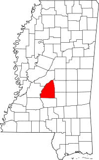
This list helps us learn about the important historic sites right here in Rankin County. There are 14 places currently on this list. One place used to be on the list but isn't anymore. Let's explore some of these amazing historic spots!
Contents
Cool Historic Places in Rankin County
Brandon Cemetery
The Brandon Cemetery is a very old cemetery located in Brandon, Mississippi. You can find it at the corner of Old Depot Road and Mississippi Highway 471 Extension. It was added to the National Register of Historic Places in 2010. Cemeteries like this can tell us a lot about the people who lived in an area long ago.
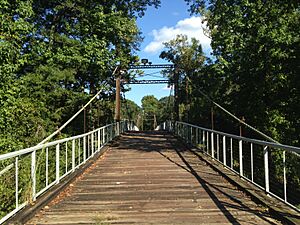
Byram Bridge
The Byram Bridge is a historic bridge near Frenchs Store, Mississippi. It crosses the Pearl River and connects Rankin County with Hinds County, Mississippi. This bridge was listed in 1979. Old bridges are important because they show us how people traveled and built things in the past.
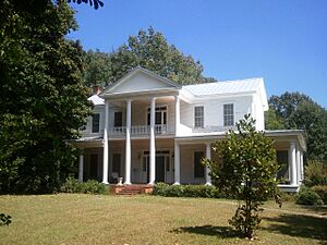
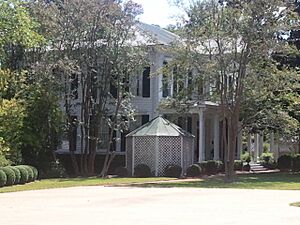
Cocke-Martin-Jackson House
The Cocke-Martin-Jackson House is a historic home located at 107 Pleasant Street in Brandon, Mississippi. This house was added to the list in 1997. Historic houses often have unique architecture and stories about the families who lived there.
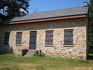
Hebron Academy
South of Brandon, Mississippi, on Mississippi Highway 18, you'll find Hebron Academy. This old school was listed in 1978. Academies like this were important places for education many years ago.
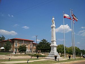
Rankin County Confederate Monument
In Brandon, Mississippi, at the junction of Government and North Streets, stands the Rankin County Confederate Monument. This monument was added to the list in 1997. Monuments are built to remember important events or people from history.
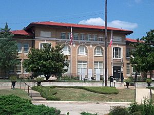
Rankin County Courthouse
The Rankin County Courthouse is a very important building in Brandon, Mississippi, located at 301 Town Square. It was listed in 1997. Courthouses are where local government decisions are made and where many important records are kept.
Stevens-Buchanan House
Another historic house in Brandon, Mississippi is the Stevens-Buchanan House, located at 505 College Street. It was added to the National Register in 1978.
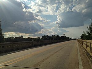
Woodrow Wilson Bridge
The Woodrow Wilson Bridge spans the Pearl River on Silas Brown Street, connecting Jackson, Mississippi and Rankin County. This bridge was listed in 1988. It's another example of how important bridges are for connecting communities.
Historic Districts
Sometimes, a whole group of buildings in an area is considered historic, not just one. These are called "historic districts."
- Downtown Brandon Historic District: This district in Brandon, Mississippi, includes parts of East and West Government Streets, and blocks of North College Street and Black Street. It was recognized in 2010.
- Pearl Street Historic District: Located at 200-204 Pearl Street in Brandon, Mississippi, this district was listed in 1997.
- South College Street Historic District: This district, found at 625-713 South College Street in Brandon, Mississippi, was added in 1998.
These districts help preserve the look and feel of older parts of towns, showing us how they used to be.
Other Listed Sites
- Armstrong Site (22RA576): This site near Goshen Springs, Mississippi, was listed in 1987. Its exact location is kept private to protect it.
- Misterfeldt Home Place: Located at 1101 Old U.S. Route 49, S. in Richland, Mississippi, this home was listed in 1986.
- Turcotte House: Southeast of Brandon, Mississippi, on Mississippi Highway 17, the Turcotte House was added to the list in 1987.
Former Listing
One property, the Lessel House in Pelahatchie, Mississippi, was once on the National Register of Historic Places. It was listed in 1980 but was removed in 1987 because it was torn down in 1986. This shows that sometimes, historic places can be lost.


