
National Register of Historic Places listings in Roberts County, South Dakota facts for kids

Have you ever wondered about old buildings or special places that tell a story about the past? In Roberts County, South Dakota, there are many such places! This article will tell you about some of these important spots that are listed on the National Register of Historic Places.
The National Register of Historic Places is like a special list kept by the United States government. It helps protect buildings, sites, and objects that are important to American history, architecture, archaeology, engineering, or culture. When a place is on this list, it means it's recognized as a valuable part of our heritage. Roberts County has 15 different places on this list, each with its own unique story!
Historic Buildings and Schools
Many of the places on the National Register in Roberts County are old buildings that were once very important to the community.
Hart School No. 3
Imagine going to school in a building from the past! The Hart School No. 3 is one of these historic places. It's located near Sisseton and was added to the list in 2000. This old schoolhouse reminds us of how education used to be.
New Effington Hospital
The New Effington Hospital in New Effington is another important building. It was listed in 1989. Hospitals are crucial for communities, and this one played a big part in the health of people in the area for many years.
Roberts County Courthouse
The Roberts County Courthouse in Sisseton is a very important building. It's where many official county decisions are made. This courthouse was added to the list in 1976, showing its long history and importance to the local government and people.
Sisseton Carnegie Library
Libraries are places of learning and discovery. The Sisseton Carnegie Library was built with money from Andrew Carnegie, a famous businessman who helped build many libraries across the country. This library, added to the list in 1996, has been a center for reading and knowledge in Sisseton for a long time.
Andrew and Mary Stavig House
Homes can also be historic! The Andrew and Mary Stavig House in Sisseton was listed in 1997. This house tells a story about the people who lived there and the way homes were built in the past.
Walla Lutheran Church
Churches are often central to a community's history. The Walla Lutheran Church near New Effington was added to the list in 2004. It's a beautiful example of historic church architecture and has served its congregation for many years.
Unique Historic Sites
Not all historic places are buildings. Some are unique structures or even special areas that hold historical value.
New Effington Rest Stop Tipi
Have you ever seen a giant tipi at a rest stop? The New Effington Rest Stop Tipi is a unique and interesting structure located right off I-29 near New Effington. It was listed in 2015 and serves as a cool landmark and a nod to Native American culture.
Knapp Ranch
Ranches are a big part of South Dakota's history. The Knapp Ranch near Ortley was added to the National Register in 2005. It represents the history of farming and ranching in the area, which is very important to the state's heritage.
Robar Trading Post
Trading posts were once vital places where people could trade goods and supplies. The Robar Trading Post near Wilmot is a historic district that was listed in 1988. Its exact location is kept private to protect it, but it reminds us of the early days of commerce and settlement.
South Dakota Department of Transportation Bridge No. 55-030-418
Even bridges can be historic! This bridge near Ortley was added to the list in 1999. It's an example of older engineering and how important bridges are for connecting communities and allowing travel.
Other Historic Locations
There is also a site known as Site 39RO71 near Sisseton. Its address is restricted to protect its historical importance, but it is recognized as a significant place in Roberts County's past.
These historic places in Roberts County help us understand the past and appreciate the history of South Dakota. They are like windows into different times, showing us how people lived, worked, and built their communities.
Images for kids
-
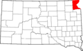
Location of Roberts County in South Dakota
