National Register of Historic Places listings in Saline County, Missouri facts for kids
Have you ever wondered about places that are super important to history? In the United States, there's a special list called the National Register of Historic Places. It's like a Hall of Fame for buildings, sites, and objects that tell us amazing stories about the past. These places are worth protecting so future generations can learn from them.
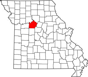
Saline County, Missouri is a county in Missouri that has many of these special places! In fact, there are 32 different properties and areas in Saline County that are on this list. Three of them are even more important and are called National Historic Landmarks. This means they are recognized as being significant to the history of the entire country! Let's explore some of these cool historic spots.
Contents
Arrow Rock: A Village Frozen in Time
Arrow Rock is a small village in Saline County that feels like stepping back in time. It's so historic that the entire village is a National Historic Landmark!
The Arrow Rock Historic District
The Arrow Rock Historic District is a whole area that has been kept just as it was many years ago. It's located within the Arrow Rock State Park. Imagine walking down streets where people lived and worked over a hundred years ago! This district was added to the National Register in 1966.
Historic Buildings in Arrow Rock
- Arrow Rock Tavern: This old tavern, located on Main Street, was added to the list in 1972. Taverns were like hotels and restaurants back in the day, where travelers could rest and eat.
- George Caleb Bingham House: This was the home of a famous American artist named George Caleb Bingham. He was known for painting scenes of American frontier life. His house, located at 1st and High Streets, became a National Historic Landmark in 1966.
- Arrow Rock Ferry Landing: This spot was where a ferry would cross the river, helping people and goods get from one side to the other. It's at the northern end of 2nd Street and was added to the list in 2013.
State Park Structures
Within the Arrow Rock State Historic Site, there are several structures that are also on the National Register, showing how important even smaller parts of the park are:
- Arrow Rock State Historic Site Bridge: This bridge, southeast of Arrow Rock, was listed in 1985.
- Arrow Rock State Historic Site Grave Shelter: Also southeast of Arrow Rock, this shelter for graves was listed in 1985.
- Arrow Rock State Historic Site Lookout Shelter: Found east of Arrow Rock, this shelter with a view was added in 1985.
- Arrow Rock State Historic Site Open Shelter: Another shelter southeast of Arrow Rock, listed in 1985.
Historic Sites in Marshall
Marshall, Missouri is another important city in Saline County with many historic buildings.
Notable Buildings in Marshall
- Baity Hall: This building is part of Missouri Valley College, located at 500 East College. It was added to the National Register in 1986.
- Buckner House: Located at 125 North Brunswick Avenue, this house was recognized in 1984.
- Chicago and Alton Depot: Train stations, or depots, were very important for travel and trade. This one on Sebree Street was listed in 1979.
- First Presbyterian Church: This church at 212 East North Street has been on the list since 1977.
- Fitzgibbon Hospital: An important community building, this hospital at 868 South Brunswick Avenue was added in 2012.
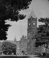
- Saline County Courthouse: The courthouse, located on Courthouse Square, is where many important county decisions were made. It was listed in 1977.
Historic Districts and Sites Near Marshall
- Mt. Carmel Historic District: This district, found on 290th Road and Missouri Highway 41 North, was added in 2009.
- Free Will Baptist Church of Pennytown: About 8 miles southeast of Marshall, this church off Missouri UU was listed in 1988.
- Van Meter State Park: This park near Marshall has two listed structures: the Van Meter State Park Combination Building (1985) and the Van Meter State Park Shelter Building (1985).
Archeological Wonders
Saline County is also home to several important archeological sites, where scientists study the remains of ancient cultures.
- Fisher-Gabbert Archeological Site: This site, about 1 mile northeast of Miami, was listed in 1972.
- Gumbo Point Archeological Site: Located on the southern side of the Missouri River, about 2 miles north of the junction of U.S. Route 65 and Route 127, this site was added in 1969.
- Guthrey Archeological Site: About 2 miles east of Miami, this site was listed in 1970.
- Old Fort (Miami, Missouri): This site is located within Van Meter State Park and was recognized in 1972. It might have been an ancient fortified village.
- Plattner Archeological Site: About 1 mile north of Malta Bend, this site was added to the list in 1971.
- Utz Site: This is a very important archeological site, stretching for a mile from southwest to northeast. It's located in the southern half of Section 19, Township 52 North, Range 21 West, near Marshall. It became a National Historic Landmark in 1966.
Other Historic Places in Saline County
Saline County has other unique historic places spread across its towns and rural areas.
- First Christian Church (Sweet Springs, Missouri): This church at 400 Bridge Street in Sweet Springs was listed in 1980.
- Sweet Springs Historic District: A historic area in Sweet Springs, roughly along Lexington, Marshall, Miller, and Spring Streets, was added in 1997.
- Henry Blosser House: This house, east of Malta Bend off U.S. 65, was listed in 1978.
- George A. Murrell House: Located near Napton, about 0.75 miles east and 0.5 miles north of Missouri E and H, this house was added in 1997.
- Neff Tavern Smokehouse: Northeast of Napton off Missouri 41, this smokehouse was listed in 1978.
- William B. Sappington House: About 3 miles southwest of Arrow Rock on County Road TT, this house was recognized in 1970.
Historic Trails
Old trails that pioneers and traders used are also important parts of history.
- Santa Fe Trail-Grand Pass Trail Segments: Parts of the famous Santa Fe Trail near the junction of U.S. 65 and County Road T in Grand Pass were listed in 1994.
- Santa Fe Trail-Saline County Trail Segments: Other parts of the Santa Fe Trail on County Road 416 (Rural Route 3) west of the junction with Missouri 41 near Stanhope were also added in 1994.
These historic places in Saline County help us remember and understand the rich history of Missouri and the United States!
Images for kids


