
National Register of Historic Places listings in Sarasota County, Florida facts for kids

Have you ever wondered about the oldest and most special places in Sarasota County, Florida? This article is all about the cool buildings and areas that are listed on the National Register of Historic Places in Sarasota County. These places are super important because they tell us stories about the past!
There are almost 100 amazing spots in Sarasota County that are on this special list. One place was on the list but isn't anymore. Let's explore some of these historic treasures!
Contents
Cool Historic Places in Sarasota County
What is the National Register?
The National Register of Historic Places is like a special club for buildings, sites, and areas that are important to the history of the United States. When a place is added to this list, it means it's recognized for its historical, architectural, or archaeological value. It helps protect these places for future generations to enjoy and learn from.
Why are These Places Special?
These historic places are like time capsules! They show us how people lived, worked, and played many years ago. They can be old houses, schools, churches, or even entire neighborhoods. Each one has a unique story that helps us understand the history of Sarasota County and Florida.
Exploring Sarasota's Historic Gems
Sarasota County has a wide variety of historic places. From grand old homes to important community buildings, there's a lot to discover!
Homes with Stories
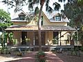
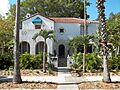
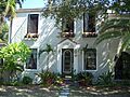
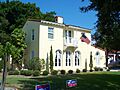
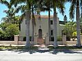
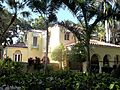
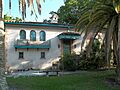
Many beautiful old houses in Sarasota County are on the National Register. The William Martin Armistead House (1510 Hyde Park Street, Sarasota) is one example. Another is the Bacheller-Brewer Model Home Estate (1903 Lincoln Drive, Sarasota). These homes show us the different styles of architecture from long ago. The Frank and Matilda Binz House (5050 Bay Shore Road, Sarasota) and the Bryson-Crane House (5050 Brywill Circle, Sarasota) are also notable. The Capt. W. F. Purdy House (3315 Bayshore Road, Sarasota) is another interesting old home.
Schools and Learning Places
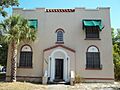
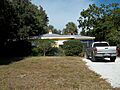
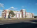
Schools are important parts of a community's history. The Bay Haven School (2901 West Tamiami Circle, Sarasota) is a historic school building. The Osprey School (337 North Tamiami Trail, Osprey) also made the list. These schools remind us how education has changed over the years. The Out of Door School (444 Reid Street, Sarasota) is another historic educational site. The Sarasota High School (1001 South Tamiami Trail, Sarasota) is also recognized for its history.
Community Hubs
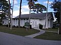
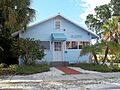
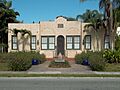
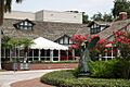
Many places where people gathered are also historic. The Bee Ridge Woman's Club (4919 Andrew Avenue, Sarasota) was a place for women to meet and work on community projects. The Johnson Chapel Missionary Baptist Church (506 Church Street, Laurel) is a significant religious site. The Lemon Bay Woman's Club (51 North Maple Street, Englewood) is another example of a community gathering spot. The Municipal Auditorium-Recreation Club (801 North Tamiami Trail, Sarasota) has hosted many events.
Downtown Discoveries
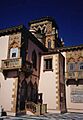
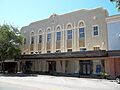
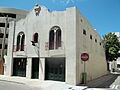
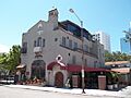
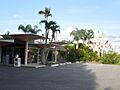
Downtown Sarasota has many historic buildings. The American National Bank Building (1330 Main Street, Sarasota) shows off old banking architecture. The Appleby Building (501-513 Kumquat Court, Sarasota) is another historic commercial building. The Atlantic Coast Line Passenger Depot (1 South School Avenue, Sarasota) was once a busy train station. The DeMarcay Hotel (27 South Palm Avenue, Sarasota) and the El Vernona Hotel-John Ringling Hotel (111 North Tamiami Trail, Sarasota) were important places for visitors. The Sarasota Opera House (57 North Pineapple Avenue, Sarasota), originally the Edwards Theatre, is a beautiful place for performances. The Roth Cigar Factory (30 Mira Mar Court, Sarasota) tells a story about local industry.
Nature's Treasures
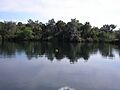
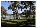
Not all historic places are buildings! Some are natural sites. The Little Salt Spring (off U.S. Route 41, North Port) is an amazing archaeological site. It has helped scientists learn about ancient life. The Warm Mineral Springs (12200 San Servando Ave., North Port) is another unique natural spot.
Venice's Planned Past
The city of Venice has many historic areas because it was a carefully planned city. The Armada Road Multi-Family District and the Edgewood Historic District are examples of historic neighborhoods. The Hotel Venice (200 North Nassau Street, Venice) is a grand old hotel. The Venice Depot (303 East Venice Avenue, Venice) was the city's train station. The John Nolen Plan of Venice Historic District recognizes the original city layout.
Images for kids
-
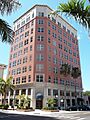
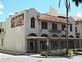
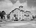
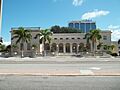
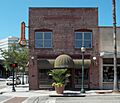
The American National Bank Building in Sarasota.
-
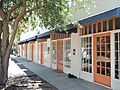
The Appleby Building.
-

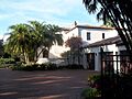
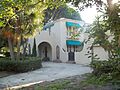
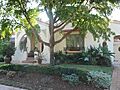
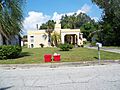
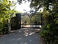
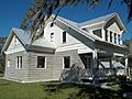
The gate of the William Martin Armistead House.
-
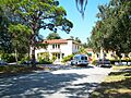
A building in the Armada Road Multi-Family District.
-
The Atlantic Coast Line Passenger Depot.
-
The Bacheller-Brewer Model Home Estate.
-
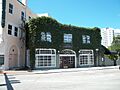
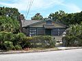
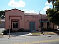
The Bacon and Tomlin, Inc. building.
-
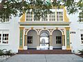
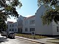
The Bay Haven School.
-
The Bee Ridge Woman's Club.
-
The Frank and Matilda Binz House.
-
A building in the Bispham-Wilson Historic District.
-
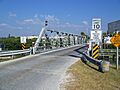
The Blackburn Point Bridge.
-
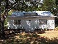
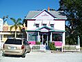
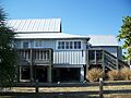
The Blalock House in Venice.
-
The Bryson-Crane House.
-
A building in the Burns Court Historic District.
-
The Burns Realty Company-Karl Bickel House.
-
The William J. Burns House.
-
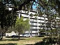
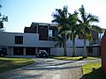
A building in the Waters and Elsa Burrows Historic District.
-
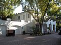
The Caples'-Ringlings' Estates Historic District.
-
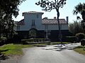
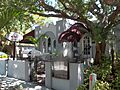
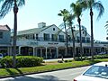
Casa Del Mar.
-
A building in the Central-Cocoanut Historic District.
-
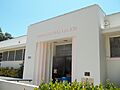
The Chidsey Library.
-
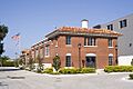
The City Waterworks building.
-
The Corrigan House.
-
The Crisp Building.
-

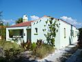
The F. A. DeCanizares House.
-
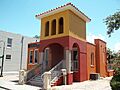
The DeMarcay Hotel.
-
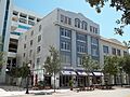
A building in the Downtown Sarasota Historic District.
-
The entrance to the Eagle Point Historic District.
-
The Earle House.
-
A house in the Edgewood Historic District.
-
The Sarasota Opera House (Edwards Theatre).
-
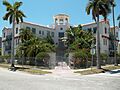
The El Patio Apartments.
-
The El Vernona Apartments-Broadway Apartments.
-
The El Vernona Hotel-John Ringling Hotel.
-
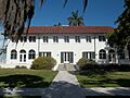
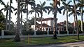
The Field Estate.
-
The Frances-Carlton Apartments.
-
The Dr. Joseph Halton House.
-
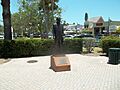
A statue in the Harding Circle Historic District.
-
A building in the Hermitage-Whitney Historic District.
-
The Hotel Venice.
-
The House at 507 Jackson Drive.
-
The House at 710 Armada Road South.
-
The Johnson Chapel Missionary Baptist Church.
-
The Johnson-Schoolcraft Building.
-
The Edson Keith Estate.
-
The Dr. Walter Kennedy House.
-
The S. H. Kress Building.
-
A street in the Laurel Park Historic District.
-
The Hilton Leech House and Amagansett Art School.
-
The Lemon Bay Woman's Club.
-
The Levillain-Letton House.
-
Little Salt Spring.
-
A building in the Maine Colony Historic District.
-
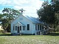
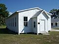
The Miakka School House.
-
The Municipal Auditorium-Recreation Club.
-
The Lucienne Nielsen House.
-
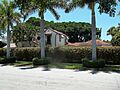
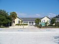
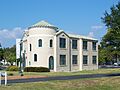
The Nokomis Beach Pavilion.
-
A building in the John Nolen Plan of Venice Historic District.
-
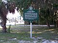
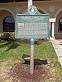
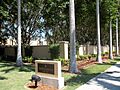
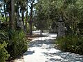
A marker at the Osprey Archeological and Historic Site.
-
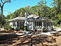
The Osprey School.
-
The Out of Door School.
-
A street in the Overtown Historic District.
-
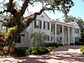
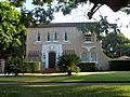
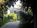
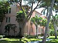
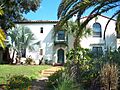
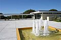
The Christy Payne Mansion at Marie Selby Botanical Gardens.
-
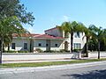
The Capt. W. F. Purdy House.
-
The L. D. Reagin House.
-
The Leonard Reid House.
-
The Revere Quality Institute House.
-
A building in Rigby's La Plaza Historic District.
-
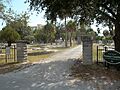
Rosemary Cemetery.
-
The Roth Cigar Factory.
-
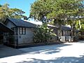
The Sanderling Beach Club.
-
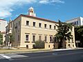
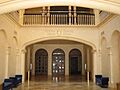
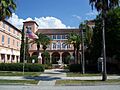
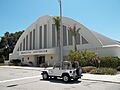
The Sarasota County Courthouse.
-
The Sarasota Herald Building.
-
The old Sarasota High School.
-
The Sarasota Times Building.
-
The Sarasota Woman's Club.
-
The George Schueler House.
-
The South Side School.
-
The Southwick-Harmon House.
-
The Thomas House.
-
The Triangle Inn.
-
The U.S. Post Office-Federal Building.
-
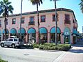
The Valencia Hotel and Arcade.
-
A building in the Venezia Park Historic District.
-
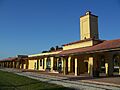
The Venice Depot.
-
Warm Mineral Springs.
-
The Warm Mineral Springs Motel.
-
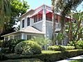
The J. G. Whitfield Estate.
-
The H. B. William House.
-
The Dr. C. B. Wilson House.
-
Worth's Block.


