
National Register of Historic Places listings in Saratoga County, New York facts for kids

Saratoga County in New York is a place full of history! Many buildings, places, and even some objects here are so special that they are listed on the National Register of Historic Places. This is like a special list kept by the United States government. It helps protect important places so people can learn about them for many years.
Some of these places are even more important and are called National Historic Landmarks. This means they have played a very big role in the history of the entire country! Let's explore some of these amazing historic spots in Saratoga County.
Contents
What is the National Register of Historic Places?
The National Register of Historic Places is an official list of places in the United States that are important to history, architecture, archaeology, engineering, or culture. When a place is added to this list, it means it's recognized as a valuable part of our past. This helps to save these places from being changed or destroyed.
Why are places listed?
Places are listed for many reasons. Some are very old, like Native American sites from thousands of years ago. Others are special because of their unique building style, like Greek Revival or Victorian homes. Some are important because famous people lived there, or big historical events happened there.
Historic Homes and Buildings
Saratoga County has many old homes and buildings that tell stories of the past. These places show us how people lived, worked, and built things long ago.
Homes with History
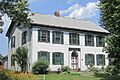
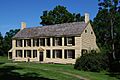
- The Abraham Best House in Vischer Ferry was built around 1815. It's a great example of the Federal style of architecture, which was popular in the early 1800s.
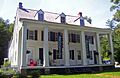
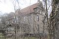
- The Col. Sidney Berry House in Northumberland dates back to about 1800. Imagine living in a house that's over 200 years old!
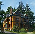
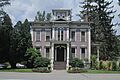
- The Gansevoort Mansion was built in 1813 by Herman Gansevoort. It's a beautiful old home that has stood the test of time.
- The George West House in Rock City Falls was once the home of George West, a successful businessman and even a member of Congress.
Churches and Meeting Places
Many historic churches are found in Saratoga County. They often show beautiful architectural styles and were important centers for communities.
- The Batchellerville Presbyterian Church is a Greek Revival style church built in 1867. Greek Revival buildings often look like ancient Greek temples with columns.
- The Calvary Episcopal Church in Burnt Hills was built in 1849 in an early Gothic Revival style. This style often features pointed arches and tall windows.
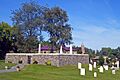
- The Clifton Park Center Baptist Church and Cemetery was built in 1837. It's a place where people gathered for worship and where many early residents are buried.
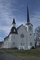
- The Stillwater United Church was designed by a famous architect, Marcus F. Cummings, and built in 1873.
Stores and Taverns
Old general stores and taverns were once busy places where people bought supplies, shared news, and rested during travels.
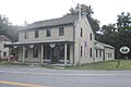
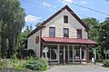
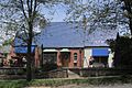
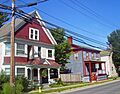
- The Barker General Store in Beecher Hollow was built in 1847. It was a central spot for the community.
- The Grooms Tavern Complex in Clifton Park includes an 1825 tavern, a wagon shop, and a blacksmith shop. It shows what a travel stop might have looked like long ago.
- The Jonesville Store is an old country store that used to be a hub of activity.
Important Districts and Parks
Some historic listings aren't just single buildings, but whole areas or parks that are important.
Saratoga Springs Historic Districts
Saratoga Springs has several historic districts, which are areas with many old buildings that together tell a story.
- The Broadway Historic District is the main commercial and residential area of Saratoga Springs. Many buildings from the 1800s are still standing here.
- The East Side Historic District is a neighborhood where many wealthy people lived in the 19th century.
- The West Side Historic District was home to many working-class families in the 1800s.
Parks and Natural Wonders
- Canfield Casino and Congress Park in Saratoga Springs is a National Historic Landmark District. It was once a bottling plant and hotel, and now it's a public park and museum.
- Saratoga Spa State Park District is also a National Historic Landmark. It's famous for its natural springs, which are like small geysers, and made Saratoga a popular resort town.
- The Petrified Sea Gardens in Saratoga Springs is a special place where scientists found ancient stromatolites. These are layered rocks formed by tiny living things, and they are very old! A pioneering woman scientist, Winifred Goldring, studied them here.
Transportation and Industry
Saratoga County's history also includes important developments in transportation and industry.
Canals and Waterways
- The Champlain Canal is a 60-mile canal that connects Lake Champlain to the Hudson River. It was built at the same time as the famous Erie Canal and was very important for moving goods.
- The New York State Barge Canal is a National Historic Landmark District. It's a modern version of the Erie Canal, built in the early 1900s to help boats travel across New York State.
- The tugboat Urger was built in 1901 and is a historic canal tugboat. Imagine the stories it could tell about life on the canals!
Mills and Factories
- The Mechanicville Hydroelectric Plant was built in 1897-1898. It's a power plant that uses water to create electricity, which was a big deal back then!
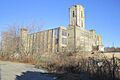
- The Ormsby-Laughlin Textile Companies Mill in Waterford was built around 1894. It's the only factory left from a major industrial area once called Dial City.
- Victory Mills in the village of Victory is a historic textile mill building from 1918.
Battlefields and Monuments
Saratoga County played a key role in the American Revolutionary War.
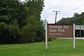
- Saratoga National Historical Park is a National Historical Park. It protects the site of the Battles of Saratoga, which was a very important victory for the Americans in 1777 during the Revolutionary War.
- The Col. Elmer E. Ellsworth Monument and Grave in Mechanicville honors Elmer E. Ellsworth, who was the first soldier to die in the American Civil War.
Other Unique Places
- The Arrowhead Casino Prehistoric Site in Saratoga Springs is a very old Native American site, dating back 8,000 to 9,000 years ago! This helps us learn about the first people who lived in this area.
- The Davis-Ferris Organ in Round Lake is the oldest three-manual organ in the entire nation. It's a National Historic Landmark!
- Grant Cottage in Mount McGregor is where Ulysses S. Grant, a famous general and former U.S. President, spent his last days and died in 1885.
- Yaddo in Saratoga Springs is a National Historic Landmark. It was once the home of a wealthy financier and his writer wife, and now it's a famous place where artists can come to work and create.
Former Listings
Sometimes, a historic place might be removed from the National Register if it's destroyed or changed too much.
- The Ruhle Road Stone Arch Bridge in Malta was a historic stone bridge built around 1873. Sadly, it collapsed in 1993 and was removed from the list.
These are just some of the many amazing historic places in Saratoga County. Each one holds a piece of history, helping us understand the past and appreciate the stories of those who came before us.
Images for kids
-
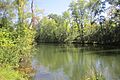
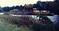
Kaydeross Creek in the Arrowhead Casino Prehistoric Site.
-
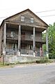
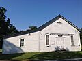
The historic Barker General Store.
-
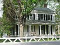
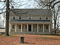
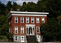
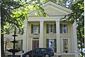
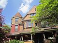
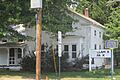
The Col. Sidney Berry House.
-
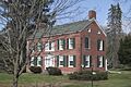
The Abraham Best House.
-
Broadway in the Broadway Historic District.
-
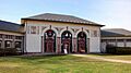
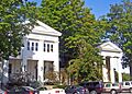
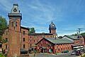
Brookside Museum.
-
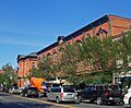
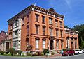
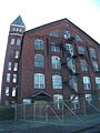
The Bullard Block.
-
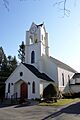
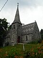
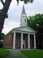
Calvary Episcopal Church.
-
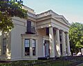
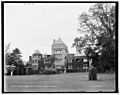
Canfield Casino.
-
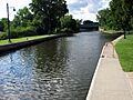
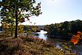
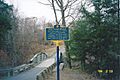
The Champlain Canal.
-
St. Paul's Episcopal Church in the Charlton Historic District.
-
Clifton Park Center Baptist Church and Cemetery.
-
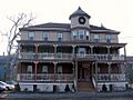
The Clifton Park Hotel.
-
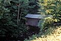
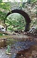
The Copeland Covered Bridge.
-
The Saratoga Springs Visitor Center, formerly The Drinkhall.
-
Dunning Street Cemetery.
-
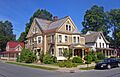
Homes in the East Side Historic District.
-
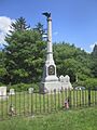
The Elmer E. Ellsworth Monument.
-
Homes on Franklin Square.
-
The Gansevoort Mansion.
-
The Nathan Garnsey House.
-
Gideon Putnam Burying Ground.
-
Grant Cottage.
-
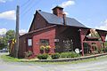
Grooms Tavern.
-
The Hadley Parabolic Bridge.
-
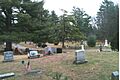
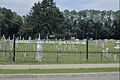
Jonesville Cemetery.
-
The Jonesville Store.
-
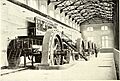
The Mechanicville Hydroelectric Plant.
-
Mohawk Valley Grange Hall.
-
A lock on the New York State Barge Canal.
-
Buildings in the Northside Historic District.
-
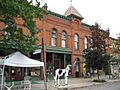
The Noxon Bank Building.
-
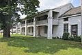
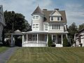
Oakcliff historic house.
-
The Ormsby-Laughlin Textile Companies Mill.
-
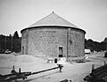
Peebles Island.
-
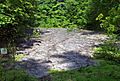
A grotto at Petrified Sea Gardens.
-
The former Pure Oil Gas Station.
-
The Cyrus Rexford House.
-
Round Lake Village Inn in the Round Lake Historic District.
-
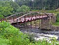
The Ruhle Road Lenticular Metal Truss Bridge.
-
St. Stephen's Episcopal Church.
-
Saratoga Gas, Electric Light and Power Company Complex.
-
General Schuyler House at Saratoga National Historical Park.
-
Saratoga Spa State Park.
-
Old Saratoga Reformed Church.
-
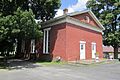
Smith's Grain and Feed Store.
-
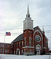
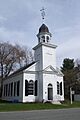
Stillwater United Church.
-
The Hiram Charles Todd House.
-
A house on Union Avenue in the Union Avenue Historic District.
-
The Union Mill Complex.
-
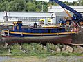
The historic canal tugboat Urger.
-
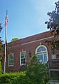
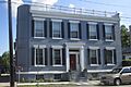
The U.S. Post Office in Ballston Spa.
-
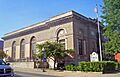
The U.S. Post Office in Saratoga Springs.
-
The Verbeck House.
-
Victory Mills.
-
Shepard Wheeler House in the Vischer Ferry Historic District.
-
Saratoga County Bank in the Waterford Village Historic District.
-
West Charlton United Presbyterian Church.
-
Houses on Washington Street in the West Side Historic District.
-
The George West House.
-
The Wiggins-Collamer House.
-
The Mansion at Yaddo.
-
The Ruhle Road Stone Arch Bridge (former listing).


.jpeg)


.jpg)


.jpg)


_01.jpg)


.jpg)

