National Register of Historic Places listings in Scott County, Virginia facts for kids
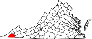
Have you ever wondered about old buildings or places that are super important to history? In Scott County, Virginia, there are some amazing spots that are so special, they're on a list called the National Register of Historic Places. This list helps protect places that tell us about the past. It's like a hall of fame for historic buildings, areas, and even old Native American sites!
When a place is on this list, it means it's recognized by the United States government for its history, architecture, or what it means to our culture. There are 10 of these special places right here in Scott County. Let's explore some of them!
Historic Places in Scott County
These are some of the cool historic places you can find in Scott County, Virginia:
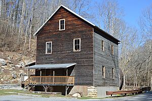
Bush Mill
Imagine a time when people used water power to grind grain into flour! That's what happened at Bush Mill. This old mill, located near Nickelsville, was built a long time ago and shows us how people used to make food. It's a great example of early American industry and how communities worked. It was added to the National Register in 2008.
The Carter Family Homes
Scott County is famous for being the home of the Carter Family, who were pioneers in country music! Several places connected to this legendary family are on the National Register.
A. P. and Sara Carter House
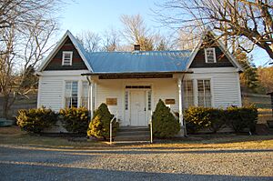
This was the home of A. P. Carter and his wife, Sara Carter. A. P. was a key member of the original Carter Family musical group. Their house, located in Maces Spring, became a historic landmark in 1985. It reminds us of where their amazing music journey began.
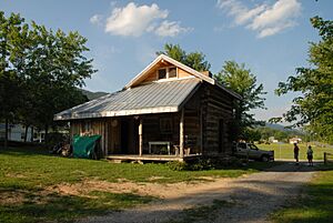
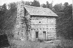
A. P. Carter Homeplace
Close by, also in Maces Spring, is the A. P. Carter Homeplace. This was where A. P. Carter grew up. It's a simple cabin that tells the story of the family's humble beginnings before they became famous musicians. It was listed on the National Register in 1976.
A. P. Carter Store
The A. P. Carter Store was a general store run by A. P. Carter. It was a place where people in the community could buy supplies and gather. Today, it's often used as a museum to celebrate the Carter Family's legacy. It was added to the list in 1985.
Maybelle and Ezra Carter House
Maybelle Carter was another very important member of the Carter Family, known for her unique guitar playing style. This house was her home with her husband, Ezra Carter. It's also in Maces Spring and was listed in 1985, showing how deeply rooted the family was in this area.
Flanary Archeological Site
Imagine finding clues about people who lived thousands of years ago! The Flanary Archeological Site is one of those places. It's located across the Clinch River from Dungannon. Archeologists study sites like this to learn about ancient cultures and how they lived in this region. This site was recognized for its historical importance in 1983.
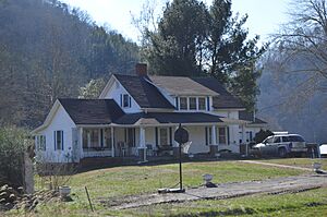
Fulkerson-Hilton House
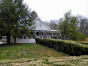
The Fulkerson-Hilton House is an old home located near Hiltons, close to the North Fork of the Holston River. This house tells us about the architecture and way of life from earlier times in Scott County. It was added to the National Register in 2002.
Gate City Historic District
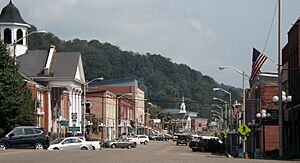
Sometimes, it's not just one building that's historic, but a whole area! The Gate City Historic District includes several blocks in the heart of Gate City. This district shows what a town center looked like in the past, with many old buildings that have kept their original charm. It became a historic district in 2010.
Kilgore Fort House
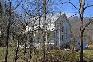
The Kilgore Fort House is a very old and unique building located southwest of Nickelsville. It's called a "fort house" because it was built to be strong and offer protection during the early days of settlement. It gives us a peek into what life was like for pioneers. It was listed on the National Register in 1972.
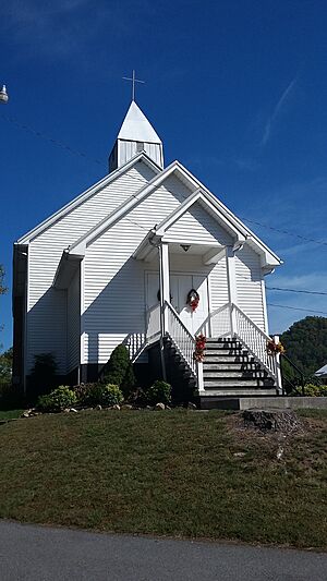
Mt. Vernon Methodist Church
Churches are often important centers for communities, and the Mt. Vernon Methodist Church is no exception. Located in Maces Spring, this church has been a place of worship and gathering for many years. Its history reflects the community's spiritual life and growth. It was added to the National Register in 1985.
These places are like living history books, helping us understand the past and appreciate the heritage of Scott County!
Images for kids


