
National Register of Historic Places listings in The Highlands, Louisville, Kentucky facts for kids
This article is about special places in The Highlands area of Louisville, Kentucky. These places are listed on the National Register of Historic Places. This means they are important parts of history and culture in the United States.
The Highlands is a big area with many neighborhoods. Here are some of them:
- Belknap
- Bonnycastle
- Cherokee Triangle
- Deer Park
- Hawthorne
- Hayfield Dundee
- Highlands-Douglass
- Irish Hill
- Original Highlands
- Tyler Park
Contents
Exploring Historic Places
What is the National Register of Historic Places?
The National Register of Historic Places is like a special list of buildings, places, and objects that are important to American history. When a place is on this list, it means it's recognized for its historical or architectural value. It helps protect these places so future generations can learn from them.
Cool Historic Spots in The Highlands
The Highlands has many interesting places on this list. They include old houses, churches, and even parts of neighborhoods. Each one tells a story about Louisville's past.
Homes with History
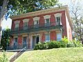
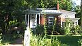
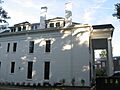
Many old homes in The Highlands are on the National Register. For example, the Leslie V. Abbott House in Belknap is a beautiful old home. The Bullock-Clifton House in Deer Park is another historic house. These homes show how people lived long ago. The Engelhard House in Tyler Park and the Nicholas Finzer House in Irish Hill are also great examples of historic homes.
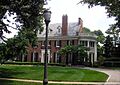
One very special old home is Farmington. It's a historic plantation in Hawthorne. This house was built in 1810 and is a great example of early American architecture. It even had a famous visitor, Abraham Lincoln, who stayed there in 1841!

Important Buildings and Churches
The Willam R. Belknap School is an old school building in Belknap. It was built in 1908 and is named after a local businessman. It's a reminder of how education has changed over time.
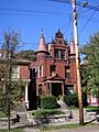
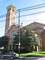
Churches are also important historic buildings. The Calvary Evangelical Lutheran Church and the Saint Francis of Assisi Complex are both on the list. These buildings show different styles of architecture and the history of faith in the community.

The Commodore Apartment Building in Bonnycastle is an interesting example of an older apartment building. It shows how cities grew and how people started living in different ways.

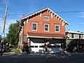
Some old fire stations are also historic. Steam Engine Company No. 11 in Irish Hill and Steam Engine Company No. 20 (which has two locations on Bardstown Road) are on the list. These buildings tell the story of how firefighters protected the city in the past.

Parks and Monuments
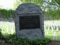
Cave Hill Cemetery is a very large and historic cemetery. It's a beautiful place with many old trees and monuments. It's also home to the Cave Hill National Cemetery, which is a special burial ground for soldiers. Many famous people are buried here, including Colonel Sanders.

There are also important monuments. The John B. Castleman Monument in Cherokee Triangle honors a general from the American Civil War. The Union Monument in Louisville is also in Cave Hill Cemetery and remembers soldiers who fought for the Union.

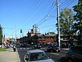
Some entire neighborhoods are considered historic districts. The Cherokee Triangle Area Residential District and the Highlands Historic District are examples. This means that many buildings in these areas together tell a story about how the neighborhoods developed.

Why are These Places Important?
These historic places help us understand the past. They show us how people lived, worked, and built communities in Louisville. By protecting them, we keep history alive and make sure that future generations can learn from these important landmarks.
Images for kids
-
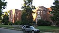
The Willam R. Belknap School.
-
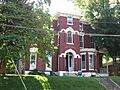
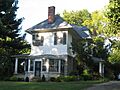
The Bullock-Clifton House.
-
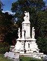
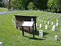
Smyser Memorial in Cave Hill National Cemetery.
-
The Engelhard House.
-
The Nicholas Finzer House.
-
A street in the Highlands Historic District.
-
The Howard-Gettys House.
-
The Humphrey-McMeekin House.
-

Rose Hill.
-
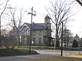
St. James Roman Catholic Church.
-
The Valentine Schneikert House.
-
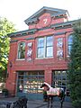
The Schuster Building.
-
Steam Engine Company No. 20 at 1330 Bardstown Road.
-
Steam Engine Company No. 20 at 1735 Bardstown Road.
-
The Union Monument in Louisville.
-
The David Wilson House.
-
The Woodbourne House.
-
The August Bloedner Monument, formerly listed.


