
National Register of Historic Places listings in Travis County, Texas facts for kids

Have you ever wondered about the oldest and most special buildings or places in your town? In Travis County, Texas, where the big city of Austin is, there are many amazing spots that are officially recognized for their history! These places are listed on something called the National Register of Historic Places.
This list helps us keep track of all the important buildings, areas, and sites in Travis County that have a special story. It's like a hall of fame for historical places in the United States.
There are 206 places in Travis County on this list! Two of them are even more special and are called National Historic Landmarks. This means they are super important to the history of the entire country.
Contents
What is the National Register of Historic Places?
The National Register of Historic Places is the official list of places in the United States that are worth saving. These can be buildings, neighborhoods, archaeological sites, or even objects. They are chosen because they have a unique history, beautiful architecture, or are connected to important people or events.
Why are these places important?
When a place is added to the National Register, it means it's recognized for its value. This helps protect it from being torn down or changed too much. It also helps people learn about the past and understand how our communities grew. Imagine being able to visit a building that's been around for over 100 years!
Cool Historic Buildings in Austin
Many of the historic places in Travis County are located in Austin. Let's explore a few of them!
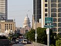
The Texas State Capitol
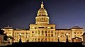
One of the most famous buildings is the Texas State Capitol. It's located right in the heart of Austin at Congress and 11th Streets. This huge, beautiful building is where the Texas government meets to make laws. It was built a long time ago and is even a National Historic Landmark! You can see its tall dome from many parts of the city.
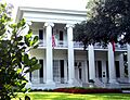
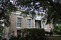
The Governor's Mansion
Close to the Capitol is the Governor's Mansion. This is where the Governor of Texas lives. It's a grand old house that has been home to many important leaders throughout Texas history. It's also a National Historic Landmark, showing how important it is to our state's story.
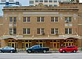
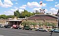
The Driskill Hotel
If you walk around downtown Austin, you might spot the Driskill Hotel. This fancy hotel was built in 1886 and is one of the oldest hotels in Texas. It has amazing architecture and has hosted many famous guests over the years. It's a great example of how old buildings can still be used and enjoyed today.
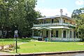
French Legation
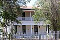
The French Legation is a unique historical site. It was built in 1841 and was once the home of the French representative to the Republic of Texas. Yes, Texas used to be its own country! This building helps us remember that exciting time in history.
Elisabet Ney Museum
The Elisabet Ney Museum is a cool place to visit. It was the studio and home of Elisabet Ney, a famous sculptor. She created many important statues, including ones of Texas heroes. Her home is now a museum where you can see her art and learn about her life.
Paramount Theatre
The Paramount Theatre is a historic theater on Congress Avenue. It opened in 1915 and has shown movies, plays, and concerts for over a century. It's a beautiful place that reminds us of how people used to enjoy entertainment.
Moonlight Towers
You might notice some tall, metal towers around Austin that look like giant streetlights. These are called Moonlight Towers. Austin is the only city in the world that still has these original towers! They were built in the late 1800s to light up the city streets at night. They are a unique part of Austin's history.
Deep Eddy Pool
Deep Eddy Pool is the oldest swimming pool in Texas! It started as a swimming hole in the Colorado River and became a popular spot for people to cool off. It's a fun place to visit and imagine what summer days were like long ago.
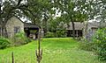
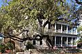
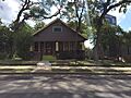
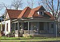
McKinney Homestead
Outside of central Austin, the McKinney Homestead is a historic district that includes the ruins of an old home. It tells the story of early settlers in Travis County and how they lived on the land. It's a glimpse into the past of rural Texas.
Images for kids
-
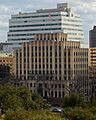
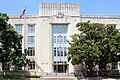
The Dewitt C. Greer State Highway Building.
-
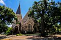
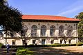
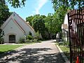
All Saints Chapel.
-

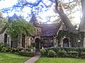
Anthony and Louise Viaer Alumni Hall.
-
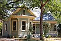
Arnold Bakery.
-

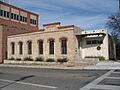
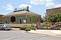
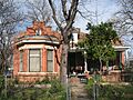
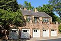
Austin Central Fire Station #1.
-

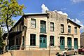
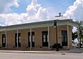
The Austin Daily Tribune Building.
-
The Austin History Center.
-
The Austin US Courthouse.
-
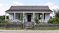
The Aynesworth-Wright House.
-
The Bailetti House.
-

The former site of the Charles W. Barnes House.
-
The William Braxton Barr House.
-
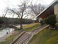
Barton Springs.
-
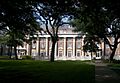
Battle Hall.
-
The Judge Robert Lynn Batts House.
-
The Bertram Building.
-
Bluebonnet Tourist Camp.
-
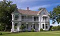
The Boardman-Webb-Bugg House.
-
The Bremond Block Historic District.
-
The Genaro P. and Carolina Briones House.
-
The Brizendine House.
-

The Brown Building.
-
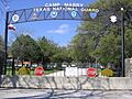
Camp Mabry Historic District.
-
The Carrington-Covert House.
-
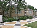
The George Washington Carver Library.
-
The Daniel H. and William T. Caswell Houses.
-
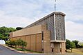
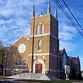
Central Christian Church.
-
The Chapman House.
-
Oakwood Cemetery.
-
Clarksville Historic District.
-
Commercial Building at 4113 Guadalupe Street.
-
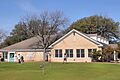
The Community Center.
-
Congress Avenue Historic District.
-
The Connelly-Yerwood House.
-
The Frank M. and Annie G. Covert House.
-
Covert Park at Mount Bonnell.
-
The Cox-Craddock House.
-
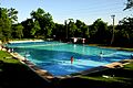
Deep Eddy Bathing Beach.
-
The Delta Kappa Gamma Society International Headquarters Building.
-
Delwood Duplex Historic District.
-
The J. Frank Dobie House.
-
The Driskill Hotel.
-
East Main Street Historic District in Pflugerville.
-
The Evans Industrial Building.
-

The Federal Office Building.
-
The Fischer House.
-
The Seymour and Barbara Fogel House.
-
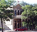
The French Legation.
-
The German American Ladies College.
-
Gethsemane Lutheran Church (Congress Avenue).
-
Gethsemane Lutheran Church (Anderson Lane).
-
The Gilfillan House.
-
The Goodman Building.
-
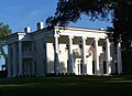
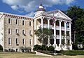
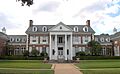
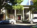
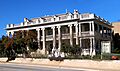
The Governor's Mansion.
-
The Granger House and The Perch.
-

Green Pastures.
-
The Haehnel Building.
-

Hancock Golf Course.
-
The John Hancock House.
-
The Haynes-DeLashwah House.
-
The Hildreth-Flanagan-Heierman House.
-
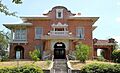
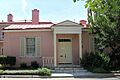
The Henry Hirshfeld House and Cottage.
-
The Hofheintz-Reissig Store.
-
House at 1170 San Bernard Street.
-
House at 1400 Canterbury Street.
-

Hyde Park Historic District.
-
Hyde Park Presbyterian Church.
-
The Robert Irvin House.
-
The A. J. Jernigan House.
-
The Phillip W. Jobe House.
-
The C.E. Johnson House.
-
The Kappa Kappa Gamma House.
-
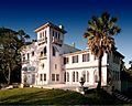
Laguna Gloria.
-
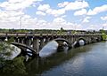
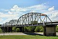
The Lamar Boulevard Bridge.
-

The Charles P. Ledbetter House.
-
The Limerick-Frazier House.
-
Lions Municipal Golf Course.
-
Little Campus.
-
The Littlefield House.
-
The Lung House.
-
The John W. Maddox House.
-
The Peter and Clotilde Shipe Mansbendel House.
-
The Mather-Kirkland House.
-
The Mayfield-Gutsch Estate.
-
The Arthur N. and Jane Y. McCallum House.
-
The Robert H. and Edith Ethel McCauley House.
-
The Floyd McGown House.
-
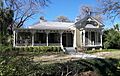
The McKinney Homestead.
-
The Fannie Moss Miller House.
-
The Millett Opera House.
-
The Missouri, Kansas and Texas Land Co. House.
-
The Montopolis Bridge.
-
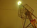
A Moonlight Tower.
-

Moore's Crossing Historic District.
-
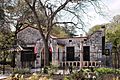
The Moore-Hancock Farmstead.
-
The Charles B. Moreland House.
-
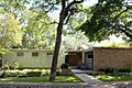
The Chester and Lorine Nagel House.
-
The Neill-Cochran House.
-
The Newton House.
-
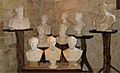
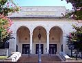
Inside the Elisabet Ney Museum.
-

The Norwood Building.
-
The Old Bakery.
-
The Old Land Office Building.
-
Old West Austin Historic District.
-
The Oliphant-Walker House.
-
The Page-Gilbert House.
-
The Michael Paggi House.
-
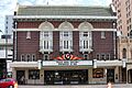
The Paramount Theatre.
-

The James F. and Susie R. Parker House.
-
The Perry Estate-St. Mary's Academy.
-
The Edgar H. Perry, Jr. House.
-
The George A. Peterson House.
-
The Joseph O. Polhemus House.
-
The William Sidney Porter House.
-
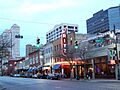
Rainey Street Historic District.
-

The F. T. and Belle Ramsey House.
-
The Rather House.
-

The Raymond-Morley House.
-
The Louis and Mathilde Reuter House.
-
The Alice H. Robbins House.
-
The Robinson-Macken House.
-
The Edward H. Rogers Homestead.
-
The Rogers-Bell House.
-
The Royal Arch Masonic Lodge.
-
The George W. Sampson House.
-
Santa Rita Courts.
-

The Kurt and Meta Schemedes House.
-
The J. P. Schneider Store.
-
Scholz Garten.
-
The Scottish Rite Dormitory.
-

The Seaholm Power Plant.
-

The Rev. Henry M. and Jennie Sears House.
-
Shadow Lawn Historic District.
-
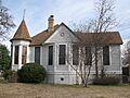
The Sheeks-Robertson House.
-
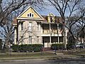
The Col. Monroe M. Shipe House.
-
Shotguns at 1203-1205 Bob Harrison.
-
The Simms House.
-
Sixth Street Historic District.
-
Smith Rock Shelter.
-
The Smith-Marcuse-Lowry House.
-
The Smith-Clark and Smith-Bickler Houses.
-
The Richmond Kelley Smoot House.
-
The Southgate-Lewis House.
-
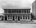
The Southwestern Telegraph and Telephone Building.
-

St. David's Episcopal Church.
-

St. Edward's University Main Building and Holy Cross Dormitory.
-
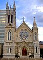
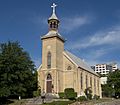
St. Mary's Cathedral.
-
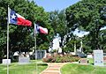
The State Cemetery of Texas.
-
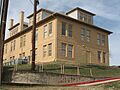
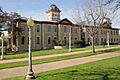
The State Lunatic Asylum.
-
The Stavely-Kunz-Johnson House.
-
Swedish Hill Historic District.
-
The Teachers State Association of Texas Building.
-
The Texas Federation of Women's Clubs Headquarters.
-
The Texas State Capitol.
-
The U.S. Post Office and Federal Building.
-
University Baptist Church.
-
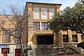
University Junior High School.
-
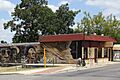
The Victory Grill.
-
The Wahrenberger House.
-
The James M. and Leana B. Walsh House.
-
Wesley United Methodist Church.
-
West Line Historic District.
-

The West Sixth Street Bridge at Shoal Creek.
-

Westgate Tower.
-
Westhill.
-

The W.T. and Clotilde V. Williams House.
-
Willow-Spence Streets Historic District.
-
Woodlawn.
-
Wooldridge Park.
-
The Goodall Wooten House.
-
The Worrell-Ettlinger House.
-
The Wroe-Bustin House.
-

Zilker Park Historic District.
-
The Ziller House.
-

The John C. Houghton House (demolished).

.jpg)


.jpg)


.jpg)


.jpg)


.jpg)


.jpg)


