
National Register of Historic Places listings in Ulster County, New York facts for kids

Welcome to Ulster County, New York! This area is full of amazing places that are super old and important to history. These special spots are listed on the National Register of Historic Places. Think of it like a Hall of Fame for buildings, areas, and other cool landmarks across the United States.
Ulster County has many of these historic places, and some are even more special! Eight of them are called National Historic Landmarks. These are the very best of the best, recognized for their huge importance to American history. Let's explore some of these awesome places!
Contents
Discovering Ulster County's Historic Gems
Ulster County is home to many fascinating historic sites, from old houses to unique churches and even parts of an old canal. Each one tells a story about the past.
Homes and Farms with Long Histories
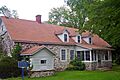
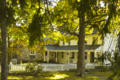
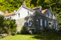
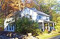
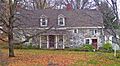
Many of Ulster County's historic places are old homes and farms that show us how people lived long ago.
Early Settler Homes
- The Peter Aldrich Homestead in Gardiner is a house from 1750! It's one of the oldest homes in the Shawangunk Valley.
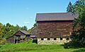
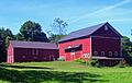
- The Appeldoorn Farm in Accord has been in the same family for almost 300 years, with many of its original buildings still standing. Imagine living in a house that's been around for so long!
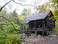
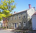
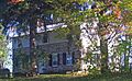
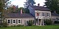
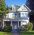
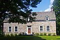
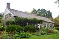
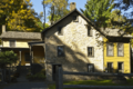
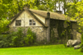
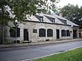
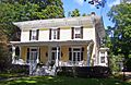
- The Bevier House in Gardiner is a farmhouse from the mid-1800s, built before the Civil War. It's a great example of how farms looked back then.
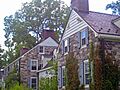
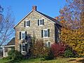
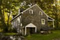
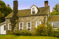
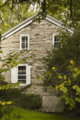
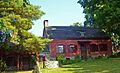
- The William Decker House in Shawangunk is a stone house built by an early settler. It shows us the strong, sturdy homes people built to last.
- The Dill Farm in Shawangunk dates back to about 1760, with buildings from the early 1800s. It's a peek into what family farms were like centuries ago.
- The Andries DuBois House in Wallkill is the oldest house in that town. It has been carefully restored to look just like it did originally.
- The Dubois-Kierstede Stone House in Saugerties, built in 1727, is now a museum where you can learn about its history.
- The Hendrikus DuBois House in Libertyville belonged to the son of a "Duzine" (a group of French Huguenot founders) who fought in the American Revolution.
- The Ephriam DuPuy Stone House in Rochester is a mid-1700s stone house, showing the strong building styles of that time.
- The John A. Lafevre House and School in Gardiner includes a stone house from 1772 and a one-room schoolhouse from 1838. Imagine going to school in just one room!
- The Abraham and Maria LeFevre House in Gardiner is another old home that gives us a glimpse into the past.
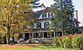
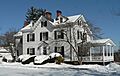
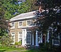
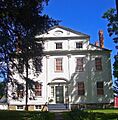
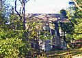
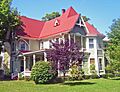
- The Locust Lawn Estate in Gardiner is a grand estate from 1814, built in the Federal style. It belonged to Josiah Hasbrouck, a U.S. Congressman.
- The Shuart-Van Orden Stone House in Plattekill, built in 1772, is one of the oldest houses in the area.
- The Tobias Van Steenburgh House in Kingston, built around 1700, is one of the few houses in the city that wasn't burned by the British during the Revolutionary War. That's pretty amazing!
- The Wynkoop House in Saugerties is an intact Dutch stone house from the 1730s.
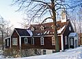
- The Cornelius Wynkoop Stone House in Marbletown, built in the 1770s, is a beautiful Georgian-style stone house where George Washington once stayed overnight!
Unique Architectural Styles
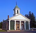
- The All Saints' Chapel in Rosendale is an unusual church from 1876, built in the Gothic Revival style with local Rosendale cement. It's been used as the Rosendale library since 1959.
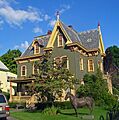
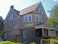
- The Boice House in Kingston, an 1850s Greek Revival home, was later changed to the fancy Second Empire style by a local quarry owner.
- The Dubois-Sarles Octagon in Marlboro is a rare octagon-shaped house built in the 1850s. It's unique because it's built on a "sidehall plan."
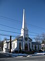
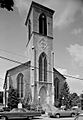
- The First Reformed Protestant Dutch Church of Kingston is a beautiful church from 1852. Its congregation started in 1659, making it one of the oldest churches in the U.S. that's still active!
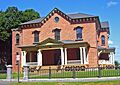
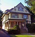
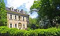
- The James and Mary Forsyth House in Kingston is a special Italian villa-style house from 1849, designed by a famous architect named Richard Upjohn.
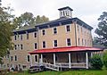
- The Hoornbeek Store Complex in Napanoch shows how building styles changed from the Federal style to the Greek Revival style in the early 1800s.
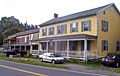
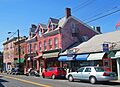
- The Kirkland Hotel in Kingston is a rare wooden hotel from 1899 that's still standing.
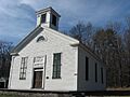
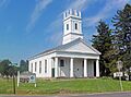
- The Reformed Dutch Church of New Hurley in Wallkill is a Greek Revival church from the 1820s, replacing one of the first churches built in the county.
- The Reformed Church of Shawangunk Complex has a stone church from the mid-1700s, which is the oldest building still used by a Dutch Reformed Church group in America.
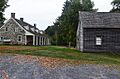
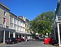
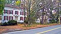
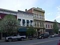
Historic Districts and Communities
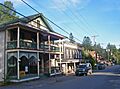
- The Alligerville Historic District is a well-preserved town that grew up around the Delaware and Hudson Canal.
- The Binnewater Historic District in Rosendale is another area with historic buildings.
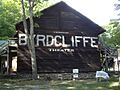
- The Byrdcliffe Historic District in Woodstock was a special community for artists who wanted to create a perfect society.
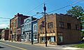
- The Chestnut Street Historic District in Kingston is a historic neighborhood.
- The Clinton Avenue Historic District in Kingston, around the Senate House, was the city's first historic district.
- The Cragsmoor Historic District is an artists' community with many fancy 19th-century houses.
- The High Falls Historic District grew around a big stopping point on the D&H Canal.
- The Huguenot Street Historic District in New Paltz is super important! It has stone houses from the late 1600s, built by the first settlers of New Paltz. It's one of the oldest neighborhoods in America that's been lived in continuously.
- The Hurley Historic District has well-preserved Dutch stone houses from the early 1700s. Kingston was burned during the Revolutionary War, so Hurley became the temporary capital of New York for two months!
- The Kingston Stockade District is the area inside the original 1654 stockade (a protective fence). It's often called Uptown Kingston.
- The Kripplebush Historic District in Marbletown is another area with historic buildings.
- The Main Street Historic District in Stone Ridge has houses and a church from the late 1700s and early 1800s.
- The Main-Partition Streets Historic District in Saugerties is also a historic area.
- The New Paltz Downtown Historic District is the well-preserved center of this lively college town from the 1800s.
- The Pine Hill Historic District is the heart of a 19th-century mountain resort town.
- The Rest Plaus Historic District in Marbletown is another historic area.
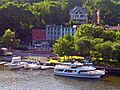
- The Rondout–West Strand Historic District in Kingston was once the village of Rondout and a busy port at the end of the D&H Canal. It's now a popular area with shops and restaurants.
- The Snyder Estate Natural Cement Historic District in Rosendale has many old buildings, mines, and other structures used to make Rosendale cement, a very important building material in the 1800s. It also includes homes of the Snyder family, who owned the cement business.
- The Trapps Mountain Hamlet Historic District in Gardiner shows the remains of an abandoned community that existed from 1797 to the 1940s on the Shawangunk Ridge.
Important Buildings and Structures
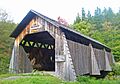
- The Ashokan-Turnwood Covered Bridge in Olive Bridge is a beautiful covered bridge.
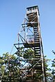
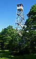
- The Balsam Lake Mountain Fire Observation Station in Hardenburgh was one of the first places in the Catskills to have a fire lookout tower. The current tower was built in 1930 and used until 1988.
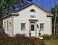
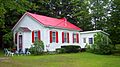
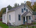
- The Bruynswick School No. 8 in Shawangunk is a well-preserved one-room schoolhouse from the 1800s.
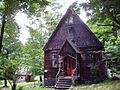
- The Chapel Hill Bible Church in Marlboro is a Gothic Revival church that was originally built in Manhattan in 1860 and then moved to Marlboro in 1905!
- The Community Theatre in Kingston, now called the Ulster Performing Arts Center, is a Classical Revival theater from 1926. It's one of the few theaters left from before World War II in the Hudson Valley.
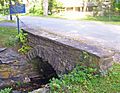
- The Elm Street Stone Arch Bridge in Pine Hill, built in 1900, is one of the few stone arch bridges left in the county.
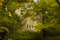
- The Elting Memorial Library in New Paltz started as an old stone house and was expanded to become the main library.
- The Esopus Meadows Lighthouse stands on the Hudson River. It's part of a group of historic lighthouses on the river.
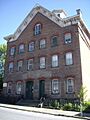
- The Fitch Bluestone Company Office in Kingston, built in 1870, is unique because it's made entirely of bluestone, a local building material.
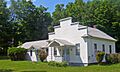
- The Gardiner School is a late 1800s wooden school building that has been restored and is now used as the town hall.
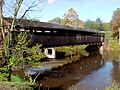
- The Grant Mills Covered Bridge in Hardenburgh is a well-preserved covered bridge from 1902, and it's the highest one in the Catskills! Now, only people walking can use it.
- The George and John R. Hunt Memorial Building in Ellenville is a Neoclassical building from the early 1900s that has been used for many things, mostly as the village library.
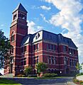
- The Kingston City Hall is a grand building from 1873 that has been restored. It was built on the old border between Kingston and Rondout to show that the two cities had merged.
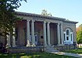
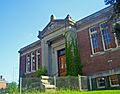
- The Kingston City Library is a beautiful Neoclassical building from 1903, built with money from Andrew Carnegie, who helped build many libraries across the country.
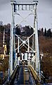
- The Kingston-Port Ewen Suspension Bridge was a very important link for travel along the Hudson River, completed in 1921.
- The Kingston/Rondout 2 Lighthouse is another historic lighthouse on the Hudson River.
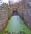
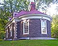
- The Lock Tender's House and Canal Store Ruin in High Falls includes an 1848 house for the person who managed Lock 20 of the D&H Canal, and the remains of a canal store.
- The Loerzel Beer Hall in Saugerties was a brewery built in 1873 and is now apartments.
- The Mill Street Stone Arch Bridge in Pine Hill, built in 1897, was made by the same builder as the Elm Street bridge.
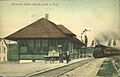
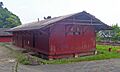
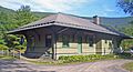
- The Milton Railroad Station is one of the few train stations left from the West Shore Railroad, built in 1883.
- The Morton Memorial Library in Pine Hill is a Georgian Revival library from 1902, built by a generous person who spent summers there.
- The Mount Tremper Fire Observation Station is another important fire lookout tower in the Catskills.
- The O&W Railroad Station at Port Ben in Wawarsing is an abandoned passenger station from 1912.
- The Ontario and Western Railroad Passenger Station in Napanoch is a well-preserved train station from 1903, located next to the old D&H Canal.
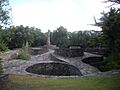
- Opus 40 in Saugerties is a unique outdoor sculpture garden created by a Bard College professor named Harry Fite in the 1930s.
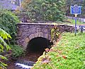
- Perrine's Bridge in Rosendale is the second-oldest covered bridge in New York and the only one along the entire Wallkill River. It's a really cool sight!
- The Phoenicia Railroad Station is a train station from 1899 that now houses the Empire State Rail Museum.
- The Ponckhockie Union Chapel in Kingston is a historic chapel.
- The Red Hill Fire Observation Station in Denning was the last fire tower in the Catskills to be used, closing in 1990 after 70 years. It was also the first one to be restored and reopened for visitors!
- The Saugerties Lighthouse is an 1869 lighthouse on the Hudson River, no longer in use but still a beautiful landmark.
- The Second Reformed Dutch Church of Kingston is another historic church in the city.
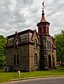
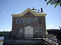
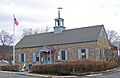
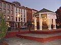
- The Senate House in Kingston is a very important place because it was where the first New York State Senate met in 1777. It was the first building in Kingston to be listed as historic.
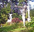
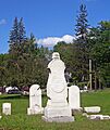
- The Sharp Burial Ground in Kingston is an old cemetery with some beautiful gravestones from the early 1800s.
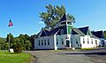
- The Spring Glen Synagogue is an early 1900s synagogue built by the first Jewish settlers in the Catskills. It's still used for special holidays!
- The Tuthilltown Gristmill in Gardiner was the oldest continuously operating gristmill (a mill for grinding grain) in New York State for a long time.
- The Ulster Heights Synagogue in Wawarsing was built in 1924 by early Jewish settlers and is still used for High Holy Days.
- The Ulster House Hotel in Pine Hill is a rare wooden hotel from 1882, showing what hotels were like during the peak of the Catskill resort era.
- The United States Lace Curtain Mills in Kingston is a historic industrial building.
- The U.S. Post Office-Ellenville is special because President Franklin D. Roosevelt himself approved its design after people complained about the first plan!
Naturalist Retreats and Unique Sites
- Slabsides and Riverby in West Park were the cabins and study of famous naturalist John Burroughs. He loved nature and wrote many books about it.
- The Emile Brunel Studio and Sculpture Garden in Boiceville is a unique roadside attraction from before World War II. The studio looks like a European farmhouse, which is unusual for the area.
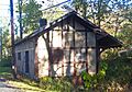
- The Coykendall Lodge in Hardenburgh was the lodge of a railroad boss named Samuel Coykendall. It's one of the few buildings allowed to stay on Forest Preserve land.
- The Holy Cross Monastery in West Park was the first home established by a religious order in 1904.
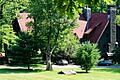
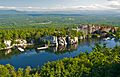
- The Lake Mohonk Mountain House Complex in New Paltz is an amazing resort built on a mountaintop. It's been the location of several important international meetings.
- The National Youth Administration Woodstock Resident Work Center is now the Woodstock School of Art.
Images for kids
-
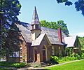
All Saints' Chapel, Rosendale
-
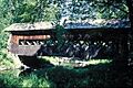
Ashokan-Turnwood Covered Bridge
-
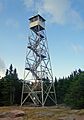
Balsam Lake Mountain Fire Observation Station
-
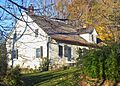
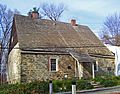
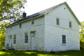
Zachariah Barley Stone House
-
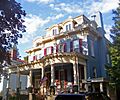
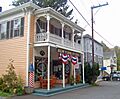
Beaverkill Valley Inn
-
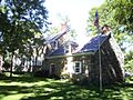
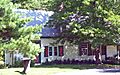
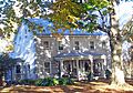
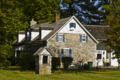
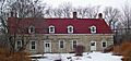
Bevier House
-
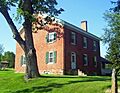
Bevier Stone House
-
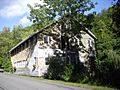
Binnewater Historic District
-
Boice House
-
Emile Brunel Studio and Sculpture Garden
-
Bruynswick School No. 8
-
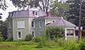
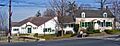
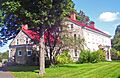
Brykill
-
John Burroughs Cabin
-
Byrdcliffe Historic District
-
Camp Wapanachki (Zen Mountain Monastery)
-
Chapel Hill Bible Church
-
Chetolah
-
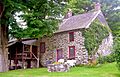
Chichester House
-
Christ Lutheran Church and Parsonage
-
Church of the Holy Transfiguration of Christ-on-the-Mount
-
Clinton Avenue Historic District
-
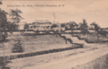
Cole-Hasbrouck Farm Historic District
-
Community Theatre (Ulster Performing Arts Center)
-
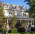
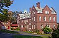
Cordts Mansion
-
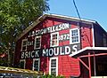
J. B. Crowell and Son Brick Mould Mill Complex
-
Johannes Decker Farm
-
William Decker House
-
Delaware and Hudson Canal
-
Dill Farm
-
District School No. 14
-
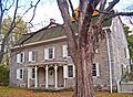
Andries DuBois House
-
DuBois-Deyo House
-
Dubois-Kierstede Stone House
-
Dubois-Sarles Octagon
-
Hendrikus DuBois House
-
Ephriam DuPuy Stone House
-
J. Dupuy Stone House
-
Ellenville Downtown Historic District
-
Elliot–Buckley House
-
Elm Street Stone Arch Bridge
-
Elting Memorial Library
-
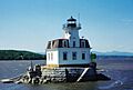
Esopus Meadows Lighthouse
-
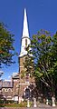
First Reformed Protestant Dutch Church of Kingston
-
Fitch Bluestone Company Office
-
James and Mary Forsyth House
-
Gardiner School
-
Grant Mills Covered Bridge
-
Thaddeus Hait Farm
-
Jean Hasbrouck House
-

Major Jacob Hasbrouck Jr. House
-
High Falls Historic District
-
Holy Cross Monastery
-
Jacob Hoornbeck Stone House
-
Hoornbeek Store Complex
-

Hornbeck Stone House
-
House at 184 Albany Avenue
-
House at 313 Albany Avenue
-
House at 322 Albany Avenue
-
House at 356 Albany Avenue
-
George and John R. Hunt Memorial Building
-
Hurley Historic District
-
Johannes Jansen House and Dutch Barn
-
Thomas Jansen House
-
Jenkins-DuBois Farm and Mill Site
-
William Kenyon House
-
Kingston City Hall
-
Kingston City Library
-
Kingston Stockade District
-
Kingston-Port Ewen Suspension Bridge
-

Kingston/Rondout 2 Lighthouse
-
Kirkland Hotel
-
Krom Stone House and Dutch Barn
-
Krom Stone House at 31 Upper Whitfield Road
-
Krom Stone House at 45 Upper Whitfield Road
-
Lucas Krom Stone House
-
John A. Lafevre House and School
-
Lake Mohonk Mountain House Complex
-
Abraham and Maria LeFevre House
-
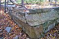
Lock Tender's House and Canal Store Ruin
-
Locust Lawn Estate
-
Loerzel Beer Hall
-
Main Street Historic District
-
Main-Partition Streets Historic District
-
Jacob F. Markle Stone House
-
Mill Street Stone Arch Bridge
-
Milton Railroad Station
-
Morton Memorial Library
-
Mount Tremper Fire Observation Station
-
New Paltz Downtown Historic District
-
O&W Railroad Station at Port Ben
-
Olive and Hurley Old School Baptist Church
-
Ontario and Western Railroad Passenger Station
-
Opus 40
-
Frank A. Palen House
-
Pearl Street Schoolhouse
-
Perrine's Bridge
-
Phoenicia Railroad Station
-
Pine Hill Historic District
-
Red Hill Fire Observation Station
-
Reformed Church of Shawangunk Complex
-
Reformed Dutch Church of New Hurley
-
Johannes Rider Stone House
-
Rondout–West Strand Historic District
-
Sahler Stone House
-
Sahler Stone House and Dutch Barn
-
Saugerties Lighthouse
-
Schoonmaker Stone House and Farm
-
C. K. Schoonmaker Stone House
-
Second Reformed Dutch Church of Kingston
-
Senate House
-
Sharp Burial Ground
-
Shuart-Van Orden Stone House
-
George J. Smith House
-
John Smith House
-
Snyder Estate Natural Cement Historic District
-
Spring Glen Synagogue
-
Stilwell Stone House
-

Stilwill-Westbrook Stone House
-
Benjamin Ten Broeck House
-
Jacob Ten Broeck Stone House
-
Terwilliger House
-
Terwilliger-Smith Farm
-
The Locusts
-
Trapps Mountain Hamlet Historic District
-
Tuthilltown Gristmill
-
Ulster Heights Synagogue
-
Ulster House Hotel
-
U.S. Post Office-Ellenville
-
Benjamin Van Keuren House Ruin
-

Tobias Van Steenburgh House
-
Jacobus Van Wagenen Stone House
-
Vosburg Turning Mill Complex
-
West Strand Historic District
-

Dirck Westbrook Stone House
-
Winfield Corners Stone House
-
Wynkoop House
-
Cornelius Wynkoop Stone House


_Zachariah_Barley_Stone_House,_193_Whitfield_Rd.,_Rochester,_Ulster_Cnty,_NY_1.png)


.jpg)


.jpg)


_Krom_Stone_House_at_31_Upper_Whitfield_Rd.,_Rochester,_Ulster_Cnty,_NY_1.png)


_Sahler_Stone_House,_Kyserike_Rd.,_Rochester,_Ulster_Cnty,_NY_1.png)


_Schoonmaker_Stone_House_%26_Farm,_Samsonville_Rd.,_Rochester,_Ulster_Cnty,_NY_1_edited-1.png)

.jpg)


_Winfield_Corners_Stone_House,_Winfield_Rd.,_Rochester,_Ulster_Cnty,_NY_2.png)


