National Register of Historic Places listings in Union County, South Dakota facts for kids
This page is all about the cool historic places in Union County, South Dakota, that are listed on the National Register of Historic Places. Think of the National Register as a special list of buildings, sites, and objects that are important to American history. It's like a hall of fame for old places!
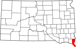
In Union County, South Dakota, there are 16 different places that have made it onto this important list. These places are protected and celebrated because they tell us stories about the past. You can even see where some of these places are on a map if you look up their coordinates!
Contents
- Historic Places in Union County
- Baker House (Alcester)
- Governor William J. Bulow House (Beresford)
- Chicago and Northwestern Railroad Depot (Beresford)
- Hultgren Farm (Big Springs)
- Hyden House (Alcester)
- John August Larson Home (Beresford)
- Junction City Rest Stop Tipi (Junction City)
- Charles Murtha House and Brick Yard (Elk Point)
- Nora Store (Alcester)
- J.W. Reedy House (Beresford)
- St. Peter's Catholic Church (Jefferson)
- South Dakota Dept. of Transportation Bridge No. 64-061-199 (Elk Point)
- Star School District 61 (Alcester)
- Swanson House (Alcester)
- United Brethren Church (Spink Township)
Historic Places in Union County
Here are some of the amazing historic spots you can find in Union County, South Dakota:
Baker House (Alcester)
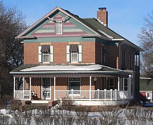
The Baker House is located at 48113 SD Highway 48 in Alcester. It was added to the National Register on August 7, 1979. This house is a great example of old architecture in the area.
Governor William J. Bulow House (Beresford)
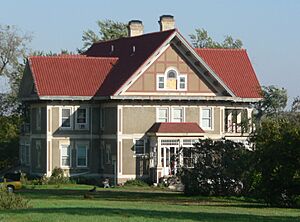
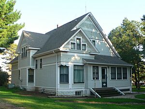
You can find the Governor William J. Bulow House at 207 W. Hemlock St. in Beresford. It was listed on May 8, 1986. This house was once home to William J. Bulow, who was a governor of South Dakota.
Chicago and Northwestern Railroad Depot (Beresford)
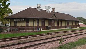
The old train station, called the Chicago and Northwestern Railroad Depot, is at 1 Depot Sq. in Beresford. It became a historic site on January 31, 1985. Train depots like this one were very important for travel and trade a long time ago.
Hultgren Farm (Big Springs)
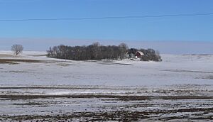
The Hultgren Farm is located at 47953 309th St. in Big Springs. It was added to the list on January 28, 2004. This farm shows us what farming life was like in the past.
Hyden House (Alcester)
The Hyden House is at 405 Hyden House in Alcester. It was recognized as historic on July 5, 1996.
John August Larson Home (Beresford)
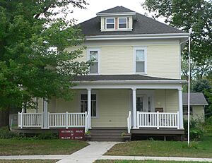
This home is at 407 W. Hemlock in Beresford. It was listed on October 31, 1985.
Junction City Rest Stop Tipi (Junction City)
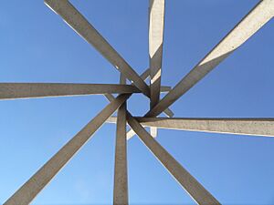
You can see the Junction City Rest Stop Tipi at Mi. 26.6 on I-29 in Junction City. It was added on January 20, 2015. This unique structure is part of a group of "Concrete Interstate Tipis" in South Dakota.
Charles Murtha House and Brick Yard (Elk Point)
The Charles Murtha House and Brick Yard is at 707 W. Main St. in Elk Point. It became a historic site on February 1, 1982. This place includes both a house and an old brick-making area.
Nora Store (Alcester)
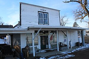
The Nora Store is located at 30705 475th Ave. in Alcester. It was listed on November 20, 2007. Old general stores like this were once the heart of small communities.
J.W. Reedy House (Beresford)
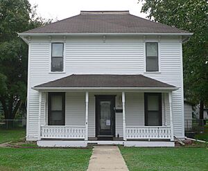
The J.W. Reedy House is at 309 N. 2nd in Beresford. It was added to the National Register on December 13, 1984.
St. Peter's Catholic Church (Jefferson)
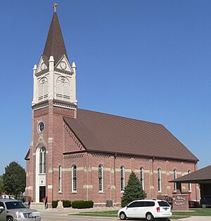
St. Peter's Catholic Church is at 400 Main St. in Jefferson. It was listed on July 19, 1989. Churches often play a big role in the history of a town.
South Dakota Dept. of Transportation Bridge No. 64-061-199 (Elk Point)
This bridge is a local road crossing over Brule Creek near Elk Point. It was recognized as historic on December 9, 1993. Old bridges are important for understanding how people traveled and built things in the past.
Star School District 61 (Alcester)
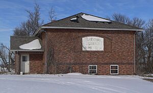
The Star School District 61 building is at 47446 305th St. in Alcester. It was added to the list on February 19, 2008. This old schoolhouse reminds us of how education used to be.
Swanson House (Alcester)
The Swanson House is at 30572 483rd Ave. in Alcester. It was listed on May 31, 2006.
United Brethren Church (Spink Township)
The United Brethren Church is at 31141 476th Ave. in Spink. It was added to the National Register on February 9, 2001.


