National Register of Historic Places listings in Venango County, Pennsylvania facts for kids
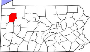
Welcome to Venango County, Pennsylvania! This page lists special places in the county that are part of the National Register of Historic Places. These are important buildings, bridges, or areas that tell us about history. They are protected so future generations can learn from them.
Venango County has 19 places listed on the National Register. One of these is even more special and is called a National Historic Landmark. It means it's super important to the history of the whole country! One place used to be on the list but was removed.
Contents
- Historic Places in Venango County
- Allegheny Baptist Church
- Bridge in Cherrytree Township
- Bridge in Clinton Township
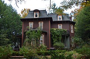
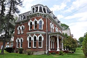
- Connely-Holeman House
- Samuel F. Dale House
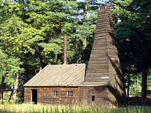
- Drake Oil Well (National Historic Landmark)
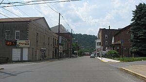
- Emlenton Historic District
- Franklin Historic District
- Indian God Rock Petroglyphs Site
- National Transit Building
- Oil City Armory
- Oil City Downtown Commercial Historic District
- Oil City North Side Historic District
- Oil City South Side Historic District
- Pithole Stone Arch Bridge
- Rockland Furnace
- Site of Pithole City
- U.S. Post Office (Oil City, Pennsylvania)
- Witherup Bridge
- Former Listing
Historic Places in Venango County
Venango County is full of interesting spots! Here are some of the places that have been recognized for their historical importance.
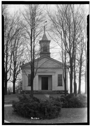
Allegheny Baptist Church
- Location: Pleasantville, at Pennsylvania Route 27 and Main Street.
- Listed: December 15, 1978.
- What it is: This historic church has been a part of the Pleasantville community for many years.
Bridge in Cherrytree Township
- Location: Cherrytree Township, southeast of Titusville. It crosses Oil Creek on State Route 1011.
- Listed: June 22, 1988.
- What it is: This old bridge, also known as Jersey Bridge, is an important part of the local transportation history.
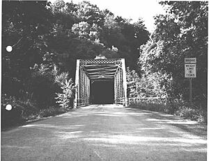
Bridge in Clinton Township
- Location: Clinton Township, south of Kennerdell. It goes over Scrubgrass Creek on State Route 3005.
- Listed: June 22, 1988.
- What it is: This bridge is another example of the historic bridges found in Venango County.
Connely-Holeman House
- Location: Pleasantville, at 317 Chestnut Street.
- Listed: October 11, 2007.
- What it is: This house is a historic home in Pleasantville, showing us what homes looked like in the past.
Samuel F. Dale House
- Location: Franklin, at 1409 Elk Street.
- Listed: December 4, 1975.
- What it is: The Samuel F. Dale House is a historic residence in Franklin.
Drake Oil Well (National Historic Landmark)
- Location: Cherrytree Township, about 3 miles (4.8 km) southeast of Titusville, in Drake Well Memorial Park.
- Listed: November 13, 1966.
- What it is: This is a very special place! The Drake Oil Well is where Edwin Drake successfully drilled for oil in 1859. This event started the modern oil industry, changing the world forever. It's a National Historic Landmark because of its huge importance.
Emlenton Historic District
- Location: Emlenton, roughly around the Allegheny River, borough limits, Kerr Avenue, and Hickory and Center Streets.
- Listed: November 10, 1997.
- What it is: This district includes many historic buildings and areas in Emlenton, showing the town's past.
Franklin Historic District
- Location: Franklin, roughly bounded by Miller Avenue and Otter, 8th, Buffalo, and 16th Streets.
- Listed: January 26, 1984.
- What it is: This large area in Franklin contains many historic buildings and streets that tell the story of the city's development.
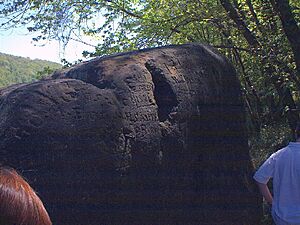
Indian God Rock Petroglyphs Site
- Location: Rockland Township, on the eastern bank of the Allegheny River above Brandon.
- Listed: May 14, 1984.
- What it is: This site features ancient rock carvings, called petroglyphs, made by Native Americans. They are a fascinating link to the very first people who lived in this area.
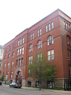
National Transit Building
- Location: Oil City, at 206 Seneca Street.
- Listed: September 13, 1978.
- What it is: This impressive building was once the headquarters for the National Transit Company, a major oil transportation company. It's a symbol of Oil City's oil boom history.
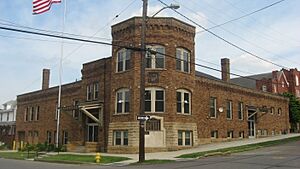
Oil City Armory
- Location: Oil City, at the junction of East 2nd and State Streets.
- Listed: May 9, 1991.
- What it is: The Armory served as a training and storage facility for military forces. Its architecture is also quite interesting.
Oil City Downtown Commercial Historic District
- Location: Oil City, generally along Seneca, Center, Elm, Sycamore, Duncomb, and Main Streets.
- Listed: October 24, 1997.
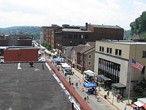
- What it is: This district includes many of the old shops and businesses in downtown Oil City, showing how the city grew during the oil era.
Oil City North Side Historic District
- Location: Oil City, roughly bounded by the Conrail railroad line, Manning Street, Park Road, Deer Street, and Linden, Hasson, Bishop, Carroll, and East Bissell Avenues.
- Listed: November 12, 1999.
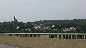
- What it is: This area on the north side of Oil City has many historic homes and buildings that were part of the city's growth.
Oil City South Side Historic District
- Location: Oil City, roughly bounded by the Allegheny River, Wilson Avenue, Lee's Lane, West Third, West Fifth, and Reservoir Streets.
- Listed: November 10, 1997.
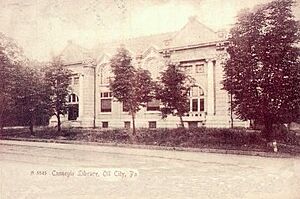
- What it is: Similar to the North Side, this district on the south side of Oil City also has many historic structures, including the beautiful Carnegie Library.
Pithole Stone Arch Bridge
- Location: Cornplanter and President Townships, over Pithole Creek on State Route 1004.
- Listed: June 22, 1988.
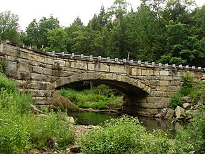
- What it is: This stone arch bridge is a lasting structure from the time when Pithole City was a bustling oil town.
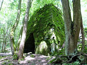
Rockland Furnace
- Location: Rockland Township, on Shull Run north of the Allegheny River, northwest of Emlenton.
- Listed: September 6, 1991.
- What it is: This site contains the remains of an old iron furnace. It reminds us of the early industries in the area before oil became king.
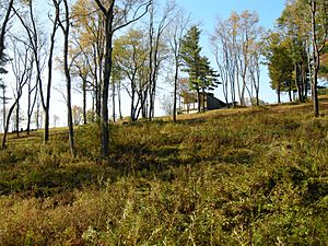
Site of Pithole City
- Location: Cornplanter Township, about 10 miles (16 km) southeast of Titusville.
- Listed: March 20, 1973.
- What it is: Pithole City was a boomtown that grew incredibly fast during the oil rush, then disappeared almost as quickly. Today, it's an important archaeological site that shows how quickly towns could rise and fall with the oil industry.
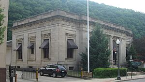
U.S. Post Office (Oil City, Pennsylvania)
- Location: Oil City, at 270 Seneca Street.
- Listed: September 15, 1977.
- What it is: This building served as the main post office for Oil City for many years. It's a great example of government architecture from its time.
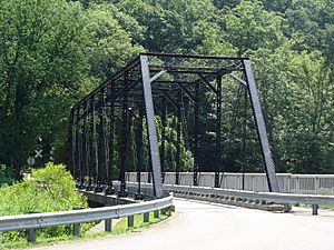
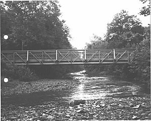
Witherup Bridge
- Location: Clinton Township, over Scrubgrass Creek on State Route 3007, south of Kennerdell.
- Listed: June 22, 1988.
- What it is: Another historic bridge in Clinton Township, showing the engineering of the past.
Former Listing
One property was once on the National Register but has since been removed.
Plumer Block
- Location: Franklin, at 1205 Liberty Street.
- Listed: April 20, 1978.
- Removed: June 27, 1988.
- What it was: The Plumer Block was a historic building in Franklin. It was removed from the list, likely because it was changed too much or no longer existed.

All content from Kiddle encyclopedia articles (including the article images and facts) can be freely used under Attribution-ShareAlike license, unless stated otherwise. Cite this article:
National Register of Historic Places listings in Venango County, Pennsylvania Facts for Kids. Kiddle Encyclopedia.

