
National Register of Historic Places listings in Washington County, Vermont facts for kids

Have you ever wondered about old buildings or places that have a special story? In Washington County, Vermont, there are many amazing spots that are so important, they're listed on something called the National Register of Historic Places. This special list helps protect places that are important to American history, architecture, or culture. Think of it like a hall of fame for buildings, bridges, and even whole neighborhoods!
Washington County has 70 places on this list, including two very special ones called National Historic Landmarks. These landmarks are extra important to the history of the entire United States.
Contents
What is the National Register of Historic Places?
The National Register of Historic Places is an official list kept by the United States government. It's managed by the National Park Service. When a building, site, or even a whole area is added to this list, it means it's recognized as being important to our country's past.
Why are Places Added to the List?
Places get on the National Register for different reasons:
- Important History: Maybe a big event happened there, or an important person lived or worked there.
- Cool Design: Some places are added because they have unique or beautiful architecture. They show us how buildings were designed in the past.
- Special Stories: Many places tell us about how people lived, worked, or played a long time ago. They help us understand our heritage.
Being on the list helps protect these places. It can also help owners get special grants or tax breaks to keep them in good shape.
Historic Places in Washington County
Washington County is full of interesting historic sites. Let's explore some of the types of places you can find on the National Register here.
Old Buildings and Homes
Many buildings in Washington County have been around for a long time and have amazing stories.
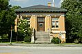
- The Aldrich Public Library in Barre is a beautiful old library building. It was added to the list in 2015.
- Athenwood and Thomas W. Wood Studio in Montpelier is a historic home and art studio. It shows us how artists lived and worked in the past.
- The Colby Mansion in Waterbury is another grand old home. It was built a long time ago and tells us about the families who lived there.
- The Chauncey B. Leonard House in Berlin is a historic house that gives us a peek into how people lived in the 1800s.
- The Theodore Wood House in Marshfield is a historic home that was added to the list in 2005.


Important Public Buildings
Some places on the list are buildings where important community activities happened.
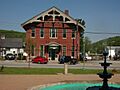
- The Barre City Hall and Opera House is a grand building in Barre City. It's where local government happens, and it also has a theater for performances!
- The Mayo Building in Northfield is another important public building. It has been a central part of the town for many years.
- The Vermont State House in Montpelier is one of the two National Historic Landmarks in the county. This is where Vermont's laws are made. It's a very important building for the whole state!
- The Worcester Town Hall and Worcester Village School are examples of important community buildings in Worcester.


Historic Districts
Sometimes, it's not just one building that's important, but a whole group of buildings or a neighborhood. These are called historic districts.
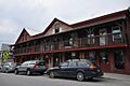
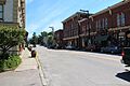
- The Barre Downtown Historic District includes many buildings in the heart of Barre City. It shows what a busy town center looked like long ago.
- The Currier Park Historic District in Barre City is a beautiful area with historic homes around a park.
- The Kents Corner Historic District in Calais is a historic village area. It includes several old buildings that show how a small community grew.
- The Montpelier Historic District covers a large part of downtown Montpelier, including many important buildings and streets.
- The Plainfield Village Historic District and Waitsfield Village Historic District are other examples of historic village centers.
- The Mad River Valley Rural Historic District is a larger area that includes parts of Moretown and Waitsfield. It shows how the landscape and farms developed over time.


Old Bridges
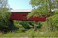
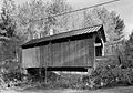
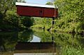
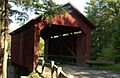
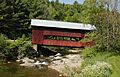
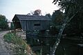
Vermont is famous for its beautiful covered bridges, and many of them are on the National Register!
- The Coburn Covered Bridge in East Montpelier crosses the Winooski River.
- The Great Eddy Covered Bridge in Waitsfield is also known as the Waitsfield Village Covered Bridge.
- The Martin Covered Bridge near Plainfield is another charming covered bridge.
- The Lower Cox Brook Covered Bridge, Northfield Falls Covered Bridge, Slaughter House Covered Bridge, Stony Brook Covered Bridge, and Upper Cox Brook Covered Bridge are all found around Northfield.
- The Warren Covered Bridge in Warren is another historic bridge over the Mad River.


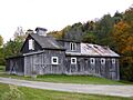
Industrial and Farm History
Washington County also has places that tell us about how people worked and made things.
- The Beck and Beck Granite Shed and E. L. Smith Roundhouse Granite Shed in Barre City show the history of the granite industry, which was very important to Barre.
- The Jones Brothers Granite Shed is now the Vermont Granite Museum. It teaches visitors all about the history of granite quarrying and carving.
- The National Clothespin Factory in Montpelier was once the last place in the US to make wooden clothespins! Now it has other businesses inside.
- The Roxbury Fish Hatchery is Vermont's first fish culture station, built in 1891. It shows how people worked to manage fish populations.
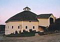
- The Joslin Farm in Waitsfield includes a unique round barn. Farms like this are important for understanding Vermont's agricultural past.
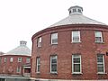
- The Socialist Labor Party Hall in Barre City is the other National Historic Landmark in the county. It's important because it shows the history of workers' movements and political groups in Vermont.


These are just some of the many fascinating places in Washington County that are recognized for their special history and importance. Exploring them can be a great way to learn about Vermont's past!
Images for kids
-
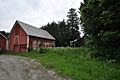
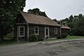
Allenwood Farm
-
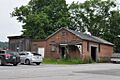
Beck and Beck Granite Shed
-
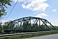
Bridge 31
-
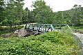
Bridge No. 27
-
Central Vermont Railway Depot
-
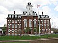
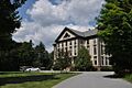
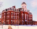
College Hall
-
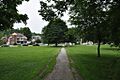
Currier Park Historic District
-
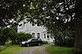
Parley Davis House
-
East Village Meetinghouse
-
Gale-Bancroft House
-
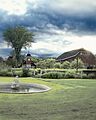
Goddard College Greatwood Campus
-
Green Mountain Seminary
-
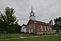
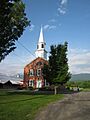
Italian Baptist Church
-
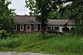
Jones-Pestle Farmstead
-
Joslin Farm
-
McLaughlin Farm (now Knoll Farm)
-
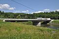
Middlesex-Winooski River Bridge
-
Mill Village Historic District
-
Montpelier Historic District
-
Nichols House
-
Northfield Falls Covered Bridge
-
Old Red Mill
-
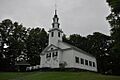
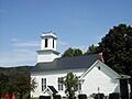
Old West Church
-
Pine Brook Covered Bridge
-
Plainfield Village Historic District
-
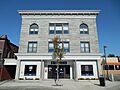
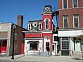
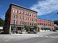
Scampini Block
-
Slaughter House Covered Bridge
-
Stony Brook Covered Bridge
-
Joshua Twing Gristmill
-
Union Co-operative Store Bakery
-
Union Meetinghouse
-
Upper Cox Brook Covered Bridge
-
Vermont State Hospital Historic District
-
Waitsfield Common Historic District
-
Waitsfield Village Historic District
-
Warren Covered Bridge
-
Warren Village Historic District
-
Waterbury Center Methodist Church
-
Waterbury Village Historic District
-
Wheelock Law Office
-
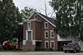
Theodore Wood House
-
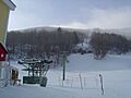
Mad River Glen Ski Area Historic District
-
Mad River Valley Rural Historic District
-
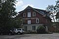
Mayo Building


.jpg)


