Nekoma, Kansas facts for kids
Quick facts for kids
Nekoma, Kansas
|
|
|---|---|

|
|
| Country | United States |
| State | Kansas |
| County | Rush |
| Elevation | 2,034 ft (620 m) |
| Time zone | UTC-6 (CST) |
| • Summer (DST) | UTC-5 (CDT) |
| ZIP code |
67559
|
| Area code | 785 |
| FIPS code | 20-49575 |
| GNIS ID | 475606 |
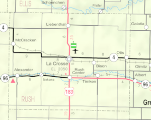
Nekoma is a small, quiet place in Rush County, Kansas, in the United States. It's called an unincorporated community, which means it doesn't have its own local government like a city or town. You can find Nekoma along Highway K-96, southwest of a city called La Crosse.
History of Nekoma
Nekoma was officially planned out in 1884 by the railroad company. When a town is "platted," it means its streets and lots are drawn on a map. This helps organize how the community will grow.
The very first post office in Nekoma opened its doors in 1890. Today, Nekoma still has a post office that uses the ZIP code 67559.
Education
Students living in Nekoma attend schools in the La Crosse USD 395 public school district. A school district is a local organization that manages public schools in a certain area.
 | May Edward Chinn |
 | Rebecca Cole |
 | Alexa Canady |
 | Dorothy Lavinia Brown |


