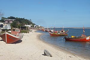
Neptunia, Uruguay facts for kids
Quick facts for kids
Neptunia
|
|
|---|---|
|
Resort of the Costa de Oro
|
|

Pando Creek on its path through Neptunia
|
|
| Country | |
| Department | Canelones Department |
| Population
(2011)
|
|
| • Total | 4,774 |
| Time zone | UTC -3 |
| Postal code |
15101
|
| Dial plan | +598 437 (+5 digits) |
Neptunia is a lovely resort town located in the southern part of Uruguay. It's part of the Canelones Department and is found along the beautiful Costa de Oro, which means 'Gold Coast'.
Contents
Geography
Location of Neptunia
Neptunia is easy to find! It sits right on a main road called the Ruta Interbalnearia. This road is like a highway that connects different beach towns.
The town is about 36 kilometers (about 22 miles) northeast of the border with the Montevideo Department.
Neptunia shares its borders with other towns. To its east, you'll find the resort of Pinamar-Pinepark. To its west, it's next to El Pinar, which is part of a larger area called the Ciudad de la Costa. A small river, the Creek Pando, separates Neptunia from El Pinar.
Population
Knowing the population helps us understand how many people live in a place. In 2011, about 4,774 people called Neptunia home.
The number of people living in Neptunia has grown a lot over the years, as you can see in the table below:
| Year | Population |
|---|---|
| 1963 | 74 |
| 1975 | 368 |
| 1985 | 743 |
| 1996 | 2,050 |
| 2004 | 3,554 |
| 2011 | 4,774 |
Source: Instituto Nacional de Estadística de Uruguay
See also
 In Spanish: Neptunia (Uruguay) para niños
 | Valerie Thomas |
 | Frederick McKinley Jones |
 | George Edward Alcorn Jr. |
 | Thomas Mensah |


