
New York State Route 9G facts for kids
Quick facts for kids
|
||||
|---|---|---|---|---|
| Lua error in Module:Infobox_road/map at line 15: attempt to index field 'wikibase' (a nil value).
Map of the Mid-Hudson Valley with NY 9G highlighted in red
|
||||
| Route information | ||||
| Auxiliary route of US 9 | ||||
| Maintained by NYSDOT and the cities of Poughkeepsie and Hudson | ||||
| Length | 42.99 mi (69.19 km) | |||
| Existed | 1930–present | |||
| Major junctions | ||||
| South end | ||||
| North end | ||||
| Location | ||||
| Counties: | Dutchess, Columbia | |||
| Highway system | ||||
| Numbered highways in New York Interstate • U.S. • N.Y. (former) • Reference • County
|
||||


New York State Route 9G (NY 9G) is a special road in New York State. It's like a long path that connects different towns and places. This road starts in a city called Poughkeepsie and travels north.
NY 9G is about 43 miles long. It follows the beautiful Hudson River for much of its journey. Imagine driving with the river on one side and pretty views on the other! The road was first created in 1930.
What is a State Route?
A state route is a road that is managed by the state government. In New York, the NYSDOT takes care of most of these roads. They make sure the roads are safe and easy to use for everyone.
Where Does NY 9G Go?
NY 9G begins in Poughkeepsie, which is in Dutchess County. It then heads north, passing through many small towns and villages.
- It crosses another important road, US 9, just north of a village called Rhinebeck.
- The road continues its journey into Columbia County.
- Finally, NY 9G ends in the city of Hudson.
So, this road helps people travel between Poughkeepsie, Rhinebeck, and Hudson, connecting communities along the Hudson River.
Images for kids
-
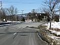
NY 9G's southern beginning point at US 9 in Poughkeepsie
-

A long dip in the road to cross a creek in Germantown.


