Newtonville, New Jersey facts for kids
Quick facts for kids
Newtonville, New Jersey
|
|
|---|---|
| Country | |
| State | |
| County | Atlantic |
| Township | Buena Vista |
| Area | |
| • Total | 3.16 sq mi (8.19 km2) |
| • Land | 3.16 sq mi (8.19 km2) |
| • Water | 0 sq mi (0.00 km2) |
| Elevation | 102 ft (31 m) |
| Population
(2020)
|
|
| • Total | 742 |
| • Density | 234.66/sq mi (90.61/km2) |
| Time zone | UTC−05:00 (Eastern (EST)) |
| • Summer (DST) | UTC−04:00 (EDT) |
| ZIP Code |
08346
|
| Area code(s) | 609, 640 |
| FIPS code | 34-51990 |
| GNIS feature ID | 878795 |
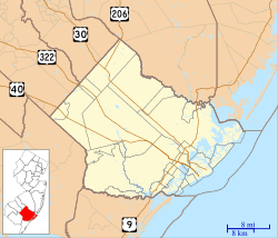
Newtonville is a small community in Buena Vista Township. It is located in Atlantic County in the state of New Jersey. Even though it's not an official town, it's recognized as a special area called a "census-designated place" (CDP) for counting people.
Newtonville is about 4.7 miles (7.6 km) east-northeast of Buena. A railway line, run by Conrail, passes through the area. The community also has its own post office with the ZIP Code 08346.
Who Lives in Newtonville?
Every ten years, the United States counts all its people. This is called a census. The most recent count for Newtonville was in 2020.
At that time, the population of Newtonville was 742 people.
| Historical population | |||
|---|---|---|---|
| Census | Pop. | %± | |
| 2020 | 742 | — | |
| U.S. Decennial Census 2020 |
|||
Black History Month on Kiddle
Famous African-American Scientists:
 | Dorothy Vaughan |
 | Charles Henry Turner |
 | Hildrus Poindexter |
 | Henry Cecil McBay |

All content from Kiddle encyclopedia articles (including the article images and facts) can be freely used under Attribution-ShareAlike license, unless stated otherwise. Cite this article:
Newtonville, New Jersey Facts for Kids. Kiddle Encyclopedia.


