Ngongotahā Valley facts for kids
Quick facts for kids
Ngongotahā Valley
|
|
|---|---|
|
Rural locality
|
|

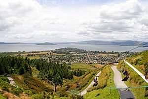
Chairlifts and gondolas ascending Mount Ngongotahā
|
|
| Country | New Zealand |
| Region | Bay of Plenty |
| Territorial authority | Rotorua Lakes District |
| Ward | Rotorua Rural General Ward |
| Community | Rotorua Rural Community |
| Electorates |
|
| Area | |
| • Total | 177.50 km2 (68.53 sq mi) |
| Population
(June 2023)
|
|
| • Total | 1,770 |
| • Density | 9.972/km2 (25.83/sq mi) |
| Postcode(s) |
3072
|
Ngongotahā Valley is a beautiful valley in New Zealand. It is located west of Rotorua. The valley was formed by the Ngongotahā Stream.
In 1939, springs along the stream were turned into a fun place called Paradise Valley Springs. The main road into the valley is even named Paradise Valley Road!
Contents
Exploring Mount Ngongotahā
Mount Ngongotahā is a big mountain in the valley. Its highest point is 757 metres tall.
Fun Activities on the Mountain
You can ride a gondola or a luge on the side of Mount Ngongotahā. It's a great way to see the views and have some fun!
The Paradise Valley Springs are still open today. They are now part of a wildlife park. You can see many different animals there.
Wingspan Bird Centre
Another cool place on Mount Ngongotahā is the Wingspan National Bird of Prey Centre. This centre helps protect New Zealand's birds of prey. These are birds like falcons and hawks.
Wingspan works to breed these birds in a safe place. They also teach people about them. You can even watch amazing demonstrations of falconry there. Falconry is when trained birds of prey hunt with people.
Ngongotahā Stream and Flooding
The Ngongotahā Stream sometimes floods. This means the water can overflow its banks.
To help stop future floods, two groups are working together. These are the Bay of Plenty Regional Council and the Rotorua Lakes Council. They have a project to reduce the flood risk.
People of Ngongotahā Valley
The Ngongotahā Valley area also includes a place called Mamaku. This whole area covers about 177.50 square kilometres.
Population Numbers
As of 2023, about 1,770 people live in Ngongotahā Valley. This means there are about 10.0 people living in each square kilometre.
| Historical population | ||
|---|---|---|
| Year | Pop. | ±% p.a. |
| 2006 | 1,464 | — |
| 2013 | 1,410 | −0.54% |
| 2018 | 1,590 | +2.43% |
In 2018, 1,590 people lived in Ngongotahā Valley. This was more people than in 2013 and 2006. There were 540 homes in the area.
Age and Background
The people living here are about half male and half female. The average age was around 39.6 years old in 2018.
About 22.8% of the people were under 15 years old. This means many young people live in the valley. About 13% were 65 years or older.
Most people (81.1%) are of European background. Many people (31.1%) are also Māori. Some people are from Pacific Islands (2.3%) or Asia (2.6%). People can identify with more than one background.
About 10.9% of the people were born outside New Zealand.
Beliefs and Education
When asked about their beliefs, most people (58.7%) said they had no religion. About 28.5% were Christian. A small number had Māori religious beliefs or other religions.
About 11.2% of adults had a university degree or higher. Most people were employed either full-time or part-time.
 | Misty Copeland |
 | Raven Wilkinson |
 | Debra Austin |
 | Aesha Ash |

