Ngooraialum facts for kids
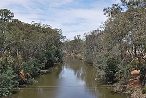
The Ngooraialum were a group of Indigenous Australians who lived in central Victoria. Their traditional lands were along the Goulburn River. This area was north of Mitchellstown, near places like Murchison and Toolamba. It was also about 64 kilometers (40 miles) from where the Goulburn River meets the Murray River. A very important place for them was Noorillim, which they called Waaring.
Ngooraialum Language
The Ngooraialum people spoke a special form of the Taungurung language. This language belongs to a larger group called Kulinic languages. Kulinic languages are part of the even bigger Pama-Nyungan language family. The name Nguraialum actually refers to the special way they spoke their language.
Ngooraialum History
The Ngooraialum were first written about in 1840. They visited a place called Mitchellstown in February of that year. At that time, their leader was named Weeng-her-bil. Records show they were a large group and in good health. In 1845, the names of 53 Ngooraialum people were officially written down.
The Ngooraialum often had disagreements with their neighbors, the Bangerang people. Today, many Ngooraialum people live in the Goulburn Valley. Some live in a settlement called Rumbalara. This community was built in 1958 near Shepparton. It replaced an older, less formal settlement.
Other Names for Ngooraialum
Over time, the Ngooraialum people have been known by several other names. These names include:
- Ngooralung-boola/Ngouraylung-bulla
- Ngurailum
- Ooraialum
- Oorilim
- Orilims
- Woo-ril-lum/Woo-rai-lim/Wo-ra-lims/Woralim
- Wor-ile-lum-buluc
 | Bessie Coleman |
 | Spann Watson |
 | Jill E. Brown |
 | Sherman W. White |


