Northway Junction, Alaska facts for kids
Quick facts for kids
Northway Junction, Alaska
|
|
|---|---|
| Country | United States |
| State | Alaska |
| Census Area | Southeast Fairbanks |
| Area | |
| • Total | 8.6 sq mi (22.2 km2) |
| • Land | 8.5 sq mi (21.9 km2) |
| • Water | 0.1 sq mi (0.3 km2) |
| Elevation | 1,693 ft (516 m) |
| Population
(2010)
|
|
| • Total | 54 |
| • Density | 6.28/sq mi (2.432/km2) |
| Time zone | UTC-9 (Alaska (AKST)) |
| • Summer (DST) | UTC-8 (AKDT) |
| Area code(s) | 907 |
| FIPS code | 02-56250 |
| GNIS feature ID | 1866965 |
Northway Junction was a small community in Southeast Fairbanks Census Area, Alaska, United States. It was known as a census-designated place (CDP). This means it was an area identified by the U.S. Census Bureau for statistical purposes. Before the 2020 Census, Northway Junction joined with the nearby community of Northway. In 2010, 54 people lived there. This was fewer than the 72 people recorded in 2000.
Contents
History of Northway Junction
The land around Northway has a long history. It was once used for hunting by the Athabascan people. They are a group of Native American tribes. The original Athabascan settlement was called Nabesna. Today, this place is known as Northway Village. It is about two miles south of where Northway Junction used to be.
How Northway Junction Started
During World War II, Northway Junction became important. The United States Army set up a supply point there. This was to help build the Alaska Highway. This important road was named after an Athabascan leader, Chief Walter Northway.
Reeve's Field Airfield
An airfield called Reeve's Field was also built in Northway Junction. This airfield was part of a larger system. It was one of many airfields across Canada and Alaska. This system was known as the Northwest Staging Route. It helped planes travel long distances during the war.
Geography of Northway Junction
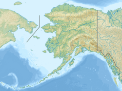
Northway Junction was located in a specific area of Alaska. The United States Census Bureau measures these areas. The total area of Northway Junction was about 8.6 square miles (22.2 square kilometers). Most of this area was land. About 8.5 square miles (21.9 square kilometers) was land. A small part, about 0.1 square miles (0.3 square kilometers), was water.
Population Changes in Northway Junction
Northway Junction first appeared in the U.S. Census in 1990. It was listed as a census-designated place (CDP).
Population Numbers Over Time
The number of people living in Northway Junction changed over the years:
- 1990: 88 people
- 2000: 72 people
- 2010: 54 people
As of the 2000 census, there were 72 people living there. These people lived in 23 households. A household is a group of people living together. Out of these, 18 were families. The population density was about 8.5 people per square mile. This means there were not many people living in a large area.
Who Lived There?
The people in Northway Junction came from different backgrounds. In 2000, about 41.67% of the people were White. About 48.61% were Native American. And 9.72% were from two or more racial groups. A small number, 4.17%, were of Hispanic or Latino background.
Many households had children. About 47.8% of households had children under 18. Most households, 56.5%, were married couples. The average household had about 3.13 people. The average family had about 3.44 people.
Age Groups in Northway Junction
The population in 2000 had different age groups:
- 38.9% were under 18 years old.
- 6.9% were between 18 and 24 years old.
- 34.7% were between 25 and 44 years old.
- 19.4% were between 45 and 64 years old.
The average age of people in Northway Junction was 27 years.
See also
 In Spanish: Northway Junction (Alaska) para niños


