Numa, Indiana facts for kids
Quick facts for kids
Numa, Indiana
|
|
|---|---|

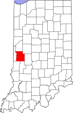
Parke County's location in Indiana
|
|
| Country | United States |
| State | Indiana |
| County | Parke |
| Township | Florida |
| Elevation | 522 ft (159 m) |
| Time zone | UTC-5 (Eastern (EST)) |
| • Summer (DST) | UTC-4 (EDT) |
| ZIP code |
47874
|
| Area code(s) | 765 |
| GNIS feature ID | 440366 |
Numa is a small place in Parke County, Indiana, in the United States. It is also known by other names like Walkers Bluff or Walkerton. Numa is an "unincorporated community." This means it's a group of homes and buildings that does not have its own local government, unlike a city or town. Instead, it is part of a larger area called Florida Township.
A Look Back at Numa's History
Numa was first planned out in 1837. This means people decided where roads and buildings would go. Some people think it might be named after Numa Pompilius, who was an ancient Roman king.
A post office opened in Numa in 1844. This was a place where people could send and receive letters and packages. However, the post office closed down in 1889, which means it stopped operating.
Where is Numa Located?
Numa is found in Indiana at a specific spot on the map. It is located at coordinates 39°37′51″N 87°22′13″W / 39.63083°N 87.37028°W. This location is about 525 feet (or 159 meters) above sea level.
 | Delilah Pierce |
 | Gordon Parks |
 | Augusta Savage |
 | Charles Ethan Porter |


