O'Chiese 203 facts for kids
Quick facts for kids
O'Chiese 203
|
|
|---|---|
| O'Chiese Indian Reserve No. 203 | |

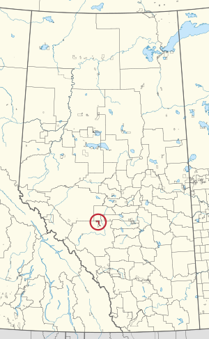
Location in Alberta
|
|
| First Nation | O'Chiese First Nation |
| Country | Canada |
| Province | Alberta |
| Municipal districts | Brazeau Clearwater |
| Area | |
| • Land | 140.20 km2 (54.13 sq mi) |
| Population
(2016)
|
|
| • Total | 789 |
| • Density | 5.63/km2 (14.6/sq mi) |
O'Chiese 203 is a special area of land in Alberta, Canada. It is known as an Indian reserve. This land is managed by the O'Chiese First Nation. The O'Chiese First Nation is a group of Indigenous people called the Saulteaux.
This reserve is one of two land areas looked after by the O'Chiese First Nation. It is located about 119 kilometers (74 miles) northwest of a city called Red Deer. The land sits at a high point, about 1,007 meters (3,304 feet) above sea level.
About O'Chiese 203
O'Chiese 203 is a specific piece of land set aside for the O'Chiese First Nation. These lands are important for Indigenous communities in Canada. They help preserve their culture and traditions.
The O'Chiese First Nation is a self-governing group. This means they make their own decisions about their community and land. They are part of the larger Saulteaux people.
Where is O'Chiese 203 Located?
The O'Chiese 203 reserve is in a central part of Alberta. It has different areas bordering it. To the west and east, it is next to Clearwater County. To the north, it borders Brazeau County.
To the south, O'Chiese 203 is next to another Indian Reserve. This neighboring reserve is called Sunchild 202. These borders help define the area of the O'Chiese 203 reserve.
Population and Size
In 2016, the population of O'Chiese 203 was 789 people. This number helps us understand how many people live on the reserve. The land area of the reserve is about 140.20 square kilometers (54.13 square miles).
This means that for every square kilometer, there were about 5.63 people living there in 2016. Understanding the population and size helps us learn about the community.
 | Charles R. Drew |
 | Benjamin Banneker |
 | Jane C. Wright |
 | Roger Arliner Young |

