
Red Deer, Alberta facts for kids
Quick facts for kids
Red Deer
|
|||||
|---|---|---|---|---|---|
|
City
|
|||||
| City of Red Deer | |||||
|
|
|||||
|
|||||
| Motto(s):
Education, Industry and Progress
|
|||||

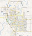
City boundaries
|
|||||

Red Deer
Location in Alberta

Red Deer
Location in Canada

Red Deer
Location in Red Deer County
|
|||||
| Country | Canada | ||||
| Province | Alberta | ||||
| Planning region | Red Deer | ||||
| Municipal district | Red Deer County | ||||
| Founded | 1882 | ||||
| • Village | May 31, 1894 | ||||
| • Town | June 12, 1901 | ||||
| • City | March 25, 1913 | ||||
| Named for | Red Deer River | ||||
| Area
(2021)
|
|||||
| • Land | 104.34 km2 (40.29 sq mi) | ||||
| • Urban | 65.93 km2 (25.46 sq mi) | ||||
| • Metro | 104.34 km2 (40.29 sq mi) | ||||
| Elevation | 855 m (2,805 ft) | ||||
| Population
(2021)
|
|||||
| • City | 100,844 | ||||
| • Density | 966.5/km2 (2,503/sq mi) | ||||
| • Urban | 99,846 | ||||
| • Urban density | 1,514.4/km2 (3,922/sq mi) | ||||
| • Metro | 100,844 | ||||
| • Metro density | 966.5/km2 (2,503/sq mi) | ||||
| • Municipal census (2019) | 101,002 | ||||
| • Estimate (2020) | 106,736 | ||||
| Demonym(s) | Red Deerian | ||||
| Time zone | UTC−7 (MST) | ||||
| • Summer (DST) | UTC−6 (MDT) | ||||
| Forward sortation areas |
T4N – T4R
|
||||
| Area code(s) | 403, 587, 825, 368 | ||||
| Highways | 2, 2A, 11, 11A, 595 | ||||
| Waterways | Red Deer River, Waskasoo Creek, Piper Creek | ||||


_(8983252801).jpg)


Red Deer is a city in Alberta, Canada. It's located right in the middle of the Calgary–Edmonton Corridor, which is a busy area between two big cities. Red Deer is an important hub for central Alberta. Many people work in health care, retail, construction, and education here. The city is surrounded by Red Deer County and is next to Lacombe County. It sits in a beautiful area with rolling hills, right by the Red Deer River.
Contents
History of Red Deer
Early Days and First Nations
Long ago, the area where Red Deer is now was home to First Nations people. These included the Blackfoot, Plains Cree, and Stoney groups. European fur traders arrived in the late 1700s.
There was an old trail used by First Nations that went from Montana Territory to Fort Edmonton. This trail, later called the Calgary and Edmonton Trail, crossed the Red Deer River at a shallow, stony spot. This spot, known as "Old Red Deer Crossing," is about 7 kilometers upstream from today's city.
How Red Deer Got Its Name
The Cree people called the river Waskasoo Seepee, which means "Elk River." When Europeans arrived, they sometimes called North American elk "red deer." This was because elk looked similar to the "red deer" species found in Europe. Later, the community was named after the river. In Plains Cree, the modern city's name is mihkwâpisimosos, meaning "red type of deer." The river itself is still called wâwâskêsiw-sîpiy, or "elk river."

In the late 1800s, First Nations on the north side of the river signed Treaty 6 in 1876. Those on the south side signed Treaty 7 in 1877. Soon after, farmers and ranchers began to settle on the rich land.
Growth and Development
A trading post and a place for travelers to stop, called a stopping house, were built at the Crossing in 1882. This spot became Fort Normandeau during the 1885 North-West Rebellion.
A man named Leonard Gaetz played a big role in the city's growth. He gave land to the Calgary and Edmonton Railway. This helped them build a bridge over the river and create a new townsite. Because of this, the old Crossing was slowly left behind. The first trains arrived in 1891.
After World War I, Red Deer became a calm, successful city. A bird watcher named Elsie Cassels helped create the Gaetz Lakes bird sanctuary.
Red Deer in Difficult Times
During the Great Depression of the 1930s, Central Alberta did not suffer from severe droughts like other areas. The city was also in good financial shape. It made money from owning its local public services.
In World War II, a large army training camp was set up in Red Deer. Today, places like Cormack Armoury and Lindsay Thurber High School are there. Two airfields for training pilots were built south of the city at Penhold and Bowden.
Post-War Expansion
Red Deer grew very quickly after major oil was found in Alberta in the late 1940s. The city became a hub for oil and gas companies. It also supported related industries, like the Joffre Cogeneration Plant.
In 1948, the area known as North Red Deer joined with the city. Red Deer now has important government and administrative services. These include a hospital, a courthouse, and a provincial building.
The railway tracks were moved to the edge of the city. Passenger train service eventually stopped. The old CPR bridge is now a popular walking trail. Red Deer is Alberta's third-largest city, with a population slightly bigger than Lethbridge.
Geography and Climate
Red Deer's Climate
Red Deer has a humid continental climate. This means it has warm, rainy summers with cool nights. Winters are usually long, cold, and very dry. The highest temperature ever recorded was 37.2°C in July 1906, July 1924, and June 1937. The lowest was -50.6°C in December 1924.
| Climate data for Red Deer (Red Deer Regional Airport) WMO ID: 71878; coordinates 52°10′43″N 113°53′35″W / 52.17861°N 113.89306°W; elevation: 904.6 m (2,968 ft); 1981-2010 normals, extremes 1904−present |
|||||||||||||
|---|---|---|---|---|---|---|---|---|---|---|---|---|---|
| Month | Jan | Feb | Mar | Apr | May | Jun | Jul | Aug | Sep | Oct | Nov | Dec | Year |
| Record high humidex | 10.5 | 17.3 | 24.8 | 28.2 | 37.0 | 35.0 | 38.5 | 37.1 | 34.2 | 27.8 | 21.7 | 14.8 | 38.5 |
| Record high °C (°F) | 14.5 (58.1) |
18.0 (64.4) |
24.8 (76.6) |
32.8 (91.0) |
33.3 (91.9) |
37.2 (99.0) |
37.2 (99.0) |
36.1 (97.0) |
35.0 (95.0) |
29.4 (84.9) |
22.8 (73.0) |
16.5 (61.7) |
37.2 (99.0) |
| Mean daily maximum °C (°F) | −4.5 (23.9) |
−1.7 (28.9) |
2.9 (37.2) |
11.3 (52.3) |
16.8 (62.2) |
20.5 (68.9) |
23.1 (73.6) |
22.5 (72.5) |
17.3 (63.1) |
11.2 (52.2) |
1.3 (34.3) |
−3.2 (26.2) |
9.8 (49.6) |
| Daily mean °C (°F) | −10.2 (13.6) |
−7.7 (18.1) |
−2.9 (26.8) |
4.8 (40.6) |
10.3 (50.5) |
14.5 (58.1) |
16.8 (62.2) |
15.9 (60.6) |
10.8 (51.4) |
5.0 (41.0) |
−3.8 (25.2) |
−8.5 (16.7) |
3.7 (38.7) |
| Mean daily minimum °C (°F) | −16 (3) |
−13.7 (7.3) |
−8.7 (16.3) |
−1.7 (28.9) |
3.7 (38.7) |
8.4 (47.1) |
10.5 (50.9) |
9.2 (48.6) |
4.3 (39.7) |
−1.3 (29.7) |
−8.8 (16.2) |
−13.8 (7.2) |
−2.3 (27.9) |
| Record low °C (°F) | −46.7 (−52.1) |
−44.4 (−47.9) |
−40.6 (−41.1) |
−31.7 (−25.1) |
−12.8 (9.0) |
−6.1 (21.0) |
−1.1 (30.0) |
−5.6 (21.9) |
−12.8 (9.0) |
−26.1 (−15.0) |
−37.2 (−35.0) |
−50.6 (−59.1) |
−50.6 (−59.1) |
| Record low wind chill | −60 | −54 | −50 | −39 | −21 | −7 | 0.0 | −5 | −14 | −38 | −49 | −57 | −60 |
| Average precipitation mm (inches) | 22.2 (0.87) |
13.1 (0.52) |
21.2 (0.83) |
21.5 (0.85) |
55.8 (2.20) |
89.3 (3.52) |
96.6 (3.80) |
63.1 (2.48) |
51.1 (2.01) |
20.7 (0.81) |
17.7 (0.70) |
14.1 (0.56) |
486.3 (19.15) |
| Average rainfall mm (inches) | 0.1 (0.00) |
0.2 (0.01) |
0.8 (0.03) |
12.9 (0.51) |
51.9 (2.04) |
89.3 (3.52) |
96.6 (3.80) |
63.1 (2.48) |
48.7 (1.92) |
14.6 (0.57) |
1.8 (0.07) |
0.4 (0.02) |
380.4 (14.98) |
| Average snowfall cm (inches) | 22.1 (8.7) |
12.9 (5.1) |
20.4 (8.0) |
8.5 (3.3) |
3.9 (1.5) |
0.0 (0.0) |
0.0 (0.0) |
0.0 (0.0) |
2.4 (0.9) |
6.1 (2.4) |
15.8 (6.2) |
13.7 (5.4) |
105.9 (41.7) |
| Average precipitation days (≥ 0.2 mm) | 7.9 | 5.7 | 6.4 | 5.8 | 11.1 | 15.4 | 14.2 | 13.0 | 11.1 | 6.6 | 6.7 | 6.0 | 110.0 |
| Average rainy days (≥ 0.2 mm) | 0.08 | 0.15 | 0.54 | 4.0 | 10.6 | 15.4 | 14.2 | 13.0 | 10.9 | 4.9 | 0.96 | 0.19 | 74.9 |
| Average snowy days (≥ 0.2 cm) | 7.9 | 5.5 | 6.0 | 2.4 | 1.0 | 0.0 | 0.0 | 0.0 | 0.38 | 2.1 | 6.0 | 5.9 | 37.1 |
| Average relative humidity (%) (at 1500 LST) | 65.5 | 62.8 | 58.6 | 43.7 | 43.2 | 50.1 | 51.5 | 49.9 | 48 | 48.6 | 63.1 | 65.5 | 54.2 |
| Source: Environment and Climate Change Canada | |||||||||||||
City Neighbourhoods
Red Deer has many different neighbourhoods. Some of these include:
- Anders Park
- Aspen Ridge
- Bower
- Central Park
- Clearview Meadows
- College Park
- Davenport
- Deer Park Estates
- Downtown
- Eastview
- Evergreen
- Fairview
- Garden Heights
- Glendale
- Grandview
- Highland Green
- Inglewood
- Johnstone Crossing
- Kentwood East
- Kingsgate
- Lancaster Green
- Laredo
- Michener Hill
- Morrisroe
- Mountview
- Normandeau
- Oriole Park
- Parkvale
- Pines
- Riverlands
- Rosedale Estates
- South Hill
- Southbrook
- Sunnybrook
- Timber Ridge
- Vanier Woods
- Waskasoo
- West Park
- Woodlea
Population and People
|
||||||||||||||||||||||||||||||||||||||||||||||||||||||||||||||||||||||||||||||||||||
In 2021, the City of Red Deer had a population of 100,844 people. This was a small increase from its 2016 population of 100,418. Red Deer covers a land area of about 104.34 square kilometers.
Red Deer became a "census metropolitan area" (CMA) in 2021. This means it's a large urban area with a population of 100,000 or more. It's the fourth CMA in Alberta, joining Calgary, Edmonton, and Lethbridge.
Different Backgrounds in Red Deer
Red Deer is a diverse city. In 2016, about 15.2% of the population identified as a "visible minority." This means they were not Indigenous or European. Also, about 7.1% of people reported having North American Indigenous roots. This includes 4.2% who are First Nations and 3.1% who are Métis.
| Panethnic group |
2021 | 2016 | 2011 | 2006 | 2001 | |||||
|---|---|---|---|---|---|---|---|---|---|---|
| Pop. | % | Pop. | % | Pop. | % | Pop. | % | Pop. | % | |
| European | 73,060 | 74.52% | 78,065 | 79.27% | 75,510 | 85.1% | 71,955 | 88.43% | 60,345 | 90.66% |
| Southeast Asian | 8,970 | 9.15% | 6,890 | 7% | 2,935 | 3.31% | 1,590 | 1.95% | 1,245 | 1.87% |
| Indigenous | 6,465 | 6.59% | 5,185 | 5.27% | 4,590 | 5.17% | 3,600 | 4.42% | 2,675 | 4.02% |
| East Asian | 1,645 | 1.68% | 1,800 | 1.83% | 1,475 | 1.66% | 1,090 | 1.34% | 715 | 1.07% |
| South Asian | 2,220 | 2.26% | 1,665 | 1.69% | 1,090 | 1.23% | 630 | 0.77% | 480 | 0.72% |
| Middle Eastern | 1,130 | 1.15% | 915 | 0.93% | 485 | 0.55% | 210 | 0.26% | 270 | 0.41% |
| Latin American | 1,725 | 1.76% | 1,765 | 1.79% | 1,185 | 1.34% | 1,410 | 1.73% | 480 | 0.72% |
| African | 1,940 | 1.98% | 1,735 | 1.76% | 990 | 1.12% | 680 | 0.84% | 280 | 0.42% |
| Other | 895 | 0.91% | 455 | 0.46% | 485 | 0.55% | 195 | 0.24% | 80 | 0.12% |
| Total responses | 98,045 | 97.22% | 98,480 | 98.07% | 88,735 | 97.98% | 81,370 | 98.31% | 66,565 | 98.31% |
| Total population | 100,844 | 100% | 100,418 | 100% | 90,564 | 100% | 82,772 | 100% | 67,707 | 100% |
- Note: Totals greater than 100% due to multiple origin responses.
Arts and Culture in Red Deer
Red Deer is a lively place for arts and culture. Many groups perform and create here. These include:
- Central Alberta Theatre
- Ignition Theatre
- Red Deer Players Society
- Bull Skit Comedy troupe
- Central Music Festival
- The Red Deer Symphony Orchestra
- The Red Deer Museum + Art Gallery
- The Red Deer Royals
The Red Deer Arts Council helps support local artists. They work with visual artists, writers, and performers.
Fun Things to Do in Red Deer
Red Deer has many exciting places to visit and activities to enjoy.
- Alberta Sports Hall of Fame: This museum celebrates famous Alberta athletes. It's located near Highway 2.
- Canyon Ski Area: If you love winter sports, this ski resort is just 7.5 kilometers east of Red Deer.
- Peavey Mart Centrium: This is a big arena where you can watch sports, concerts, and trade shows. It's home to the WHL's Red Deer Rebels hockey team.
- YMCA Northside Community Centre: This center offers summer camps, fitness classes, and programs for kids and teens. It has a gym, fitness studio, and spaces for events.
- Collicutt Centre: A huge recreation center with a leisure pool, water park, climbing walls, and an ice arena. It also has gymnastics, meeting rooms, and a walking track.
- G.H. Dawe Community Centre: This large center is shared by a school, a public library branch, and a recreation facility.
- Greater Red Deer Visitor Centre: A great place to get information about the city. It's next to the Alberta Sports Hall of Fame.
- Recreation Centre: Located downtown, this center has indoor and outdoor pools, steam rooms, and hot tubs.
- Red Deer Museum + Art Gallery: Learn about the region's history here. They also have changing art exhibits and educational programs for all ages.
- Waskasoo Park: This park winds through the city along the Red Deer River. It has over 80 kilometers of trails for biking, rollerblading, horseback riding, and walking. This park is why Red Deer is known as "Park City."
- Westerner Exposition Grounds: This is where big events like Agricon and Westerner Days happen. Westerner Days, held in early July, includes a rodeo, chuck-wagon racing, and a fair.
Sports in Red Deer
Red Deer is a city that loves sports! The Red Deer Rebels hockey team plays at the Peavey Mart Centrium. Red Deer has hosted big hockey events like the 2022 Hlinka Gretzky Cup and the 2016 Memorial Cup. The city also hosted the Canadian Finals Rodeo from 2018 to 2023.
In 2019, Red Deer hosted the 2019 Canada Winter Games. This event left behind great new facilities like the Gary W. Harris Canada Games Centre and the Downtown Servus Arena. Many Olympic and NHL athletes come from Red Deer. Even Hockey Night in Canada personality Ron MacLean calls Red Deer home.
Getting Around Red Deer
Highways and Roads
The Queen Elizabeth II Highway connects Red Deer to the cities of Calgary and Edmonton. The David Thompson Highway links areas to the west and east of Red Deer.
Air and Public Transit
The Red Deer Regional Airport is in Penhold. It mainly serves smaller planes but is growing to offer more passenger flights. Within the city, Red Deer Transit provides bus service to help people get around.
Education in Red Deer
Colleges and Universities
Red Deer Polytechnic (RDP) is a college that became a polytechnic in 2021. It was founded in 1964. RDP offers many programs, including:
- Certificates
- Diplomas
- Degrees
- Training for trades
They have over 75 different programs in arts, engineering, and trades.
Schools for Younger Students
Three different school systems operate in Red Deer.
- Red Deer Public School District: This district was founded in 1887. It serves 10,000 students in 30 schools. They offer French Immersion and welcome international students. Their high schools are Lindsay Thurber Comprehensive High School and Hunting Hills High School.
- Red Deer Catholic Regional Schools (RDCRS): This system started in 1909. It serves over 10,000 students in six communities, including Red Deer. Their high schools are École Secondaire Notre Dame High School and St. Joseph's High School.
- Greater North Central Francophone Education Region No. 2: This system operates École La Prairie. It's a French school near downtown Red Deer. It offers programs from pre-kindergarten to grade 9. All courses are taught in French for students whose first language is French.
- Public schools
- Elementary Schools
-
- Annie L. Gaetz Elementary (Kindergarten–Grade 5)
- Aspen Heights Elementary (Kindergarten–Grade 5)
- Barrie Wilson Elementary School (Kindergarten–Grade 5)
- Don Campbell Elementary (Kindergarten–Grade 5)
- Fairview Elementary (Kindergarten–Grade 5)
- G.W. Smith Elementary (Kindergarten–Grade 5)
- Gateway Christian School (Kindergarten–Grade 5)
- G.H. Dawe Community School (Kindergarten–Grade 8)
- Glendale School (Pre-Kindergarten–Grade 8)
- Grandview Elementary (Kindergarten–Grade 5)
- Joseph Welsh Elementary (Kindergarten–Grade 5)
- Mattie McCullough Elementary (Kindergarten–Grade 5)
- Mountview Elementary (Kindergarten–Grade 5)
- Normandeau School (Kindergarten–Grade 8)
- Oriole Park Elementary (Kindergarten–Grade 5)
- Pines School (Kindergarten–Grade 5)
- West Park Elementary (Kindergarten–Grade 5)
- Middle Schools
-
- Central Middle School (Grades 6–8)
- Eastview Middle School (Grades 6–8)
- G.H. Dawe Community School (Kindergarten–Grade 8)
- Gateway Christian School (Grades 6–8)
- Glendale School (Pre-Kindergarten–Grade 8)
- Normandeau School (Kindergarten–Grade 8)
- West Park Middle School (Grades 6–8)
- High Schools
-
- École Secondaire Lindsay Thurber Comprehensive High School (Grades 9–12)
- Gateway Christian School (Grades 9–12)
- Hunting Hills High School (Grades 9–12)
- North Cottage High School (Grades 10–12)
- Catholic schools
- Elementary Schools
-
- École Camille J. Lerouge School (Kindergarten–Grade 9)
- École Mother Teresa School (Kindergarten–Grade 5)
- École Our Lady of the Rosary School (Pre-Kindergarten–Grade 2)
- Father Henri Voisin School (Kindergarten–Grade 5)
- Holy Family School (Kindergarten–Grade 5)
- Maryview School (Pre-Kindergarten–Grade 5)
- St. Elizabeth Seton School (Kindergarten–Grade 5)
- St. Marguerite Bourgeoys School (Pre-Kindergarten–Grade 5)
- St. Martin de Porres School (Kindergarten–Grade 5)
- St. Patrick's Community School (Kindergarten–Grade 9)
- St. Teresa of Avila School (Pre-Kindergarten–Grade 5)
- Middle Schools
-
- École Camille J. Lerouge School (Kindergarten–Grade 9)
- St. Francis of Assisi Middle School (Grades 6–9)
- St Lorenzo Ruiz Middle School (Grades 6–9)
- St. Patrick's Community School (Kindergarten–Grade 9)
- St. Thomas Aquinas Middle School (Grades 6–9)
- High Schools
-
- École Secondaire Notre Dame High School (Grades 10–12)
- St. Joseph's High School (Grades 10–12)
- Private schools
- Destiny Christian School Society (Pre-Kindergarten, Kindergarten–Grade 9)
- Koinonia Christian School – Red Deer (Pre-Kindergarten, Kindergarten–Grade 12)
- Parkland School Special Education (Grades 1–12)
- South Side Christian School (Pre-Kindergarten, Kindergarten–Grade 12)
Media in Red Deer
For local news, you can read the Red Deer Advocate or visit rdnewsNOW. The City of Red Deer also shares regular updates.
Images for kids
-

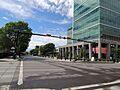
Downtown Red Deer
-
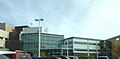
Red Deer Regional Hospital
-
Historic street cafe in Red Deer
-
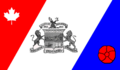
Flag of Red Deer
-
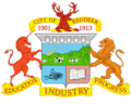
Coat of arms of Red Deer
-
Map of Red Deer City boundaries
-

City of Red Deer Logo
See also
 In Spanish: Red Deer para niños
