Lethbridge facts for kids
Quick facts for kids
Lethbridge
|
|||||
|---|---|---|---|---|---|
|
City
|
|||||
| City of Lethbridge | |||||
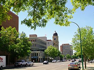
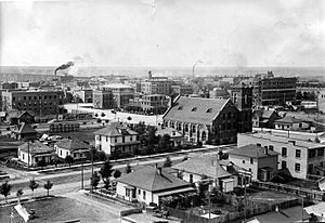
Downtown Lethbridge on 4th Avenue South
|
|||||
|
|||||
| Nickname(s):
"Bridge City", "The Windy City"
|
|||||
| Motto(s):
Ad occasionis januam "Gateway to Opportunity"
|
|||||
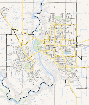
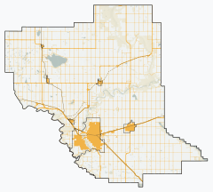
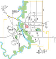
City boundaries
|
|||||
| Country | Canada | ||||
| Province | Alberta | ||||
| Planning region | South Saskatchewan | ||||
| Municipal district | Lethbridge County | ||||
| Settled | 1874 | ||||
| Incorporated | |||||
| • Town | November 29, 1890 | ||||
| • City | May 9, 1906 | ||||
| Named for | William Lethbridge | ||||
| Area
(2021)
|
|||||
| • Land | 121.12 km2 (46.76 sq mi) | ||||
| • Urban | 64.00 km2 (24.71 sq mi) | ||||
| • Metro | 2,958.96 km2 (1,142.46 sq mi) | ||||
| Elevation | 910 m (2,990 ft) | ||||
| Population
(2021)
|
|||||
| • City | 98,406 | ||||
| • Density | 812.5/km2 (2,104/sq mi) | ||||
| • Urban | 92,563 | ||||
| • Metro | 123,847 | ||||
| • Metro density | 41.9/km2 (109/sq mi) | ||||
| • Municipal census (2023) | 106,550 | ||||
| • Estimate (2020) | 101,324 | ||||
| 1446.2 | |||||
| Demonym(s) | Lethbridgian or Lethbian | ||||
| Time zone | UTC−07:00 (MST) | ||||
| • Summer (DST) | UTC−06:00 (MDT) | ||||
| Forward sortation areas |
T1H–T1K
|
||||
| Area code(s) | 403 587, 825, 368 | ||||
| Highways | |||||
| Waterways | Oldman River | ||||
| GDP (Lethbridge CMA) | CA$6.1 billion (2016) | ||||
| GDP per capita (Lethbridge CMA) | CA$52,243 (2016) | ||||
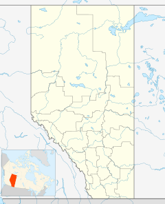
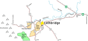
Lethbridge (/ˈlɛθbrɪdʒ/ LETH-brij) is a city in the province of Alberta, Canada. In 2023, Lethbridge became the fourth city in Alberta to have over 100,000 people, with a population of 106,550. The city is known for its warm summers, mild winters, and often windy weather, thanks to the nearby Rocky Mountains. Lethbridge is located about 215 kilometers (134 miles) southeast of Calgary along the Oldman River. It's also about 105 kilometers (65 miles) northwest of the Canada–United States border.
Lethbridge is a major hub for business, education, finance, industry, and transportation in southern Alberta. The city's economy first grew from coal mining in the late 1800s and then from agriculture in the early 1900s. Today, many people work in healthcare, education, retail, and hotels. The top five employers are government-related. Lethbridge is home to the University of Lethbridge, the only university in Alberta south of Calgary, and Lethbridge Polytechnic. The city also offers many cultural spots like theaters, art galleries, museums, gardens, and sports centers.
Contents
History of Lethbridge
Before the 1800s, different First Nations groups lived in the Lethbridge area. The Blackfoot called the area by names like Aksaysim ("steep banks") and Sik-ooh-kotok ("coal"). Other groups like the Sarcee, Cree, Nakoda (Stoney), and Kutenai people also had their own names for this land.
In 1869, after the US Army stopped alcohol trading with the Blackfeet Nation in Montana, traders John J. Healy and Alfred B. Hamilton set up a trading post called Fort Hamilton. This post, also known as Fort Whoop-Up, became a center for illegal whiskey trading. To stop this, the North-West Mounted Police arrived in 1874 and managed the post for the next 12 years.
Lethbridge's economy started to grow when Nicholas Sheran opened coal mines in 1874. The North Western Coal and Navigation Company, led by William Lethbridge (who the city is named after), opened more mines in 1882. By 1900, these mines employed about 150 people and produced 300 tonnes of coal daily. Coal production was highest during World War I. However, as oil and natural gas became more popular, coal mining slowly ended, and the last mine in Lethbridge closed in 1957.
The first railway line in Lethbridge opened in 1885. The railway was very important for coal transport and for bringing new settlers to southern Alberta. In 1905, the Canadian Pacific Railway (CPR) moved its main rail hub to Lethbridge, making the city a key center for the region. However, in the mid-1980s, the CPR moved its rail yards out of downtown Lethbridge, and the city stopped being a major rail hub.
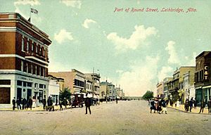
Between 1907 and 1913, Lethbridge grew rapidly. It became the main place for buying, selling, and getting services in southern Alberta. The city built important projects like a water treatment plant, a power plant, a streetcar system, and exhibition buildings. This growth, along with new construction and rising property prices, turned the mining town into a big city. After World War II, irrigation helped farms near Lethbridge, leading to more growth in the city's population and economy. Lethbridge also became a center for higher education with the opening of Lethbridge Polytechnic in 1957 and the University of Lethbridge in 1967.
Geography and Climate
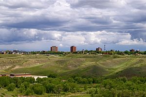
Lethbridge is located at 49.7° north latitude and 112.833° west longitude. It covers an area of about 127 square kilometers (49 square miles). The city is split by the Oldman River, and its valley has been turned into one of North America's largest urban park systems, with 16 square kilometers (4,000 acres) of protected land. Lethbridge is Alberta's third-largest city by population and area, after Calgary and Edmonton. It is about 210 kilometers (130 miles) southeast of Calgary, close to the Canadian Rockies.
Lethbridge is divided into three main areas: north, south, and west. The Oldman River separates West Lethbridge from the other two areas. Crowsnest Trail and the Canadian Pacific Kansas City rail line divide North and South Lethbridge.
- West Lethbridge (population 40,898) is the newest and largest area. It is home to the University of Lethbridge, which opened there in 1971. Most of the city's recent growth has been on the west side, and it has the youngest average age.
- North Lethbridge (population 28,172) was originally where coal miners lived. It has the oldest population and includes several industrial parks.
- South Lethbridge (population 32,412) is the city's main business area. It has the downtown core, most of the shops and restaurants, and Lethbridge Polytechnic.
Weather in Lethbridge
Lethbridge has a semi-arid climate (meaning it's quite dry). The average highest temperature is 12.8°C (55.0°F), and the average lowest temperature is -1.1°C (30.0°F). With an average of 380.2 millimeters (14.97 inches) of rain and snow each year, Lethbridge is one of the driest cities in Canada. It's also known for being windy, with winds of 40 kilometers per hour (25 mph) or higher on about 116 days a year.
Because Lethbridge is high up (929 meters or 3,048 feet) and close to the Rocky Mountains, its summers are cooler than other places in the Canadian Prairies. These factors also bring frequent chinook winds in winter. Chinooks are warm, dry winds that can quickly raise winter temperatures, making Lethbridge winters milder with less snow cover. The hottest average daytime temperature is in late July or early August, reaching about 26.4°C (79.5°F). The temperature usually reaches 35.0°C (95.0°F) or higher once or twice a year.
The highest temperature ever recorded in Lethbridge was 40.5°C (104.9°F) on August 10, 2018. The lowest temperature ever recorded was -42.8°C (-45.0°F) on several dates, including January 7, 1909.
| Climate data for Lethbridge Airport, 1981–2010 normals, extremes 1886–present | |||||||||||||
|---|---|---|---|---|---|---|---|---|---|---|---|---|---|
| Month | Jan | Feb | Mar | Apr | May | Jun | Jul | Aug | Sep | Oct | Nov | Dec | Year |
| Record high humidex | 17.3 | 21.8 | 26.3 | 30.2 | 35.4 | 37.7 | 40.9 | 39.8 | 36.1 | 30.1 | 23.0 | 17.8 | 40.9 |
| Record high °C (°F) | 20.0 (68.0) |
21.8 (71.2) |
26.8 (80.2) |
33.9 (93.0) |
34.2 (93.6) |
38.3 (100.9) |
40.0 (104.0) |
40.5 (104.9) |
36.7 (98.1) |
31.7 (89.1) |
23.3 (73.9) |
19.4 (66.9) |
40.5 (104.9) |
| Mean daily maximum °C (°F) | 0.1 (32.2) |
2.3 (36.1) |
6.4 (43.5) |
13.1 (55.6) |
18.3 (64.9) |
22.0 (71.6) |
26.1 (79.0) |
26.0 (78.8) |
20.2 (68.4) |
13.7 (56.7) |
4.8 (40.6) |
0.6 (33.1) |
12.8 (55.0) |
| Daily mean °C (°F) | −6 (21) |
−4.2 (24.4) |
−0.1 (31.8) |
6.0 (42.8) |
11.1 (52.0) |
15.2 (59.4) |
18.2 (64.8) |
17.7 (63.9) |
12.6 (54.7) |
6.6 (43.9) |
−1.2 (29.8) |
−5.4 (22.3) |
5.9 (42.6) |
| Mean daily minimum °C (°F) | −12.1 (10.2) |
−10.6 (12.9) |
−6.5 (20.3) |
−1.1 (30.0) |
3.9 (39.0) |
8.3 (46.9) |
10.3 (50.5) |
9.5 (49.1) |
4.9 (40.8) |
−0.6 (30.9) |
−7.2 (19.0) |
−11.4 (11.5) |
−1.1 (30.0) |
| Record low °C (°F) | −42.8 (−45.0) |
−42.2 (−44.0) |
−38 (−36) |
−27.2 (−17.0) |
−12.8 (9.0) |
−3.3 (26.1) |
0.0 (32.0) |
−1.7 (28.9) |
−15.6 (3.9) |
−26.7 (−16.1) |
−35.6 (−32.1) |
−42.8 (−45.0) |
−42.8 (−45.0) |
| Record low wind chill | −55 | −51 | −50 | −33 | −16 | −7 | 0 | −3 | −14 | −36 | −47 | −56 | −56 |
| Average precipitation mm (inches) | 13.5 (0.53) |
12.0 (0.47) |
22.8 (0.90) |
28.0 (1.10) |
49.9 (1.96) |
82.0 (3.23) |
42.6 (1.68) |
37.3 (1.47) |
41.4 (1.63) |
20.1 (0.79) |
17.8 (0.70) |
12.9 (0.51) |
380.2 (14.97) |
| Average rainfall mm (inches) | 0.2 (0.01) |
0.3 (0.01) |
2.3 (0.09) |
15.5 (0.61) |
45.1 (1.78) |
82.0 (3.23) |
42.6 (1.68) |
36.4 (1.43) |
39.5 (1.56) |
10.4 (0.41) |
2.0 (0.08) |
0.5 (0.02) |
276.7 (10.89) |
| Average snowfall cm (inches) | 15.4 (6.1) |
12.9 (5.1) |
22.5 (8.9) |
13.4 (5.3) |
4.8 (1.9) |
0.0 (0.0) |
0.0 (0.0) |
0.8 (0.3) |
1.9 (0.7) |
9.9 (3.9) |
16.7 (6.6) |
14.1 (5.6) |
112.4 (44.3) |
| Average precipitation days (≥ 0.2 mm) | 8.0 | 7.1 | 9.6 | 8.7 | 11.6 | 11.6 | 9.2 | 8.0 | 8.9 | 6.8 | 7.7 | 7.9 | 105.0 |
| Average rainy days (≥ 0.2 mm) | 0.30 | 0.19 | 1.6 | 5.8 | 10.9 | 11.6 | 9.2 | 8.0 | 8.7 | 4.9 | 1.6 | 0.73 | 63.3 |
| Average snowy days (≥ 0.2 cm) | 7.8 | 7.1 | 8.7 | 4.2 | 1.4 | 0.0 | 0.0 | 0.11 | 0.58 | 2.9 | 6.7 | 7.5 | 46.9 |
| Mean monthly sunshine hours | 110.2 | 147.0 | 186.1 | 233.4 | 277.0 | 290.3 | 322.1 | 297.5 | 228.5 | 189.7 | 119.1 | 106.5 | 2,507.3 |
| Percent possible sunshine | 41.1 | 51.5 | 50.6 | 56.7 | 58.2 | 59.7 | 65.6 | 66.5 | 60.2 | 56.6 | 43.5 | 41.8 | 54.3 |
| Source: Environment Canada | |||||||||||||
People of Lethbridge
| Federal census population history |
||
|---|---|---|
| Year | Pop. | ±% |
| 1901 | 2,072 | — |
| 1906 | 2,313 | +11.6% |
| 1911 | 8,050 | +248.0% |
| 1916 | 9,436 | +17.2% |
| 1921 | 11,097 | +17.6% |
| 1926 | 10,735 | −3.3% |
| 1931 | 13,489 | +25.7% |
| 1936 | 13,523 | +0.3% |
| 1941 | 14,612 | +8.1% |
| 1946 | 16,522 | +13.1% |
| 1951 | 22,947 | +38.9% |
| 1956 | 29,462 | +28.4% |
| 1961 | 35,454 | +20.3% |
| 1966 | 37,186 | +4.9% |
| 1971 | 41,217 | +10.8% |
| 1976 | 46,752 | +13.4% |
| 1981 | 54,072 | +15.7% |
| 1986 | 58,841 | +8.8% |
| 1991 | 60,974 | +3.6% |
| 1996 | 63,053 | +3.4% |
| 2001 | 67,374 | +6.9% |
| 2006 | 74,637 | +10.8% |
| 2011 | 83,517 | +11.9% |
| 2016 | 92,729 | +11.0% |
| 2021 | 98,406 | +6.1% |
| Source: Statistics Canada |
||
In the 2021 Canadian census, Lethbridge had a population of 98,406 people. This was a 6.1% increase from its 2016 population of 92,729. The city covers a land area of 121.12 square kilometers (46.76 square miles).
The population of Lethbridge continued to grow, reaching 106,550 in the 2023 municipal census. This means the city has grown by 4.99% since 2019.
Religions in Lethbridge
In 2021, about half of Lethbridge residents (49.8%) identified as Christian. This includes Catholics (16.1%), Protestants (12.9%), and other Christian groups. A large number of residents (44.3%) said they had no religious beliefs. About 8.1% of the population followed other religions, such as Islam (1.9%), Hinduism (1.3%), and Buddhism (1.1%).
Languages Spoken
According to the 2021 census, most residents (83.9%) spoke English as their first language. Other common first languages included Spanish (1.6%), Tagalog (1.4%), Nepali (1.0%), and German (0.9%).
Diverse Ethnicities
Lethbridge is a diverse city. In 2016, 12.9% of residents were visible minorities, and 7.1% were Aboriginal. The city is also home to the largest Bhutanese community in Canada.
| Panethnic group |
2021 | 2016 | 2011 | 2006 | 2001 | 1996 | 1991 | 1986 | |||||||||||
|---|---|---|---|---|---|---|---|---|---|---|---|---|---|---|---|---|---|---|---|
| Pop. | % | Pop. | % | Pop. | % | Pop. | % | Pop. | % | Pop. | % | Pop. | % | Pop. | % | ||||
| European | 74,245 | 77.12% | 73,505 | 81.24% | 70,630 | 86.78% | 65,000 | 88.42% | 60,150 | 90.77% | 55,520 | 89.27% | 52,760 | 87.65% | 52,945 | 91.18% | |||
| Indigenous | 6,395 | 6.64% | 5,290 | 5.85% | 3,770 | 4.63% | 3,455 | 4.7% | 2,290 | 3.46% | 1,810 | 2.91% | 2,980 | 4.95% | 1,710 | 2.94% | |||
| Southeast Asian | 3,105 | 3.23% | 2,390 | 2.64% | 1,125 | 1.38% | 655 | 0.89% | 395 | 0.6% | 555 | 0.89% | 515 | 0.86% | 230 | 0.34% | |||
| African | 3,105 | 3.23% | 1,895 | 2.09% | 805 | 0.99% | 410 | 0.56% | 205 | 0.31% | 230 | 0.37% | 115 | 0.19% | 55 | 0.09% | |||
| East Asian | 3,065 | 3.18% | 2,770 | 3.06% | 2,885 | 3.54% | 2,360 | 3.21% | 2,495 | 3.76% | 2,990 | 4.81% | 3,085 | 5.13% | 2,675 | 4.61% | |||
| South Asian | 2,990 | 3.11% | 2,055 | 2.27% | 920 | 1.13% | 575 | 0.78% | 265 | 0.4% | 235 | 0.38% | 290 | 0.48% | 70 | 0.11% | |||
| Latin American | 1,955 | 2.03% | 1,510 | 1.67% | 680 | 0.84% | 705 | 0.96% | 365 | 0.55% | 705 | 1.13% | 365 | 0.61% | 275 | 0.47% | |||
| Middle Eastern | 740 | 0.77% | 720 | 0.8% | 235 | 0.29% | 230 | 0.31% | 40 | 0.06% | 55 | 0.09% | 85 | 0.14% | 105 | 0.18% | |||
| Other/Multiracial | 665 | 0.69% | 350 | 0.39% | 335 | 0.41% | 130 | 0.18% | 65 | 0.1% | 85 | 0.14% | N/A | N/A | N/A | N/A | |||
| Total responses | 96,275 | 97.83% | 90,480 | 97.57% | 81,390 | 97.45% | 73,515 | 98.5% | 66,270 | 98.36% | 62,190 | 98.63% | 60,195 | 98.72% | 58,065 | 98.68% | |||
| Total population | 98,406 | 100% | 92,729 | 100% | 83,517 | 100% | 74,637 | 100% | 67,374 | 100% | 63,053 | 100% | 60,974 | 100% | 58,841 | 100% | |||
| Note: Totals greater than 100% due to multiple origin responses | |||||||||||||||||||
Lethbridge's Economy
Lethbridge is the main business, distribution, financial, and industrial center for southern Alberta. It serves a large area with a population of over 341,000 people, including parts of British Columbia. Many people from nearby areas travel to Lethbridge for work.
Historically, Lethbridge's economy was based on farming. However, it has become more diverse in recent years. Half of the city's workers are in healthcare, education, retail, and hospitality. The top five employers are government organizations. Several national companies have had their main offices in Lethbridge, like Canadian Freightways and Taco Time Canada. International shipping company H & R Transport has been based in the city since 1955.
Lethbridge acts as a central point for business in the region by offering many services. The city has good transportation options, including buses, four provincial highways, rail service, and the Lethbridge Airport. In 2002, the city created Economic Development Lethbridge to help promote and grow local businesses. The city also works with other communities in the SouthGrow alliance to boost economic development. In 2006, Lethbridge helped form the Southern Alberta Alternative Energy Partnership to support businesses focused on clean energy like wind power, solar power, and biofuel.
Arts and Culture
Lethbridge was named a Cultural Capital of Canada for 2004–2005. The Southern Alberta Ethnic Association helps celebrate different cultures and heritages in the community.
The city has many places and groups that support the arts. The Allied Arts Council of Lethbridge, started in 1958, is the largest group working to protect and improve local arts. They have worked to improve important arts buildings like the Yates Memorial Centre, the Bowman Arts Centre, and the Southern Alberta Art Gallery.
Lethbridge has a public library and three main museum/galleries. The Southern Alberta Art Gallery shows modern art. Casa is a community arts center run by the Allied Arts Council. The University of Lethbridge Art Gallery features modern exhibitions and has a large collection of Canadian, American, and European art.
The city is also home to the Lethbridge Symphony, which started in 1960. They have inspired other music groups, including the Southern Alberta Chamber Orchestra and the Lethbridge Musical Theatre. Vox Musica is a community choir that performs at Southminster United Church. The University of Lethbridge's drama department and New West Theatre put on plays at the Genevieve E. Yates Memorial Centre.
Lethbridge hosts many yearly festivals and events. Some of these include the Kiwanis Music Festival, Lethbridge Independent Film Festival, and Lethbridge Pride Fest. The most famous event is Whoop-Up Days, a rodeo and fair held every August.
Fun Attractions
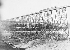
Lethbridge has several historical places to visit. The Lethbridge Viaduct, also known as the High Level Bridge, is the longest and highest steel trestle bridge in North America. It was finished in 1909. Indian Battle Park, located in the coulees (steep-sided valleys) of the Oldman River, marks the site of the last battle between the Cree and Blackfoot First Nations in 1870.
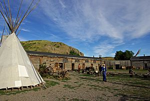
Fort Whoop-Up was originally built in 1869 as a whiskey trading post. It was later rebuilt and managed by the North-West Mounted Police.
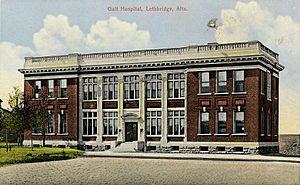
Lethbridge also has important cultural attractions. The Nikka Yuko Japanese Garden in south Lethbridge opened in 1967. The Galt Museum & Archives is the biggest museum in the area. The building used to be the city's main hospital. Other attractions include the Lethbridge Military Museum and the Helen Schuler Nature Centre, which teaches about the river valley.
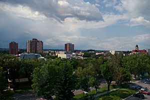
Several buildings stand out in the Lethbridge skyline. The historic post office, built in 1912, is a distinctive four-story building with a working clock tower. Other notable structures include office towers, the water tower (now a restaurant), and the Alberta Terminals grain elevators.
Sports and Recreation
Lethbridge has set aside 16% of its land for parks, including the 755-hectare (1,866-acre) Oldman River valley parks system. The city has many sports facilities, including:
- Fields for various sports
- Numerous baseball diamonds, including Spitz Stadium
- The Nicholas Sheran Park (a disc golf course)
- Two skateparks and a BMX track
- A climbing wall
- A dozen tennis courts
- Seven swimming pools
There are five golf courses in Lethbridge, including the award-winning Paradise Canyon Golf Resort. Several other courses are within 30 kilometers (19 miles) of the city.
The VisitLethbridge.com Arena, also known as the ENMAX Centre, was built for the 1975 Canada Winter Games. This 6,500-seat arena hosts concerts, circuses, cultural events, and national curling championships. It is also the home of the Lethbridge Hurricanes, a major Western Hockey League team. The arena has a running track, racquetball and squash courts, and an ice rink. Next to it, the 58,000-square-foot (5,400 m²) Servus Sports Centre (originally the Lethbridge Soccer Centre) has two indoor soccer fields. The Lethbridge Kyodokan Judo Club is also nearby and has been a Judo Canada Regional Training Centre since 2015.
On the west side of the city, Phase 1 of the Cavendish Farms Centre (formerly the ATB Centre) opened in 2016. It has two hockey rinks and the Lethbridge Curling Club. Phase 2, the Cor Van Ray YMCA, opened in May 2019. It includes a field house with basketball courts, a 300-meter (980 ft) running track, and an aquatics center with slides and a wave pool.
Lethbridge has several places for winter sports. The city has six indoor ice arenas with a total ice area of 11,220 square meters (120,770 sq ft). Most ice surfaces are available from October to April. Lethbridge is also 150 kilometers (93 miles) east of the Castle Mountain ski resort.
Lethbridge hosted the first championship game for the Western Women's Canadian Football League in 2011. The city's team, the Lethbridge Steel, played in three championship games from 2012 to 2014.
| Team | Sport | League |
|---|---|---|
| Lethbridge Bulls | Baseball | Western Canadian Baseball League |
| Lethbridge Eagles | Hockey | Alberta Junior Female Hockey League |
| Lethbridge Hurricanes | Hockey | Western Hockey League |
| Lethbridge Steel | Canadian Football | Western Women's Canadian Football League |
Getting Around Lethbridge
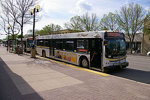
Lethbridge's public transportation uses 40 buses that run on more than a dozen routes. While many routes used to start and end downtown, Lethbridge Transit now has cross-town and shuttle routes. For example, you can take a bus directly between the University of Lethbridge and Lethbridge Polytechnic.
The Parks and Recreation department takes care of the city's 30-kilometer (19-mile) Coal Banks Trail system for walking and biking. This trail system connects the Oldman River valley with other parts of the city.
Four provincial highways (3, 4, 5, and 25) pass through or end in Lethbridge. This has created major roads like Mayor Magrath Drive and University Drive. These roads and Lethbridge's location on the CANAMEX Corridor (a trade route connecting Mexico, the United States, and Canada) make it an important shipping destination. Lethbridge is 100 kilometers (62 miles) north of the United States border and 210 kilometers (130 miles) south of Calgary.
Lethbridge has a commercial airport, Lethbridge Airport, which offers flights to Calgary and other places. The Canadian Pacific Kansas City (CPKC) rail yards are located nearby in Kipp, Alberta. The old rail yards in downtown Lethbridge were moved in 1983 and have since been redeveloped. The Park Place Mall is now located on part of the former rail yards.
Education in Lethbridge
The Lethbridge School Division and the Holy Spirit Roman Catholic School Division manage schools from kindergarten to grade 12 in the city. The Lethbridge School Division runs five high schools (Chinook High School, Immanuel Christian High School, Lethbridge Collegiate Institute, Victoria Park High School, and Winston Churchill High School), four middle schools, and 14 elementary schools. Immanuel Christian High School serves grades 6 through 12.
Lethbridge is home to two important higher education institutions: Lethbridge Polytechnic, founded in 1957, and the University of Lethbridge, founded in 1967. Red Crow Community College also has a campus in the city. In the 2015–2016 school year, the University of Lethbridge and Lethbridge Polytechnic together had about 14,820 students, which was about 20% of the city's population at the time.
Media in Lethbridge
Lethbridge has two main newspapers: the daily Lethbridge Herald and the weekly Lethbridge Sun Times. Both the university and the polytechnic have their own student-run weekly newspapers. There are also 12 FM radio stations, including CKXU-FM, a student radio station at the University of Lethbridge.
Notable People
See also
 In Spanish: Lethbridge para niños
 | Kyle Baker |
 | Joseph Yoakum |
 | Laura Wheeler Waring |
 | Henry Ossawa Tanner |


