Oakford, Indiana facts for kids
Quick facts for kids
Oakford, Indiana
|
|
|---|---|

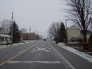
Approaching the railroad crossing in Oakford
|
|
| Country | United States |
| State | Indiana |
| County | Howard |
| Township | Taylor |
| Elevation | 860 ft (260 m) |
| Time zone | Eastern Time Zone |
| ZIP code |
46902
|
| FIPS code | 18-55584 |
| GNIS feature ID | 440462 |
Oakford is a small place in Howard County, Indiana, in the United States. It's known as an unincorporated community. This means it's a group of homes and businesses that isn't officially a town or city with its own local government.
Oakford is located in the southwestern part of Taylor Township, Howard County, Indiana. It's also part of the larger Kokomo Metropolitan Statistical Area. This area includes Kokomo and nearby communities, showing how they are connected for things like jobs and services.
History of Oakford
Oakford was first planned out in the year 1852. When it was first created, it had a different name. It was originally called Fairfield.
However, just two years later, in 1854, the community decided to change its name. That's when the name Oakford was officially chosen and adopted.
Where is Oakford Located?
Oakford is easy to find because of its location near important roads. It sits right where a railroad track crosses State Road 26. This makes it a notable spot for travelers.
For many years, Oakford was about 1 mile (or 2 kilometers) east of where State Road 26 met U.S. Route 31. But in November 2013, U.S. Route 31 was moved. Now, Oakford is right next to the exit for State Road 26 on the new, improved U.S. Route 31 highway. You can find it on the west side of that exit.
 | DeHart Hubbard |
 | Wilma Rudolph |
 | Jesse Owens |
 | Jackie Joyner-Kersee |
 | Major Taylor |


